
It’s hard to believe we’re into February and half of snowmobiling season is behind us! But time flies when we’re having fun.
I started beating the drum for a good winter in autumn and never backed down. Weak La Niña and global sea surface temperature anomalies compared favorably to previous similar winters.
Early winter wasn’t completely without warts. We did experience a meltdown and a disruptive ice storm in December. And January Thaw paid an unwelcome visit.
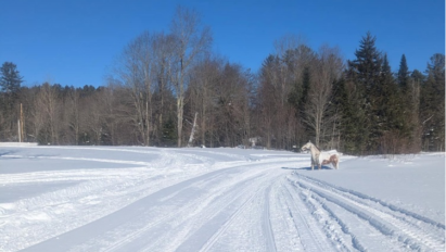
However, on the whole, Winter 2025-26 has been cold and snowy for the central Adirondacks to date.
Do we keep the good times rolling?
I’ll review, then play it forward.
January 2026 Review
Overall, January was somewhat colder than climatology in the northeast USA and very mild in the Rocky Mountain states.
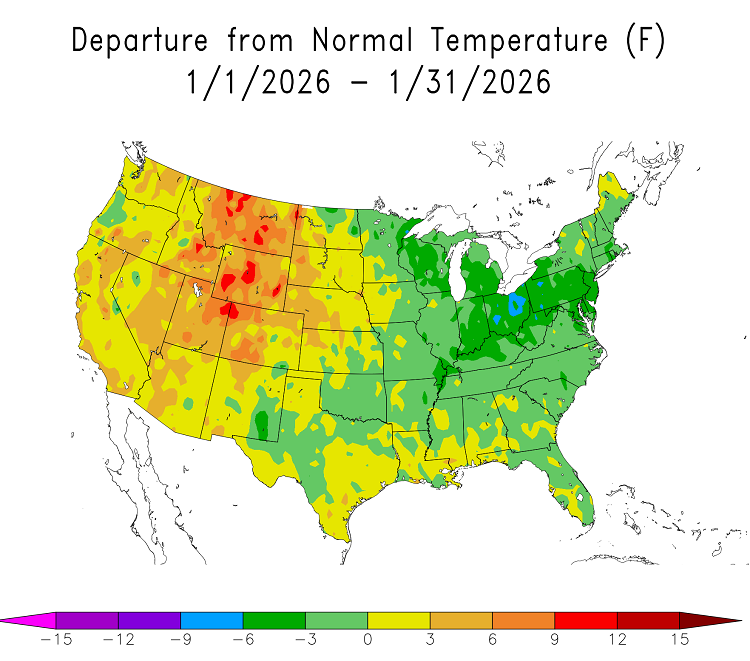
The cold anomaly doesn’t seem tremendously impressive, but monthly temperature departure also included the warmth we had during January Thaw.
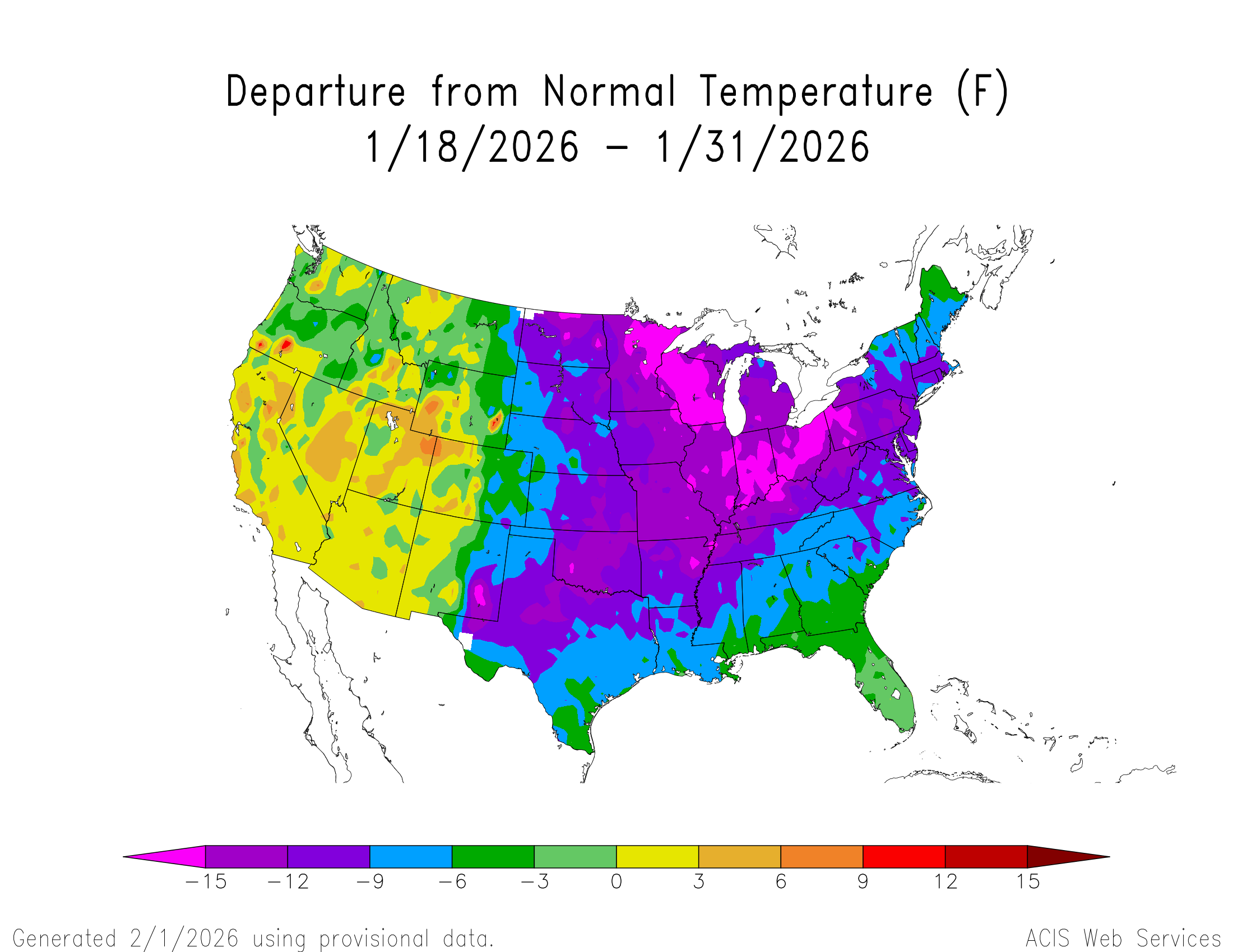
Final two weeks of January were hard core winter!
January 2026 snowfall for Indian Lake, NY was 41.6 inches, a robust 15.6 inches above climo.
Stepping back
90-day period covering late autumn through early winter showed a definite cold bias over the northeast United States.
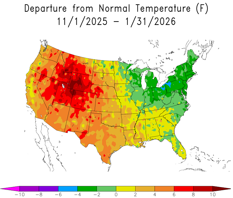
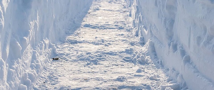
2025-26 snow season snowfall total through January 31st was 80.8 inches for Indian Lake, which is 21.9 inches greater than climo.
Yes, it’s been a cold and snowy winter in the central Adirondacks!
February 2026
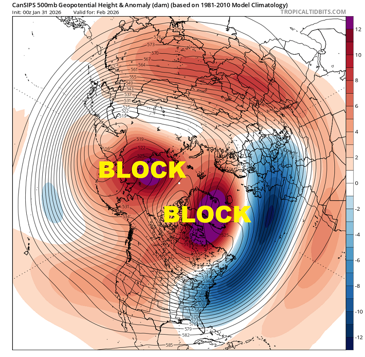
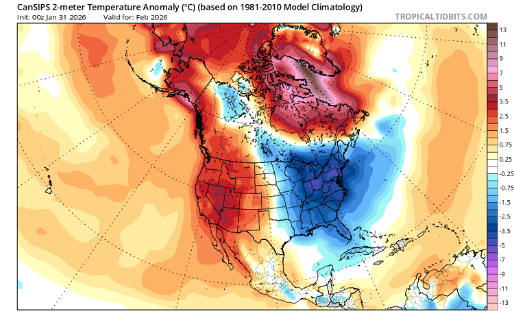
The 18,000 foot view from CanSIPS ensemble shows a strong high latitude blocking pattern. This would strongly favor cold over the eastern USA.
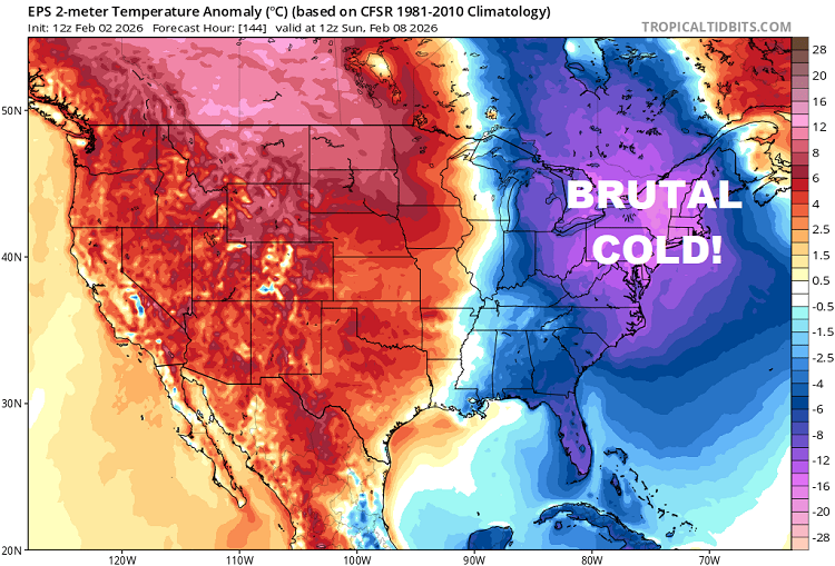
Speaking of cold…
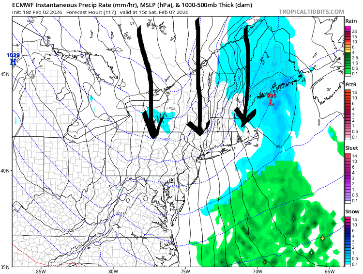
We’ll have another brutal Arctic cold shot this weekend, ushered by direct northerly discharge from Canada on Saturday. This will be DANGEROUSLY COLD!
Mid-February break
Ensemble modelology indicates prevailing cold pattern should break down for a time mid-February. Shortwave (S/W) energy will crash into southwestern USA for one of the few cold and stormy periods in that region this winter.
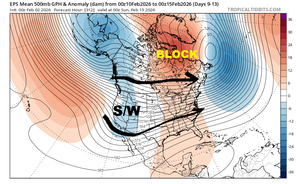
High latitude blocking over Davis Strait may tap the brakes in how warm it gets, at least in the North Country. But we would become vulnerable to precipitation other than snow.
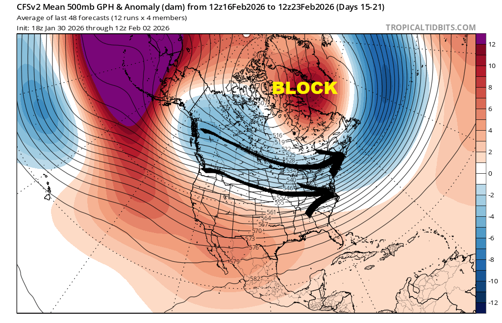
CFSv2 ensemble show a return to prevalent cold during second half of February, with the return of Canadian clippers, cold shots and lake-effect snows. Strong blocking regime should continue near Davis Strait.
March
Assuming we leave February with a robust snowpack, CanSIPS is showing enough cold for potential March Madness.
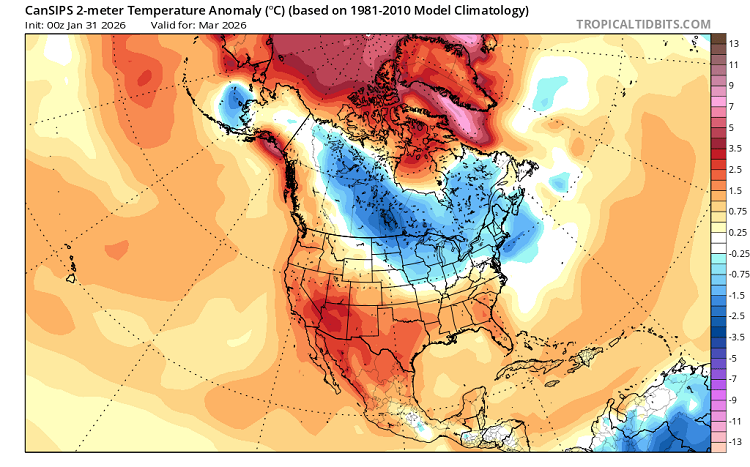
March is the start of meteorological spring, so we’ll fight the uphill battle against climo. But we can have BIG SNOW during March here in ilsnow land.
La Niña Update
Still there!
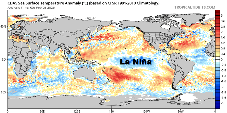
Climate Prediction Center may declare neutral ENSO with its March update. But that cool pool of water over the equatorial Pacific will continue to influence North America weather patterns into early spring.
Bottom line
Based on empirical evidence and bolstered by available long-range ensemble modelology, I believe there is much winter left in the tank.
For the ilsnow nation,
Darrin