

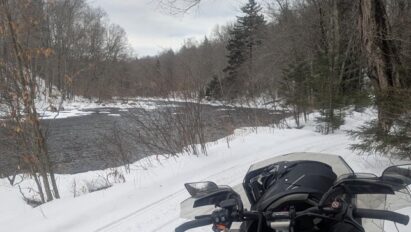
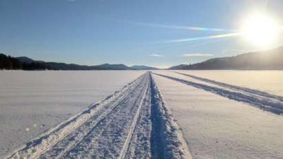
I’m tardy with my monthly update. But that’s what happens when I’ve been snowmobiling a lot!
This website is primarily for keeping people informed (and entertained) on central Adirondack snowmobiling trail conditions and wherever else I happen to ride.
January Thaw has spoiled it here for now. It shouldn’t take much to get us rolling track again.
Now, I have some time to delve into the heart of Winter 2025-26.
LET’S GO!
December 2025 Review
I put myself on record that December would be colder than climo and potentially snowy for central Adirondacks. Let’s see how that worked out!
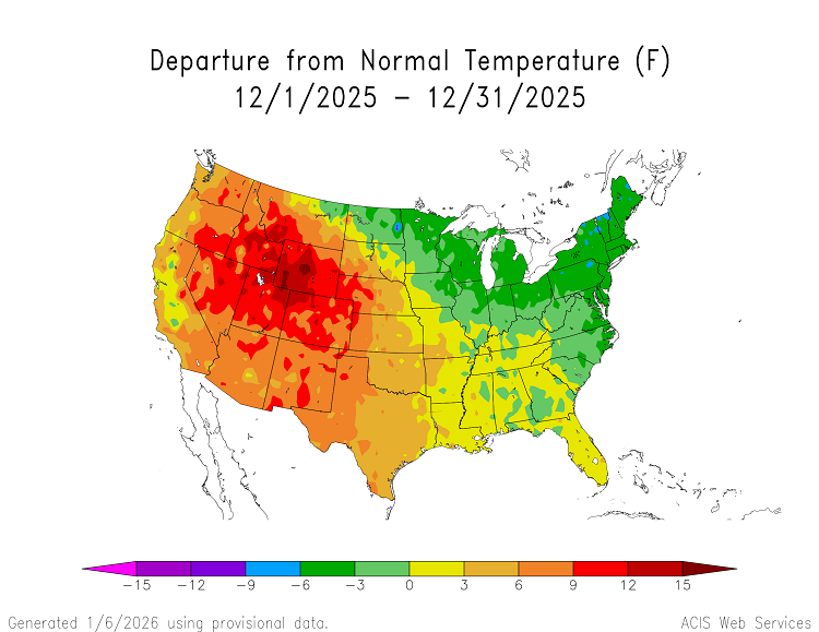
Snowfall at Indian Lake, NY cooperative weather station for December 2025 was 28.0 inches, which exceeded the climo 22.3 inches. No big nor’easters, just a parade of Canadian clipper and lake-effect snow events to gradually add to the pile.
Even though December was cold overall, we experienced a strong thaw on 19th-20th and a disruptive ice storm into the 29th. That just goes to show that almost anything can happen in a month, despite the prevailing pattern.
January 2026
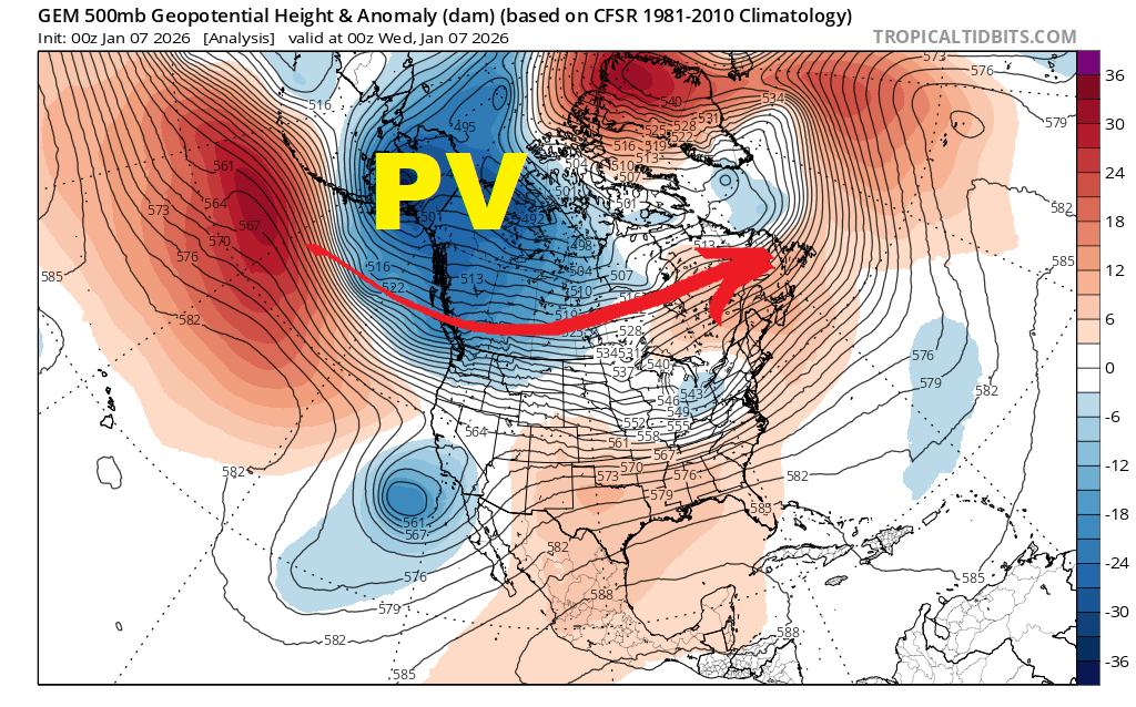
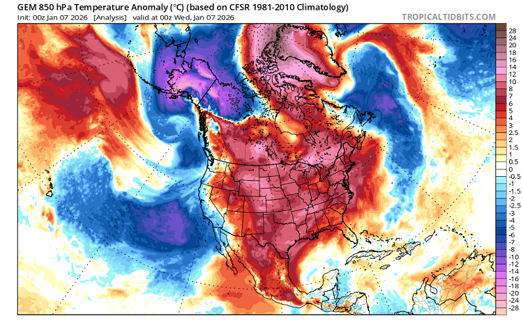
Polar Vortex (PV) over Alaska early this month was a classic set-up for our January Thaw. Arctic cold was cut-off from USA Lower 48 and vast majority of Canada.
Week of January 12-16
This will be a transition period.
- Alaska Polar Vortex (PV1) weakens
- Hudson Bay Polar Vortex (PV2) becoming re-established
- Negative phased North Atlantic Oscillation (NAO-) in place
- STRONG HIGH (H) developing over western USA.
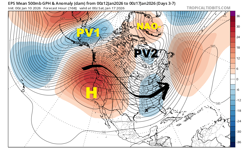
Cold shots and snow opportunities will resume after Wednesday this week.
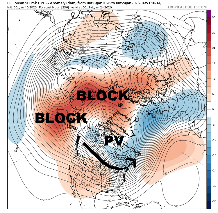
Week of January 19-24
EXPANSIVE high-latitude blocking regime should tele-connect with a parade of Canadian clippers, lake-effect snow events and Arctic cold shots around base of the Polar Vortex (PV)
Closing week of January
Strong Bering Strait block and rapid zonal flow over USA Lower-48.
This is a classic La Niña manifestation.
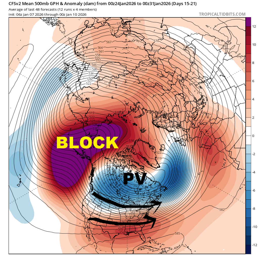
That would place us in battle ground between brutal cold in south-central Canada and strong warmth in southern USA. Successfully forecasting weather outcomes greater than 2 days away could become quite challenging. Swift moving Canadian clippers should be favored over nor’easters.
February 2026
Blocking regime indicated to continue near Alaska, with swift zonal flow at times for USA Lower-48.
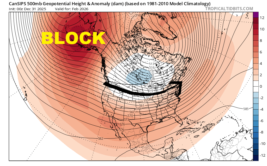
Most persistent cold would be from south-central Canada into north-central USA. But periodic cold shots should move through northeast USA. Again, fast moving Canadian clippers may be favored over nor’easters.
I don’t expect February to be lock-it-and-forget-it cold in ilsnow land. But there is potential for good snow cover build up for the central Adirondacks.
And remember, almost anything can happen in a month!
La Niña?
It’s there! The large expanse of cool water over eastern equatorial Pacific is unmistakable. Three-month temperature anomaly in NINO 3.4 region is -0.5*C, which is threshold for weak La Niña.
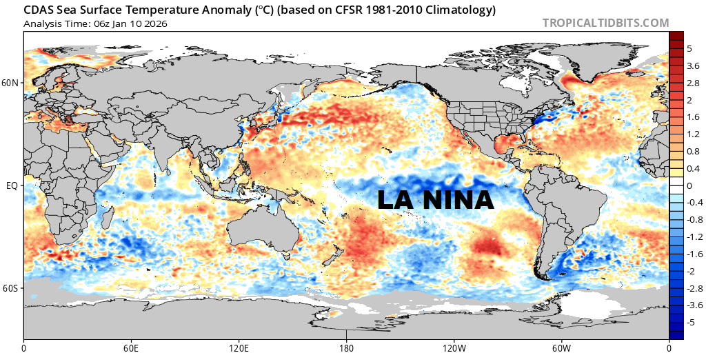
Although this La Niña episode has likely peaked and should gradually weaken from this point, it will influence the entire winter.
Bottom line
Winter has shown me reason to be optimistic for ilsnow land. While the block buster nor’easter may elude us, the frequency of light to moderate snow events and “cold most of the time” weather should provide the central Adirondacks with ample snowmobiling opportunity.
For the ilsnow nation,
Darrin

Awesome job!
I’d rather be riding, but that’ll be soon enough!
Looks like you’ll be riding a lot more this winter! Happy for everyone!