Not yet for ilsnow land. I used a clickbait headline and banner to grab attention.
Don’t go away angry! I’ve got plenty to talk about.
I’ll look at what’s going on now, then play it forward.
HERE WE GO!
North Hemisphere snowpack expansion
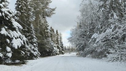
Early season snow cover explosion over Siberia is spreading into lower latitudes.

Snow cover spread lags behind climatology in the Canadian Arctic, but most modelology suggest meaningful snow build up there over the next week and a half.
Prolific snow cover spread from Siberia into Eurasia indicates the transition into North Hemisphere cold season is well underway. That doesn’t always guarantee a great winter HERE, but I’d rather start with a brimming stockpile of cold than not.
This report is brought to you by Mangino Chevrolet Buick GMC in Amsterdam, NY & Ballston Spa, NY. We know that you have high expectations, and as a car dealer we enjoy the challenge of meeting and exceeding those standards each and every time. Allow us to demonstrate our commitment to excellence! Our experienced sales staff is eager to share its knowledge and enthusiasm with you. We encourage you to browse our online inventory, schedule a test drive and investigate financing options.
September review
Pacific Ocean Sea Surface Temperature (SST) anomaly is one of the biggest drivers of weather patterns in North America. Oceans hold a vast amount of heat energy and are resistant to temperature change. Pacific Ocean is upstream from North America, so changes there blow our way.
2013 remains a strong analogue in the Pacific Ocean.


Comparing September 2013 and 2025
The match is nowhere near perfect, but not totally off track.


I believe the warmth into Northern Rockies and Northeastern United States in 2025 (relative to 2013) was skewed by deepening drought.

October
2013 was cold in the west and mild in the east compared to climatology. 500mb geopotential height anomaly was very clear on why, with persistent troughing over the southwestern United States. This pumped unseasonable warmth at times into the northeastern United States.


With drought and dry weather continuing, October 2025 could be quite mild at times for the northeastern United States.

November
In 2013, cold loosened its grip on the west and built eastward. 500mb composite anomaly indicated a persistent jet stream dip into the eastern United States.


If we get a similar performance this year, November 2025 may feature strong lake-effect snow events, especially late month.
December
Polar Vortex (PV) dug into Canada in 2013 and placed the northeastern United States in a battle zone between strong cold to our northwest and warmth to our south.


The result was an active and erratic, up-and-down temperature month.
December 2025 could be frustrating for winter lovers here in upstate New York. But there may be significant cold air buildup over Canada that month, allowing winter to seize control as we turn the calendar to 2026.
La Niña?
Most long term modelology is in line with weak La Niña into Winter 2025-26 with sea surface temperature (SST) anomaly in Niño 3.4 region crossing -0.5*C threshold. CFSv2 ensemble forecast is an example of this.


Extreme ENSO events (El Niño and La Niña) tend to badly disrupt winter for us. Weaker events allow the possibility of better winters. At least I don’t see a flashing red warning light from the equatorial Pacific as we transition through autumn toward winter.
Bottom line
Generalities are one thing. Specifics are another. Analogues can’t predict future weather events. They can only reveal possible long wave patterns.
Our mission is to get SNOWMOBILING READY. Winter will be here before you know it!
For the ilsnow nation,
Darrin