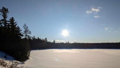

With meteorological summer (June-July-August) in the rearview mirror, we can look for signs of what autumn may do for us.
It’s time to dust off the ilsnow storm center console.
GAME ON!
Many winter outlooks are out there now. Most outlets say the same thing every year, pandering their audiences. I want to see how hemispheric weather patterns actually develop through autumn so we can have meaningful data to take a stab at winter.
This report is brought to you by Mangino Chevrolet Buick GMC in Amsterdam, NY & Ballston Spa, NY. We know that you have high expectations, and as a car dealer we enjoy the challenge of meeting and exceeding those standards each and every time. Allow us to demonstrate our commitment to excellence! Our experienced sales staff is eager to share its knowledge and enthusiasm with you. We encourage you to browse our online inventory, schedule a test drive and investigate financing options.
Pacific Ocean
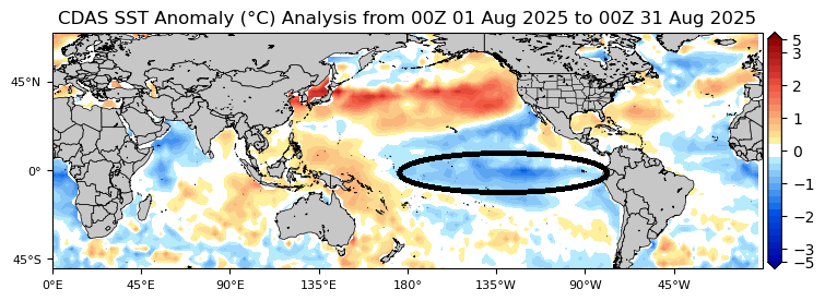
Pacific Ocean Sea Surface Temperature (SST) anomaly is one of the biggest drivers of weather patterns in North America. Oceans hold a vast amount of heat energy and are resistant to temperature change. Pacific Ocean is upstream from North America, so changes there blow our way.
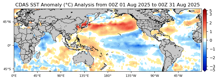
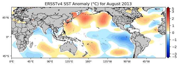
Between the current SST anomaly analysis and August 2013 analogue, two things stand out.
- Cold pool in equatorial Pacific extending from South America to international dateline.
- Large expanse of warm water in north Pacific from Japan to North America.
August Analogue
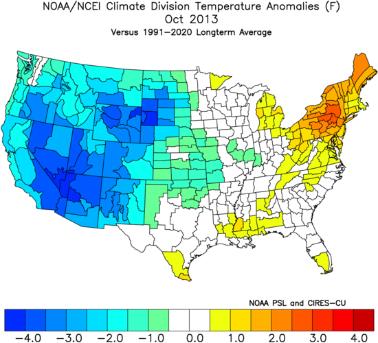
Comparing August 2013 and 2025 for temperature anomalies is a good place to start.
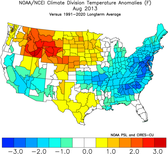
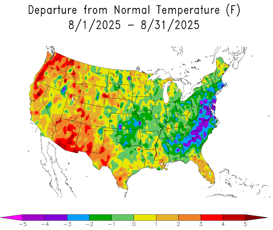
No analogues match perfect. But August 2013 and 2025 were both cooler than climatology for much of the eastern United States. Temperature departure was especially steep from New Jersey and southern Pennsylvania to Georgia.
This gives me enough confidence to play the August 2013 analogue into autumn this year.
September
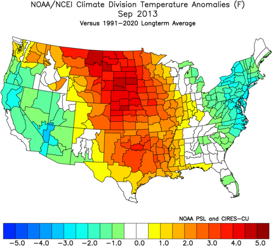
September 2013 played very warm in the middle third of the United States and relatively cool over the eastern United States. But I think something else will come into play this time around.
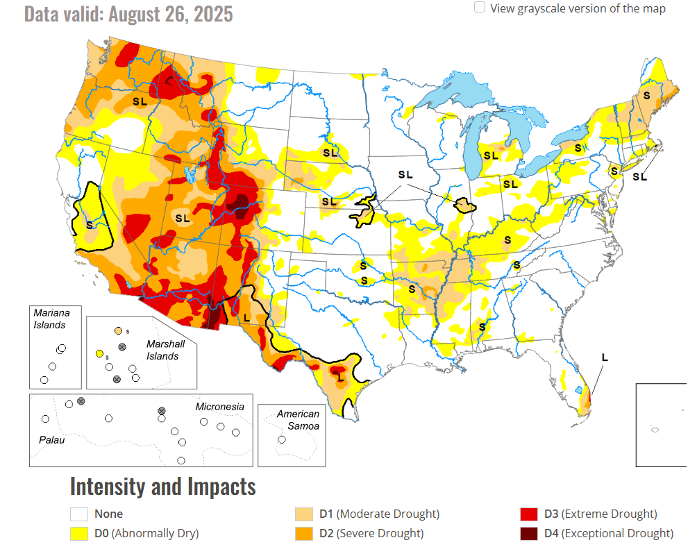
With severe to exceptional drought conditions through the Rocky Mountain states, the warm maximum may be further west into that region this year. With developing drought in the northeast, our temperatures may trend closer to climo or even a tad above.
October
October 2013 dropped a cold hammer onto the western United States. If that happens this year, we can expect snowy mayhem over the Rockies and major relief from heat out there.
When it’s cold in the west, it’s usually warm in the east. If our developing drought deepens into autumn, October could become significantly warmer than climo in ilsnow land.
November
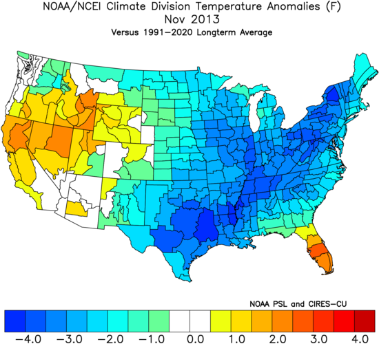
OUR TURN! In 2013, cold loosened its grip on the west. To the east, t’was a cold November for ilsnow land. A similar performance in 2025 would boost morale into the upcoming snowmobiling season!
November 2013 mean temperature was nearly 4*F below climo in Indian Lake, NY. Although snowfall was only near climo that month for my location in Indian Lake (about 9 inches), I’ll gladly take my chances for snow in a cold regime. It could become prime for big lake effect snow events into the western Adirondacks.
Winter?
I want to see what actually happens this autumn before playing ahead into winter.
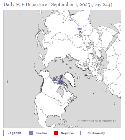
Although it’s nice to see snow cover jump to an early start over the far northern Canadian Arctic, we’re still very early into the cold season in the high latitudes.
La Niña?
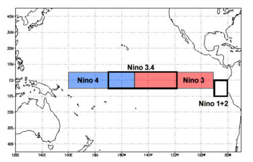
Despite the large pool of cool water over the equatorial Pacific, Climate Prediction Center has yet to declare La Niña. This is because SST anomaly hasn’t reached -0.5*C in Nino 3.4 region for at least 3 consecutive months.
A line must be drawn somewhere. But this also splits hairs. If it looks like a duck and quacks like a duck, it’s a duck. We’re in a de facto weak La Niña now.
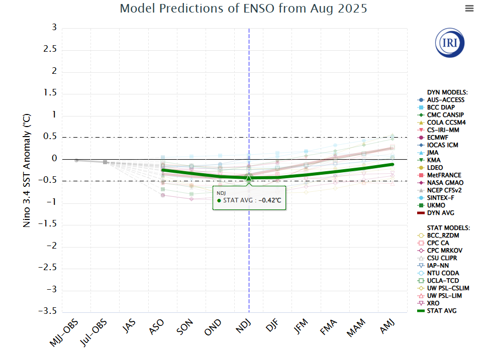
Statistical average of international modeling shows -0.42*C in Nino 3.4 region for November-December-January, just shy of the “magic” -0.5*C used to declare La Niña.
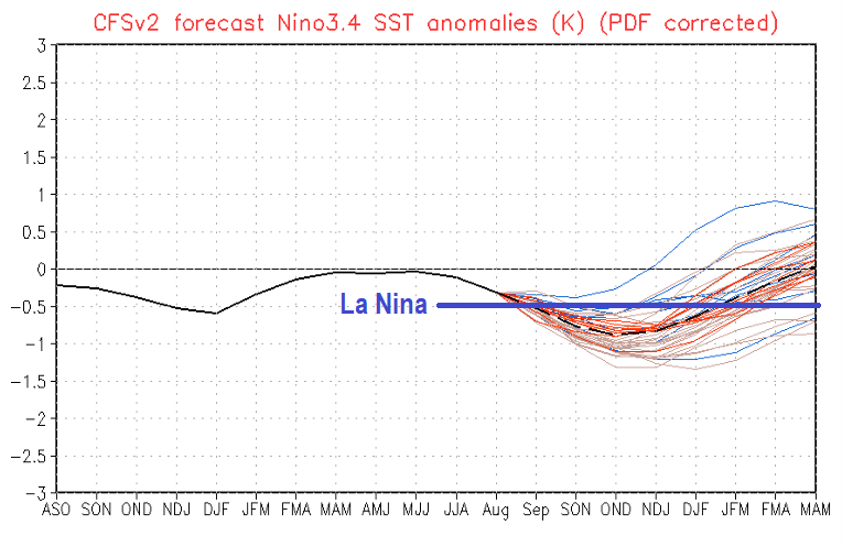
CFSv2 modeling is more aggressive with cooling, squarely indicating weak La Niña into autumn and winter.
Right now, I’m assuming weak La Niña into this winter and that could be good for us! It did well for us last winter.
That’s what I have for now!
For the ilsnow nation,
Darrin