12/27/24 Update: Groomers have been through Moose River Plains with snowmobilers out riding and having a good time at it.
Better hit it SOON! Oil will begin to leak on Saturday. Wheels will fall off Sunday and especially Sunday night as the mild flood gate opens wide. Gonna look FUG-LY by Monday.
Just another installment of “Grab-it-while-we got-it” December.
12/24/24 Update: Rapped out a fresh 3-and-a-half inches of snow at the ilsnow storm center in Indian Lake, NY. Fresh pickings for those who want to hit up Moose River Plains before Santa makes his rounds tonight.
Perkins Clearing Road is rideable from the north end (Mason Lake parking lot). But beware of vehicular traffic until loggers pull out for the season. My best understanding is the south end of Perkins Clearing Road will be closed for snowmobiling this winter with logging. We will need to use the southern bypass.
Local wooded trails should be considered at-your-risk riding with early season hazards such as blowdown, rocks, roots and wet/mud areas under thin snow cover.
12/21/24 Update: We managed to bang out couple of inches of white sugar snow by early Saturday. Been told that people are riding into Moose River Plains from Brown’s Farm and encountering some carbide clank. Marginally rideable if you want it badly enough.
Perkins Clearing Road is still being plowed for logging at both ends. But there appears to be a solid packed base under the couple inches of fresh snow. No signs saying you can’t ride in there from Mason Lake parking lot. But be wary of vehicular traffic. South end of Perkins Clearing Road expected to be closed for snowmobiling this winter. Town of Lake Pleasant groomers are staged for winter deployment once substantial snow arrives.
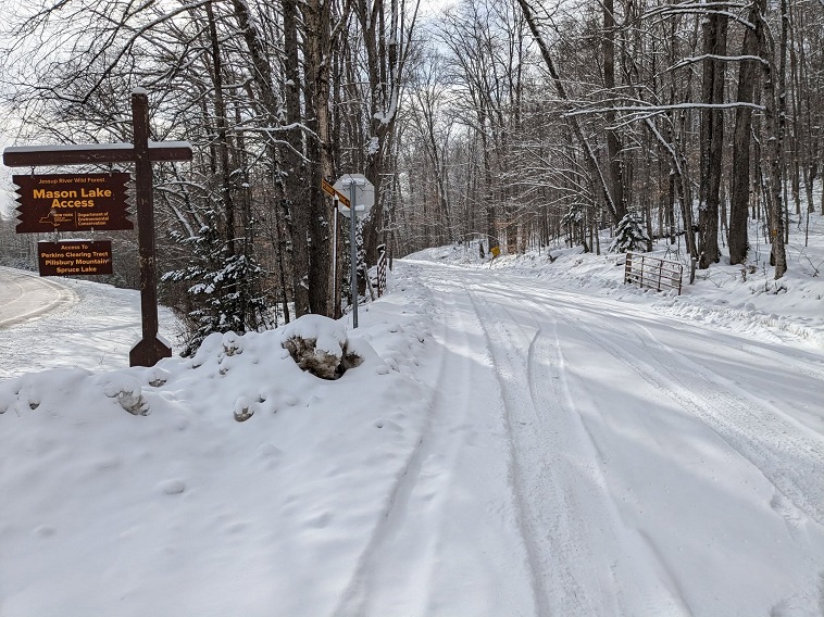
Looks can be deceiving
When December started cold, various click-bait merchants were calling for “December to Remember!” even with clear signs the cold regime would collapse by mid-month.
Autumn was mild. Our early cold season milestones were all late: First frost, first freeze, first flakes, first snow accumulation, first sub-zero morning, etc. There was a notable shortage of Arctic cold in North America leading up to the start of winter.
Much of the eastern United States has averaged near to below climo for December to date:
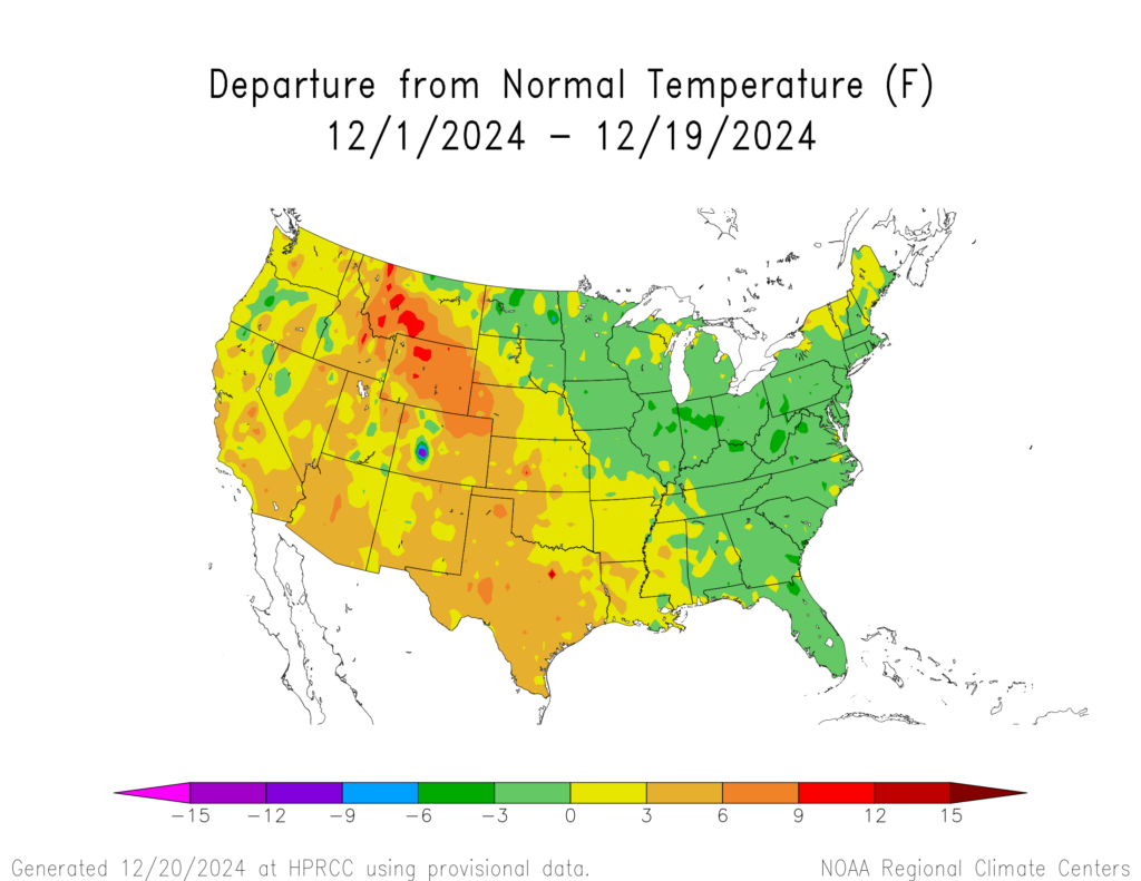
But…
- We’ve had two thaw/rain cycles.
- Outside of two major lake-effect snow events, snowfall in most areas has not been spectacular.
- Coldest temperatures barely cracked below zero, not that impressive considering record lows by mid-December are below -30*F in central Adirondacks.
This report is brought to you by Mangino Chevrolet Buick GMC in Amsterdam, NY & Ballston Spa, NY. We know that you have high expectations, and as a car dealer we enjoy the challenge of meeting and exceeding those standards each and every time. Allow us to demonstrate our commitment to excellence! Our experienced sales staff is eager to share its knowledge and enthusiasm with you. We encourage you to browse our online inventory, schedule a test drive and investigate financing options.
Coming up
Our minor snow event for Friday afternoon and night is a wasted opportunity. The two shortwave (s/w) energy pieces will not phase together quickly enough to generate a big snow here.
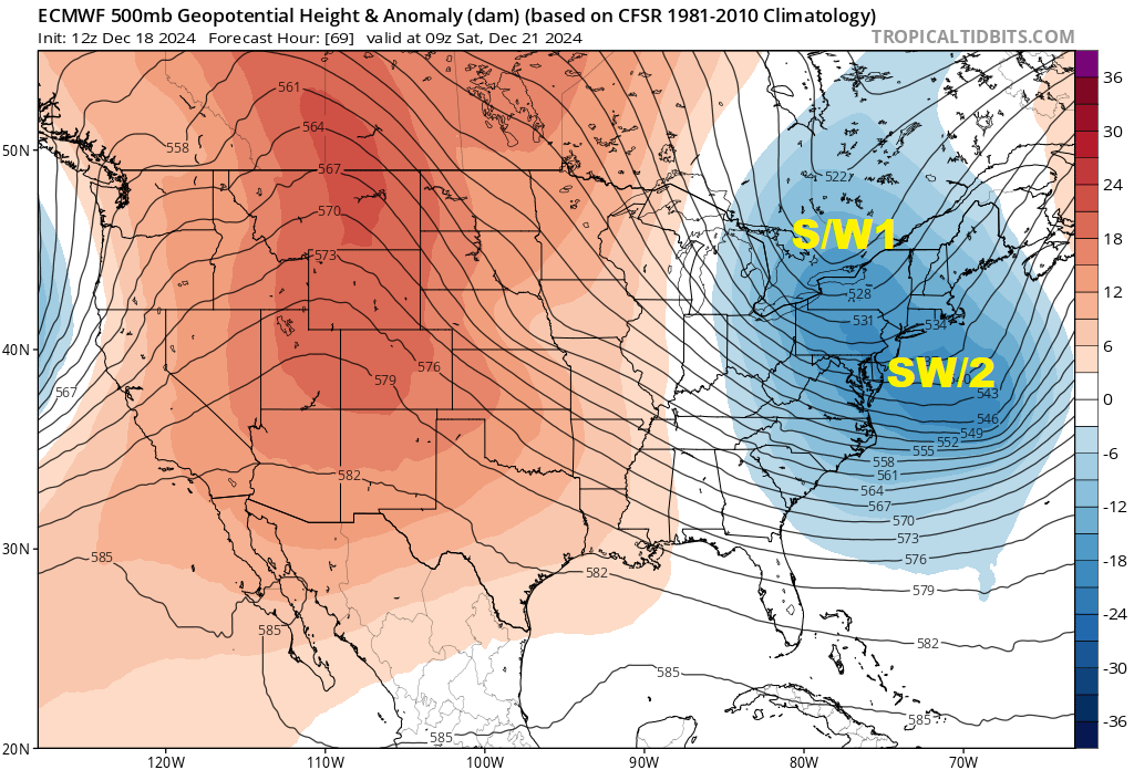
We’ll have solid cold outbreak for the weekend. Sub-zero dawns are likely Sunday and Monday, but nothing close to threatening records lows.
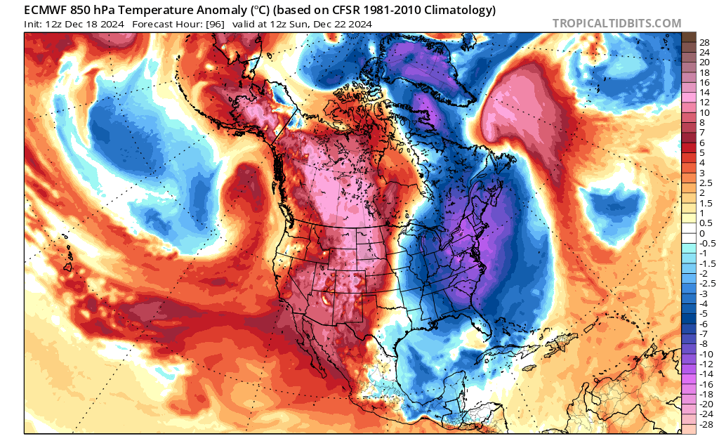
The cold should hang on long enough to seal a White Christmas for ilsnow land. Notice I didn’t say “abundantly” White Christmas.
Holiday Week
Based on thin snow cover and stunning lack of true Arctic Cold over North America, I believe that snowmobile riding options will be quite limited between Christmas and New Years Day.
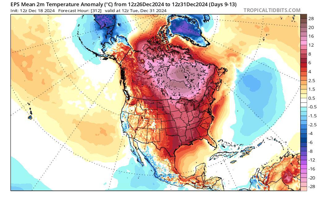
The EPS ensemble view from 18,000 feet shows the Polar Vortex (PV) trapped near the North Pole for the end of tail end of December.
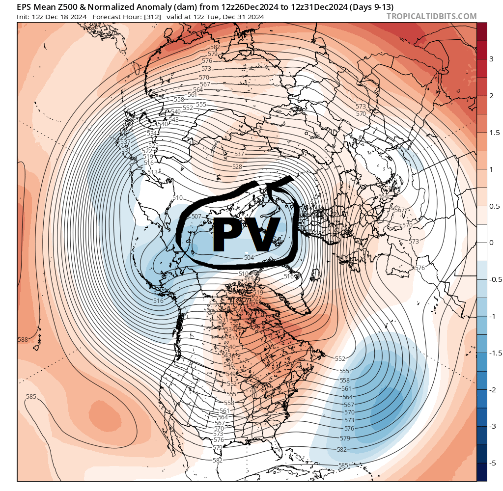
This isn’t to say we’d be in a continual blowtorch. Cold frontal passages will blunt the warmth at times, but the cold shots won’t have much punch. Weakish weather systems under this regime interacting with marginal cold are unlikely to produce significant snow.
New Year Outlook
Strong warming over northern Canada may coalesce into a blocking high as we end December. And strong jet stream energy may course through eastern United States around New Year’s Day.
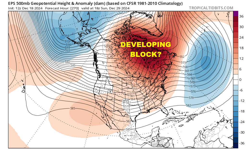
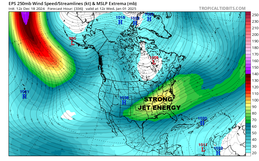
This may generate a significant eastern United States weather system. And there could be enough stale Canadian chill to facilitate a snow event for ilsnow land.
Far too early to get pumped. But when there’s no excitement happening to the horizon, we resort to kicking the can past the horizon.
Even if we hit on something good around New Year’s Day, I don’t foresee a deadlock into mid-winter cold right away. The Polar Vortex (PV) should begin its return drop into North America, but it’ll take a while to fully recharge the Canadian Arctic.
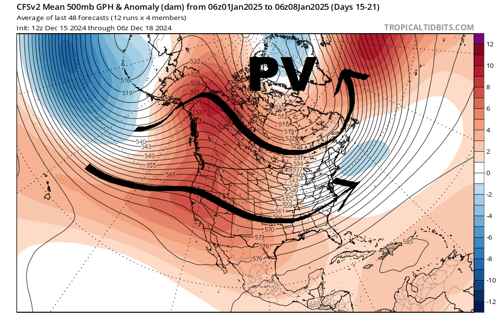
Beyond the first week of the New Year, there are signs of cold building into mid-January. Do I believe it would become cold without interruption through the end of January? Recent history with our winters would suggest not. But looking into possible weather regimes a month away is not far removed from playing darts whilst blindfolded.
The theme of the past several winters is to hit-it-when-we-get-it because if you snooze, you lose!
That’s what I’ve got for now.
For the ilsnow nation,
Darrin

