SUNDAY AM UPDATE: Good news! I picked up 4 inches of white freshness at ilsnow storm center Saturday night. Total snow cover is now 6-10 inches around Indian Lake, NY and probably a foot-or-more into Moose River Plains and back side of Perkins Clearing.
Snowmobiling season begins in Hamilton and northern Herkimer counties one hour after sundown, Sunday, December 8, 2024 at the conclusion of big game hunting season. There is no late bowhunting season here.
After meandering through a mild to warm autumn, we’re finally at the doorstep of the best season offered in the Adirondacks!
I’ll start with what’s going on, then play it forward.
This report is brought to you by Mangino Chevrolet Buick GMC in Amsterdam, NY & Ballston Spa, NY. We know that you have high expectations, and as a car dealer we enjoy the challenge of meeting and exceeding those standards each and every time. Allow us to demonstrate our commitment to excellence! Our experienced sales staff is eager to share its knowledge and enthusiasm with you. We encourage you to browse our online inventory, schedule a test drive and investigate financing options.
Present situation
This December has started much better than recent years. At present, snowpack is up to several inches around Indian Lake, and 6-12+ inches into Moose River Plains and Perkins Clearing. Snow cover is running deep north of Route 28 in western Adirondacks where a major league lake-effect snow event hit after Thanksgiving.
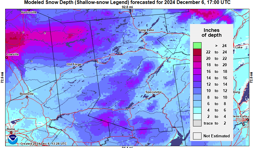
Moose River Plains
I expect DEC to swing open the gates into Moose River Plains on Monday, with Inlet and Indian Lake crews tending to trail maintenance on their respective sides next week. Even if gates are not opened immediately, snowmobiling is permitted in Moose River Plains whenever there is sufficient snow/ice coverage outside of hunting season.
Perkins Clearing
I’ve been told south end of Perkins Clearing Road will be plowed for logging and closed to snowmobiling this winter. This will require use of the southern bypass trail. Remainder of Perkins Clearing should be open for snowmobiling, including Mud Lake Road.
For now, north end of Perkins Clearing Road thence all the way back from Perkins-T into Carpenter Hill Road is being plowed for logging. Hopefully, loggers will pull out from there shortly.
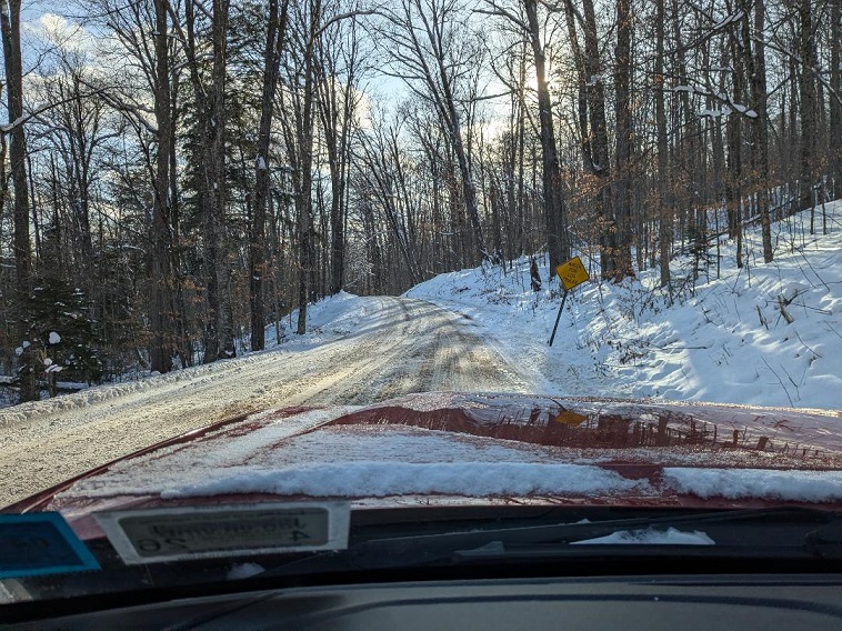
Looks like we’ll wait a bit before Perkins Clearing becomes snowmobiling happy place. I don’t have any logging info yet for Speculator Tree Farm.
Next week, into Snodeo Weekend
Our cold pattern that started December will hold into this weekend, then collapse early next week. The worst hit would be a rain event Tuesday night into Wednesday. Modelology have varying outcomes on rainfall and following snow amounts into Wednesday night and Thursday.
For now, it’s something to watch: Pray that bad doesn’t trounce the recent good.
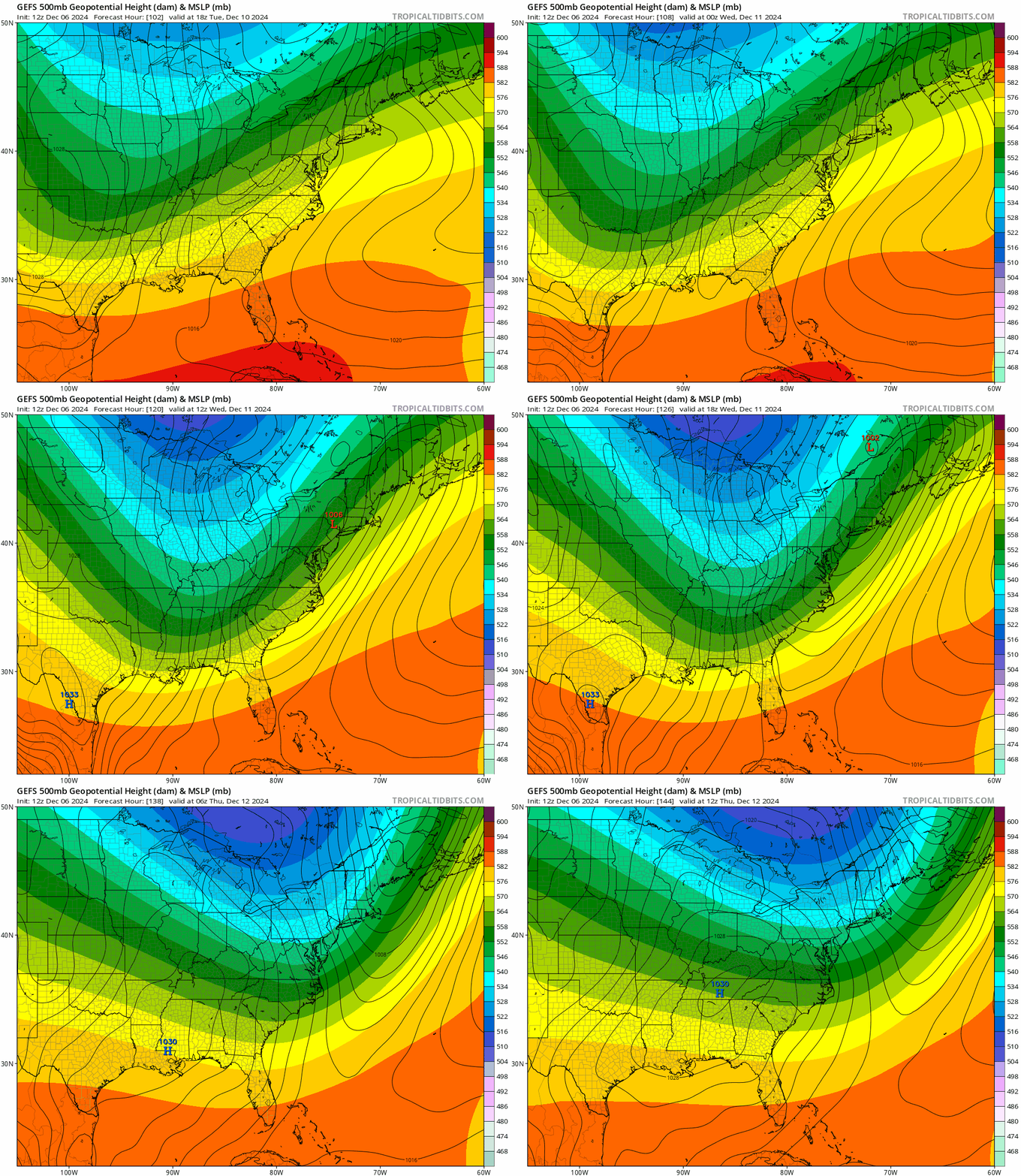
The cold surge after Wednesday’s event would be short-lived. Polar Vortex (PV) becoming shaped like a football resting on turf is a kiss-of-death. You can already see the return southwest flow starting on Friday. Temperatures would begin an upward trend into Snodeo Weekend. Not yet certain on how quickly it warms up.
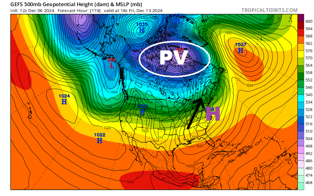
Upcoming Purgatory
GEFS (shown here) and other ensemble modelology are very discouraging for third week of December. There would be paltry cold in North America to work with. It’s far too early to hash out demons within the details, but this is NOT a good look.
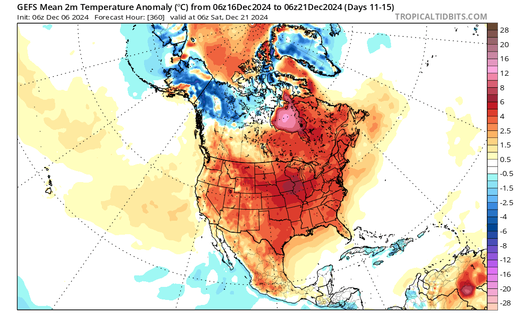
Winter false start?
When click-bait merchants were calling for “December to Remember” I didn’t buy it.
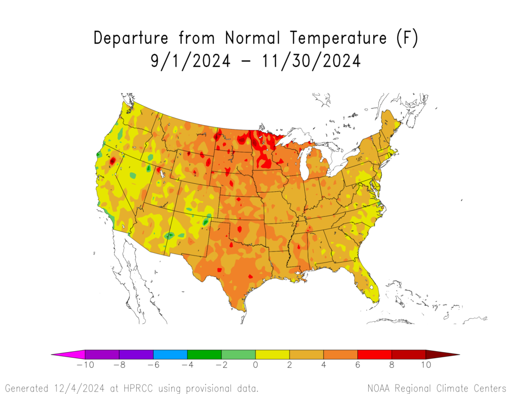
Why? Because the atmosphere needs some time to forget about autumn. Aside from bouts of anomalous chill here in mid-October and end-of-November, meteorological autumn was overwhelmingly mild.
In fact, autumn ran quite mild overall for much of the contiguous United States!
Composite analogue of world-wide sea surface temperature anomalies indicate a notable warm bias for eastern United States in December. This increases the likelihood of a mild push back to our apparent quick start to winter.
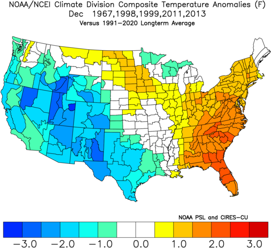
Click here for my refresher course on how world-wide sea surface temperature anomalies can influence prevailing weather patterns.
Hope on the other side
CFSv2 ensemble shows dramatic cooling from end-of-December into mid-January.
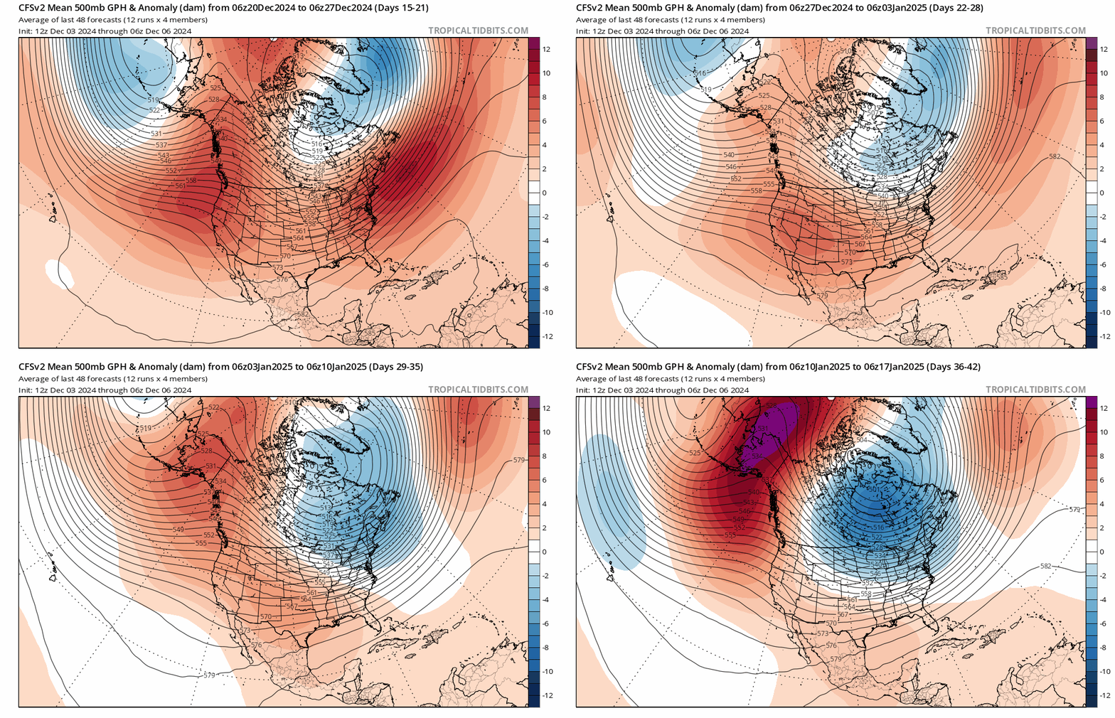
The CFSv2 suite has dubious inaccuracy issues at times. But I believe there is something solid in what it’s showing. Composite analogue of world-wide sea surface temperature anomalies indicate a strong cold bias for eastern United States in January.
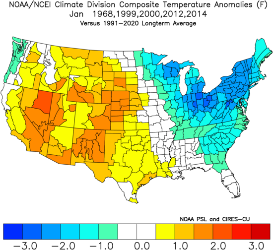
Chin up! I believe it’ll be a much different ball game than last winter.
That’s all I have for now. We’ll see how this plays out.
For the ilsnow nation,
Darrin


Darrin as usual keep up the great work. Living 3 hrs away we always keep an eye on what you have done and predict!