
I don’t do winter outlooks, per se. They cannot take into account singular events (and their timing) that can make or break snowmobiling seasons. Many times, winter outlooks can be completely wrong.
But that doesn’t mean we can’t have fun with hard, statistical analysis!
We’ll look into the past and attempt to leverage the balance of probability to this winter.
Reviewing 2023-24
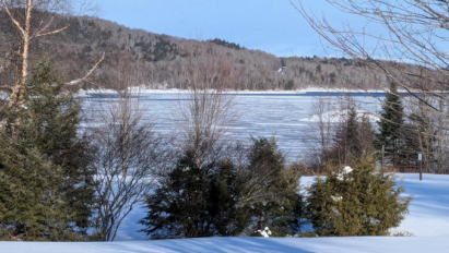
You’d be stunned to hear that Indian Lake, NY accumulated 112.7 inches of snowfall during the 2023-24 snow season.
Despite “near-normal” snowfall for central Adirondacks, strong El Niño absolutely killed last winter.
Look at the blowtorch warmth!
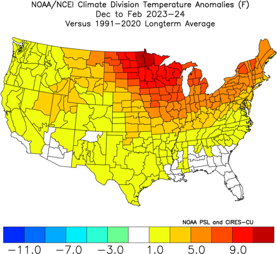
Check out December to February composite temperature anomaly from Top-5 El Niño events during the past 40 years:
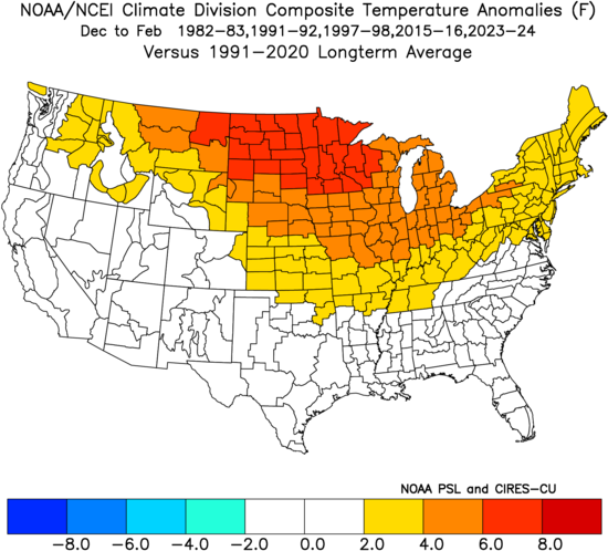
By autumn, we were steering into a strong El Niño episode for the winter. That’s why I loudly and consistently warned that Winter 2023-24 would be a dud.
Playing stupid games wins stupid prizes!
Looking to the oceans
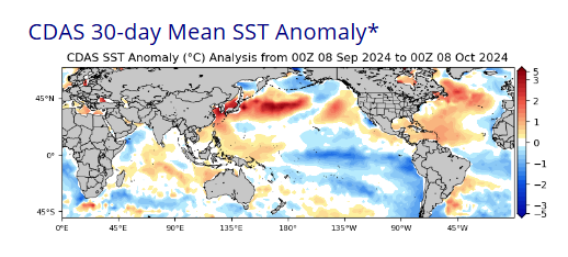
Oceans cover 70 percent of Earth’s surface. Water stubbornly resists temperature change. Therefore, distribution of warm and cold sea surface temperature (SST) anomalies may be used in attempt to predict long-term seasonal weather, in broad strokes.
Here is the latest SST Anomaly distribution, showing developing La Niña over equatorial Pacific. Also, see the expansive warm pool from Japan to International Date Line:
For this exercise, I will use a composite of Top-5 analog years:
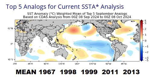
Applying analogs to Winter 2024-25
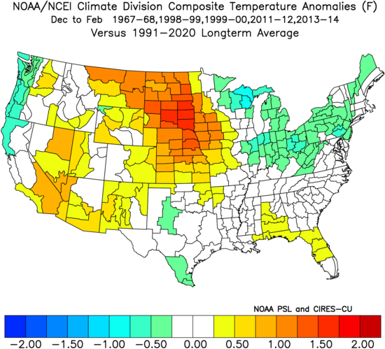
Let’s stay focused on temperature anomalies. After all, we need persistent cold to keep the snow we get!
Composite December to February temperature anomalies for Top-5 analog winters looks strikingly different than last winter for northeastern United States:
Let’s break it down, month by month!
December
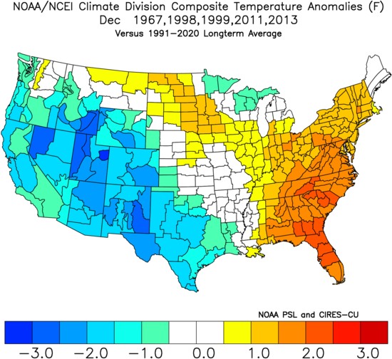
This doesn’t bode well for a strong start to winter. Strong cold bias over western United States suggests downstream warming episodes into eastern United States.
January
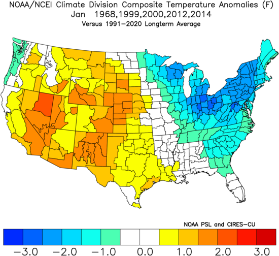
Wow! Note the STRONG cold bias over northeastern United States. January could be our best opportunity for deep and consistent cold.
February
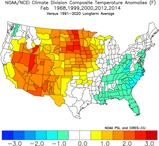
Composite temperature anomaly is near climatology for northeastern United States. This means uncertain signaling for warmth or cold. February might be a toss-up.
North Hemisphere Snow Cover Advance
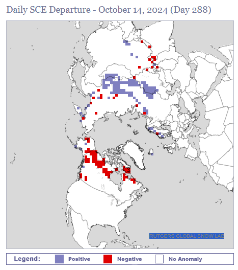
Snow cover spread has been underwhelming into North America with large expanses of negative anomaly. If this trend continues through autumn, we may have a sluggish start to winter in line with December’s mild composite analog.
Arctic Sea Ice
You can debate the cause, but you cannot question the result: The world is a warmer place than it was decades ago.
Arctic sea ice doesn’t lie! 2024 extent is far below the 1981-2010 median curve.
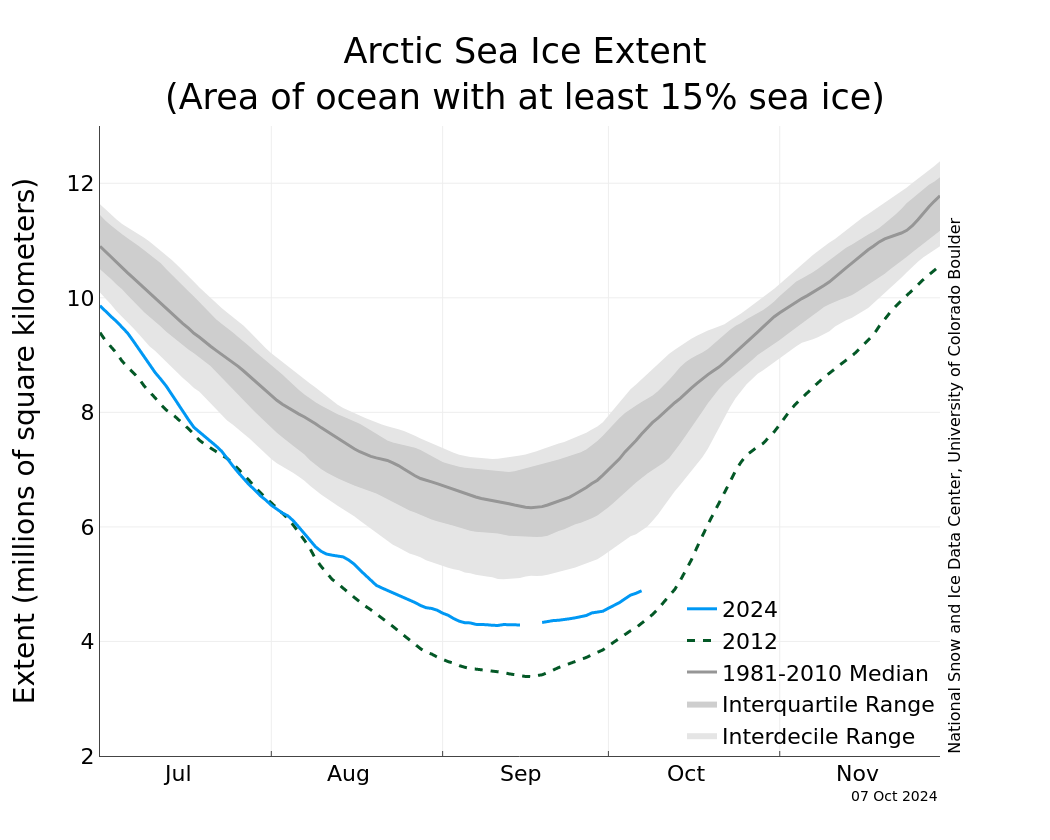
Warming Arctic makes it more difficult for cold weather to persist for several weeks at a time in temperate mid-latitudes, where we reside. This must be taken into consideration.
Bottom line
Based on balance of probability, I say with confidence that Winter 2024-25 will be colder (and better) for central Adirondacks than last winter. But I don’t see evidence yet to suggest a mythical, white unicorn “Old Fashioned Winter” either.
I’m hoping for much more snowmobiling riding than last winter, that’s for sure!
For the ilsnow nation,
Darrin