
Monday, February 19th update: Rapped out another couple inches of fluff Sunday night. Got people asking me: “Is it worth coming from (fill in the blank) hours away to ride.”
Welp… We got some snow and people are riding. Very busy from Brown’s Farm parking lot into Moose River Plains this weekend. Not as busy as usual around town, but I witnessed packs of snowmobilers swirling around ilsnow Capital City.
For the most part, the people who came up to ride were happy they did, considering we haven’t had many weekends to ride. Groomers are working with what we have, where they can. We’re past the point of holding out for better.
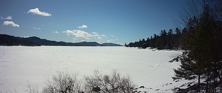
As for the lakes, all I will tell you is that ice thickness is half (or less) than usual for this time of year. And some lakes have issues with pressure cracks/ridges and open water near them. I’ll trust that we can act like reasonable adults in deciding the risk vs. reward factor on riding any particular lake. RIDING LAKES IS ALWAYS AT YOUR OWN RISK, AND THE RISK OF PEOPLE WHO MAY HAVE TO RESCUE YOU.
We’re into the Back-9 of snowmobiling season. Do with it what you may…
Saturday, February 17th update: Snowmobile access onto Indian Lake from C8/Sabael trail has been CLOSED due to unsafe ice conditions on Indian Lake.
Multiple accidents on the lake, open pressure crack, Rescue ATV through the ice. Speculator Fire and EMS also being dispatched, second ambulance from Indian Lake.Indian Lake Fire and EMS, snowmobile MVA on Indian Lake, 3 miles south of the marina.
Friday, February 16th update: What a sight for SORE EYES in Indian Lake, NY! I measured 4-and-a-half inches of white gold at the ilsnow storm center.
Other snow total reports include:
Newcomb: 4-5 inches
Speculator Village: 6 inches
Piseco: 9 inches
Wells (Gilmantown): 9+ inches
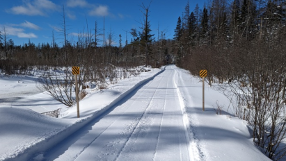
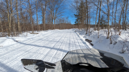
Seasonal road snowmobile trails should be good to go again. Most narrow woods trails should be rideable (low snow conditions) with caution – beware of old washouts that may not have completely frozen over.
Snowmobile trails west of Speculator Village have been REOPENED! Ride ’em with caution.
Remnant frozen snowpack is mostly 6-12 inches around Indian Lake, NY and adjacent central Adirondacks. Shady nooks and snow bowls still hide a foot-or-more of pack. Southerly exposed and water-logged areas hold less than a half-foot of pack. The dusting to an inch of snow we got Tuesday night is a mood booster, but doesn’t help much otherwise.
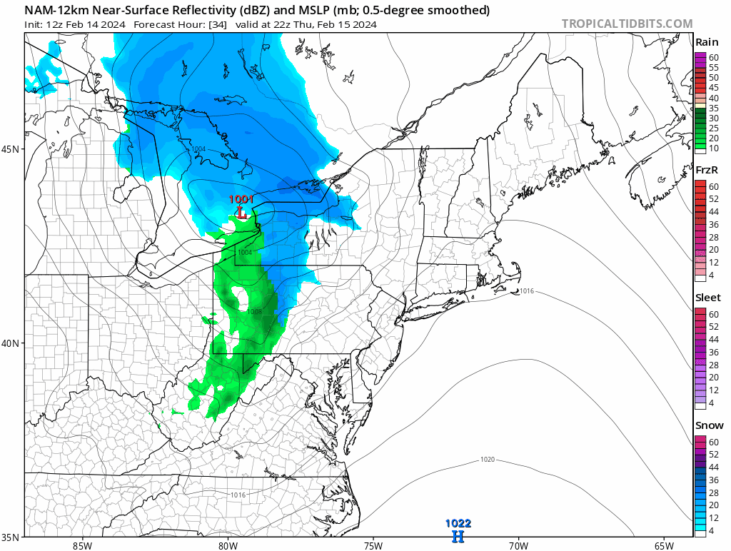
THIS is our start point.
Playing it forward thru Presidents’ Day
We’ve finally escaped the Pacific flow death lock (for now). Looks like we’re in for another cycle of winter as we approach the holiday weekend.
First installment of snow will come from a moderately strong Canadian clipper system rolling through Thursday night. This should bring seasonal road snowmobiling trails back to life. Narrow woods trails (probably) become ride-able again – but mixed bag of treats, at best.
And we’ll get to shake the snow globe at times this weekend as weather disturbances roll though.
Seasonable (not extreme) cold will hold through Presidents’ Day. Can I get a hallelujah from the ilsnow congregation? Cold and snowy weekends have been rare this winter, for sure!
Be sure to check on my daily updated weather forecasts at Weather & Webcams | ilsnow.com
This report is brought to you by Wilder Performance. your one-stop-shop for high-performance, premium parts for your Snowmobile and SxS. We are riders who are passionate about off-road sports and understand the importance of having the best performance parts to enhance your riding experience. Our frustration with the lack of quick access to these parts led us to start Wilder Performance.
We believe in doing things right the first time, which is why we offer only the highest quality products, hand-picked by our team. Our location in Mayfield, NY, gives us easy access to some of the best riding trails in the Northeast, allowing us to test and fine-tune our products to provide you with the best possible performance. At Wilder Performance, we’re committed to providing exceptional customer service and delivering your orders quickly and efficiently, so you can spend less time waiting and more time riding.
Next week
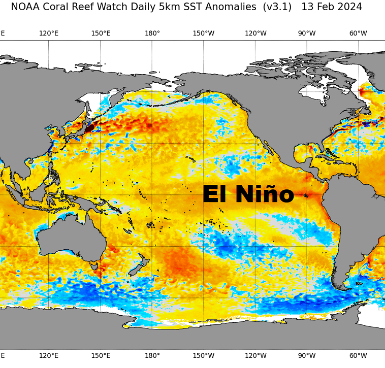
Unfortunately, cold cannot be trusted to stay uninterrupted – especially in a strong El Nino winter. A warmup should start by Tuesday afternoon, ahead of the next cold frontal passage.
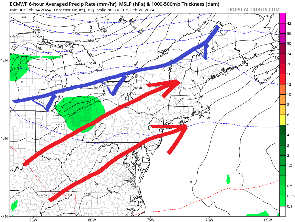
No subtropical connection, so little if any rain. Hopefully, cloudy enough to keep temperatures from boat racing well into the 40s on Tuesday or Wednesday.
I think our best opportunity for a significant snow event would be around February 23rd with Polar Vortex (PV) aligning with a well-developed trough moving into eastern United States.
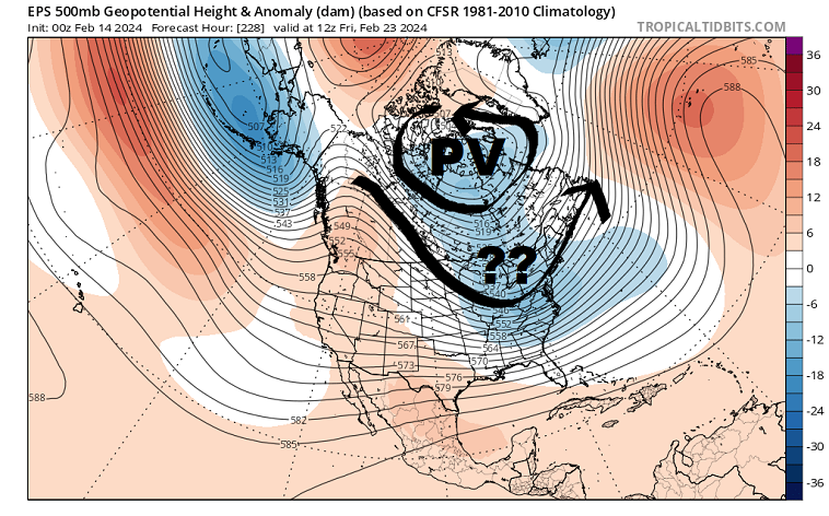
The big question (??) is how much short wave energy would be moving through at the time, something that long-range modelology can’t decipher accurately. For now, this is something only to watch.
If we can bag a good snow, a shot of seasonable cold in the storm’s wake would get us through the weekend of February 24-25.

End of February?
Strong shortwave energy (SW) crashing into Alaska/western Canada is expected to re-establish dreaded Pacific flow and break the back of our wintery interruption.
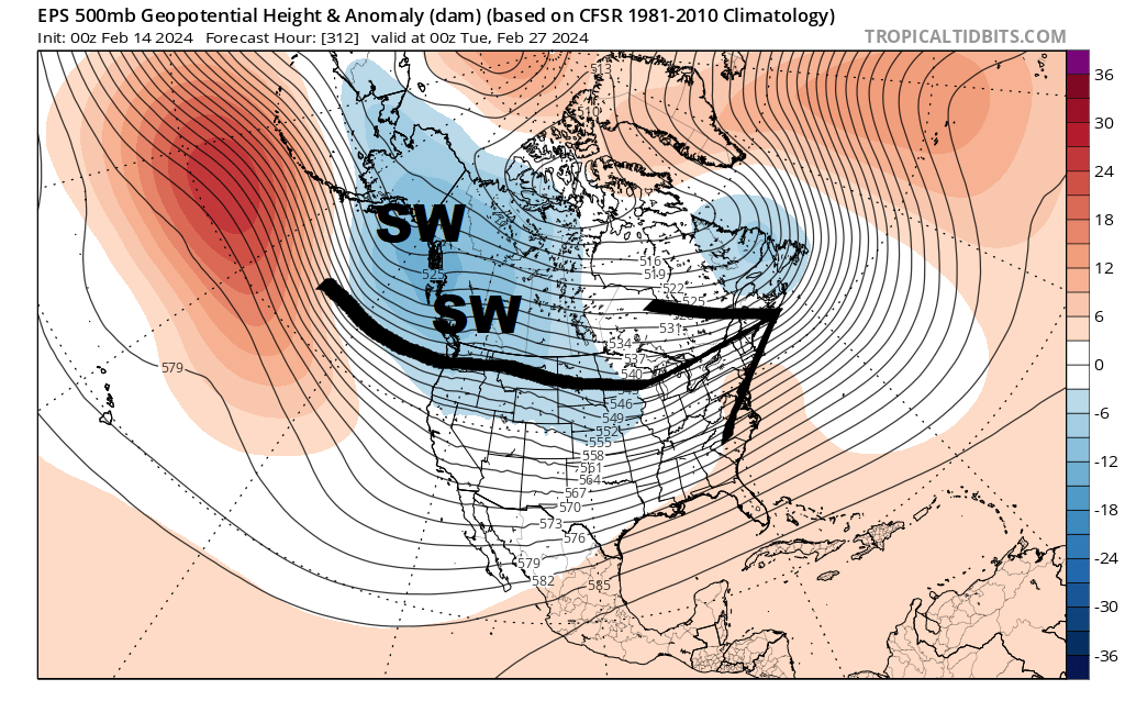
While it’s far too early to hash out the demons in the details, zonal Pacific flow patterns rarely give us happy endings. And we’d have higher late-winter sun angle to deal with.
El Niño Update
Well past the point of beating a dead horse to a bloody pulp, but here it is!
Bottom line
When get it, hit it! Just as simple as that. Don’t overthink it.
For the ilsnow nation,
Darrin