
We close the books on a snowy, yet erratic January.
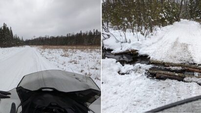
Snowmobiling was non-existent to open 2024. Then, a rapid succession of snow and mixed-phased precipitation events built up snow cover quickly into mid-January. Even though we didn’t score any major or epic snowstorms, snow removal folks were BUSY!
Recapping January in Indian Lake, NY
2024: Mean temperature: 21.6*F, Snowfall 35.5 inches
Climo: Mean temperature 14.0*F, Snowfall 25.7 inches
Despite abundant snowfall, January 2024 was quite mild overall, especially to start and end the month. But it wasn’t warm enough to crack the Top-5. That my lowest recorded temperature was only -5*F speaks VOLUMES of El Niño’s domination of North America’s winter thus far.
You can’t say we’re not getting snow this winter.
2023-24 (to date): 64.6 inches snowfall
Climo (to date): 58.8 inches snowfall
Much of our total rests on a rather snowy period in late-November and another during the heart of January. This is NOT a repeat of the infamous 2015-16 Super El Niño. This is playing much closer to 1997-98 Super El Niño winter (but not as strong) in which Indian Lake, NY got close to climo snowfall, but was quite mild (within Top-10 warmest) overall.
The best way I can sum up this winter (to date) is: Mild, occasionally quite rainy with snowy & moderately cold interruptions.
The dominating mild is a feature of strong El Niño events, not a bug. It’s what they do.
Playing it forward
Weather pattern for opening week of February is looking absolutely hostile against any Arctic cold to kick in the doors. But a strong blocking high centered near Minnesota should keep the blowtorch at bay by force feeding a shot of stale Canadian chill this weekend, which will persist through at least early next week.
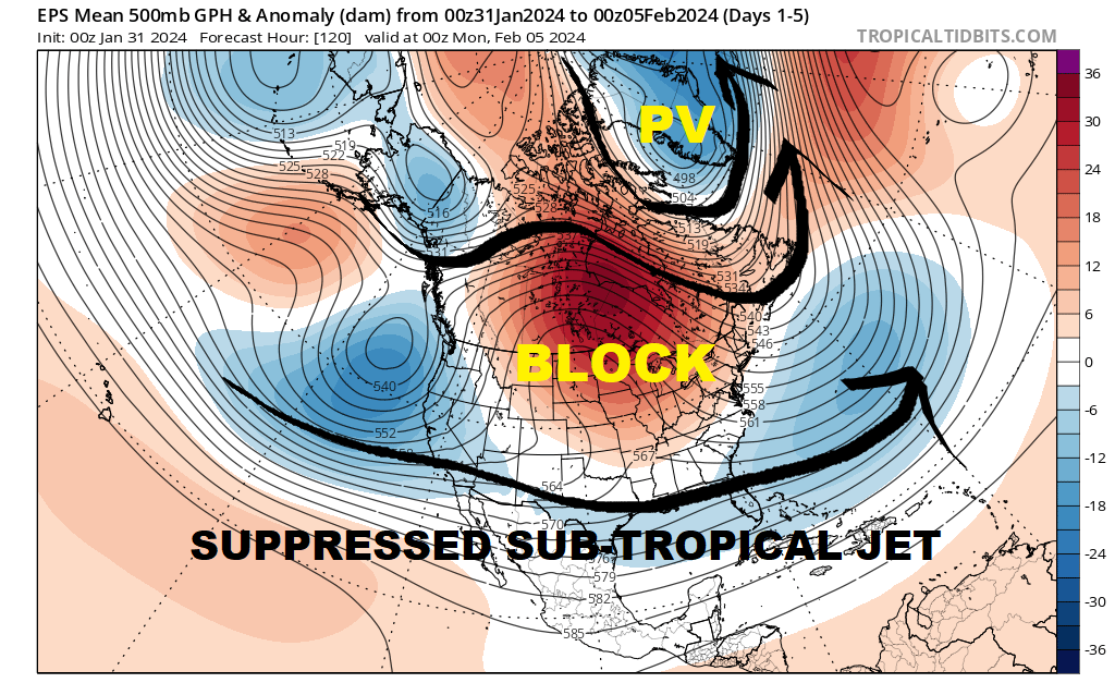
As a consequence, significant weather systems will be shunted well to our south along the suppressed sub-tropical jet stream. Probably about as boring as anything you’d see mid-winter.
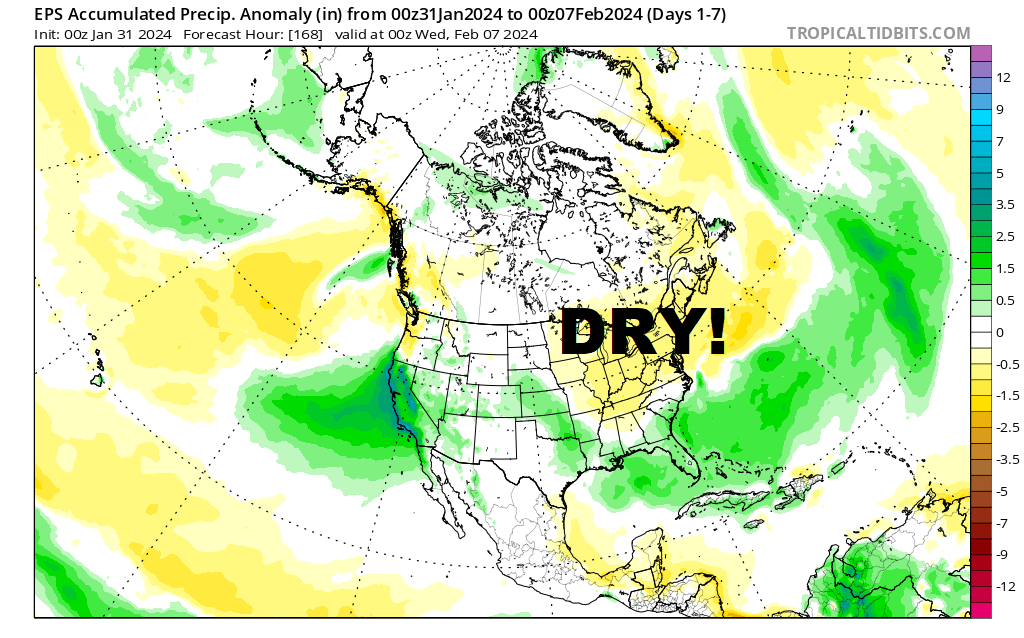
If it can’t be mid-winter cold, I’ll be happy to preserve what we have through this weekend and to begin next week. In this case, quiet and boring is GOOD!
This report is brought to you by Wilder Performance. your one-stop-shop for high-performance, premium parts for your Snowmobile and SxS. We are riders who are passionate about off-road sports and understand the importance of having the best performance parts to enhance your riding experience. Our frustration with the lack of quick access to these parts led us to start Wilder Performance.
We believe in doing things right the first time, which is why we offer only the highest quality products, hand-picked by our team. Our location in Mayfield, NY, gives us easy access to some of the best riding trails in the Northeast, allowing us to test and fine-tune our products to provide you with the best possible performance. At Wilder Performance, we’re committed to providing exceptional customer service and delivering your orders quickly and efficiently, so you can spend less time waiting and more time riding.
Next week
The block will break down next week. With strong shortwave energy (SW) expected to crash into western United States, it’s only a matter of time before we get a warm wave to wash toward us.
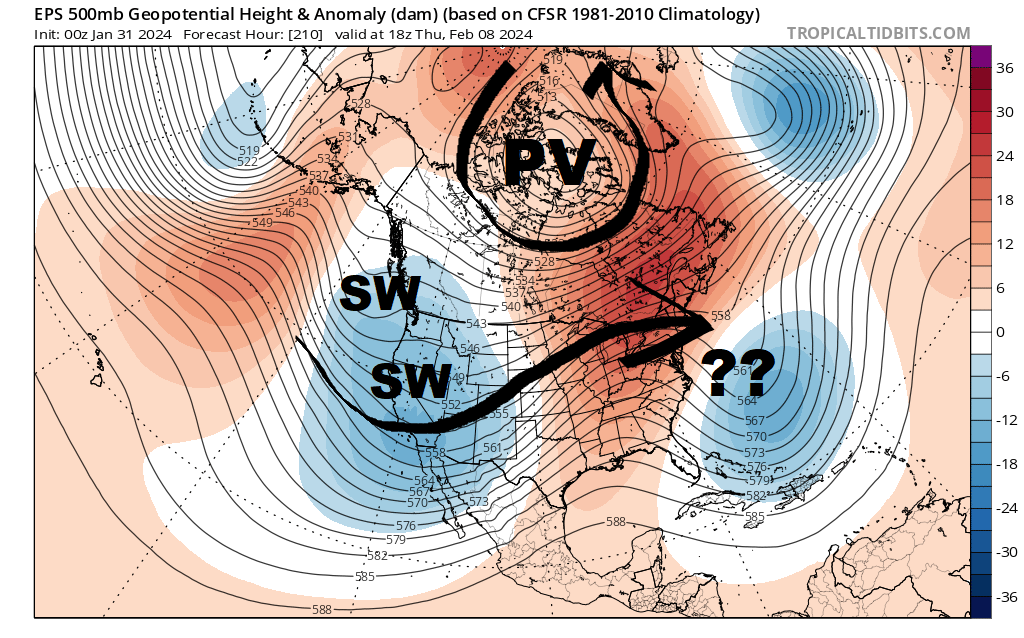
The big question mark (??) is with a storm offshore from the eastern United States. The longer that sits and spins there, the longer it would delay another onset of truly harmful weather (to snowmobiling) into central Adirondacks.
I will say this: If you can choose between snowmobiling this weekend or waiting for February 10-11, I would strongly advise cheating on the side of riding THIS weekend.
Of course, we don’t know yet the demons in the details leading to February 10-11. If you ride this weekend, you’ll definitely get a weekend in, maybe 2 if the following weekend isn’t too bad. If you wait until February 10-11, you’ll miss this weekend and take your chances on getting skunked the following weekend. Or maybe you’ll luck out and get to ride that weekend. We’re playing the percentage game at this point.
Where’s the hope?
OK! I’m getting there…
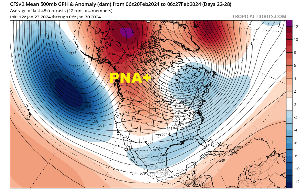
After the weekend of February 10-11, ensemble modelology is very bullish in suggesting strong PNA+ ridging over western North America by Valentine’s Day, which is a total polarity change in the Pacific North America Oscillation (PNA).
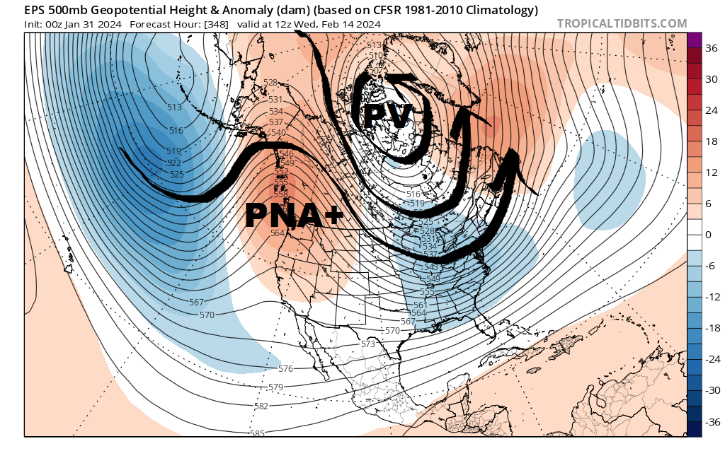
This would teleconnect with colder, stormier weather over the eastern United States, the kind of thing we’ll sorely need to get winter rolling again around here.
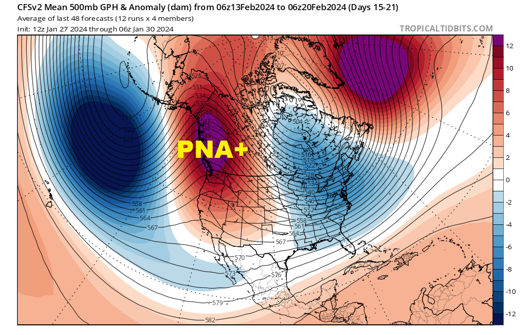
CFS weekly ensembles dovetail nicely with this and suggest we’ll dig into winter fun well into the second half of February.
I’m not going to venture a guess on how long the cold, stormy regime would ACTUALLY remain in place before it takes hold. Any outlook past 2 weeks is fuzzy at best.
But I am optimistic about our winter taking a turn for the better in mid-February. Ensemble modelology nailed, well in advance, the onset of our cold/snowy period in late-November and again for mid-January. This appears to be part of a broad cycle occurring this winter.
El Niño Update
Still large and in charge…
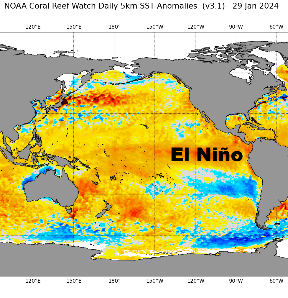
Today’s modeled snow cover analysis REEKS of strong El Niño. A classic signature…
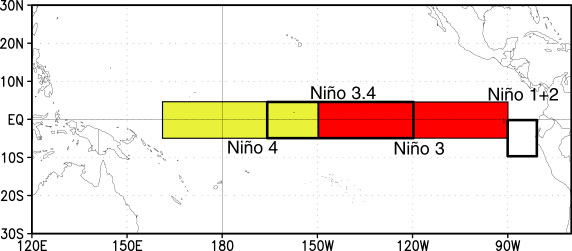
Nino 3+4 region is still oscillating around +2*C, well above the +1.5*C threshold for strong El Niño. But there are signs of decay on the eastern flank near equatorial coast of South America in Nino 1+2 region.
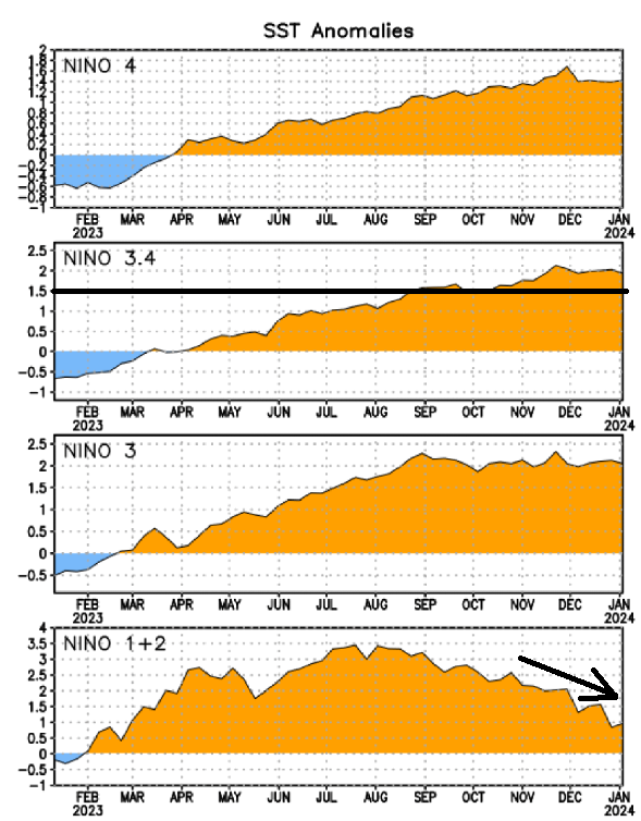
This is not a sign of imminent collapse. El Niño events usually reach their peak intensity early winter, then slowly weaken through winter and especially into spring.
That’s all I’ve got for now. Just gotta sit back and see how this plays out!
For the ilsnow nation,
Darrin