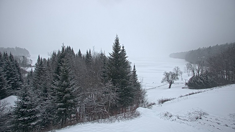
6am Saturday update: 3 inches of dense snow/sleet mixture at Indian Lake, NY. Still getting white precipitation pre-dawn Saturday, but not for long as the mild punch makes inroads.
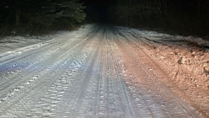
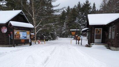
Perkins Clearing and Moose River Plains have been groomed this week and ready to rip! Once we get over the hump today, lake-effect snows will gradually add to the pile over the weekend. Forecast details at https://ilsnow.com/weather/
Don’t over think this! Get here. Hit up the seasonal road snowmobile trails for the most fun. Local/narrow woods trails are ride-able but expect to encounter mud/swampy spots. I strongly advise staying off the lakes for now.
Finally took my first snowmobile ride on January 9th. Wasn’t much, but if felt good to get back on the saddle!
For the next week and a half, there is plenty to go over. I’ll even take a crack into February at the end of this.
As usual, I’ll start with what we have now and play it forward.
Current situation
Notwithstanding our recent snow events, the scars of December still run very deep through ilsnow land, even was we press into mid January: subpar snow cover, unsafe lake crossings and unfrozen swamps.
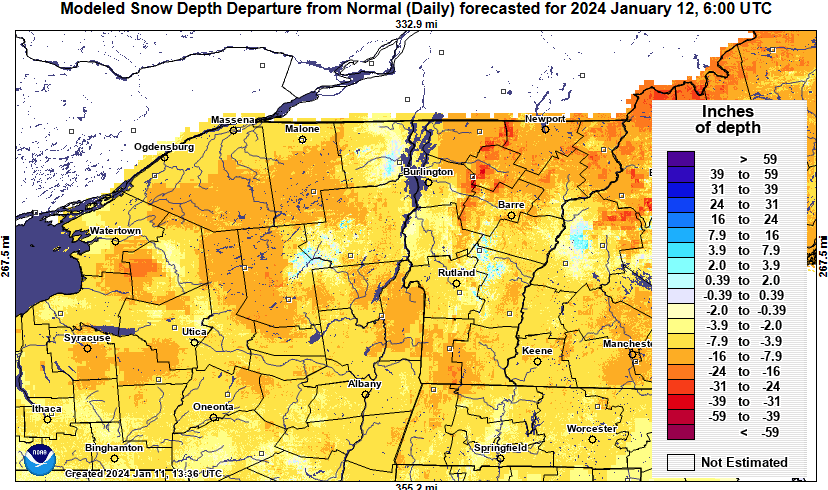
Instead of showing modeled snow cover, I’ll present modeled snow cover departure from normal.
No surprise: It sucks EVERYWHERE…
Playing it forward
Our next storm will be another mixed-phased event, with a decent front-end snow thump into central Adirondacks Friday night into early Saturday morning.
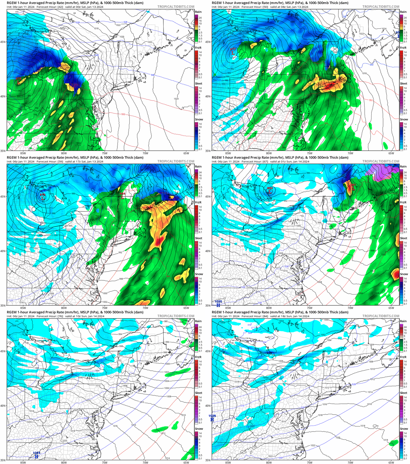
This would be remarkably similar to the previous storm. But rain fall after the precipitation changeover should be noticeably less than the previous storm. And lake-effect snow response in the storm’s wake Saturday night into Sunday would be far greater.
Once we get over the hump after Saturday, my forecasts won’t mention RAIN for a while.
That’ll be AWESOME!
As for riding options this weekend, seasonal roads like Moose River Plains and Perkins Clearing remain your best bet. Lakes remain unsafe to ride. Local town/woods trails remain swampy in large areas and would be rough riding at best.
This report is brought to you by Mangino Chevrolet Buick GMC in Amsterdam, NY & Ballston Spa, NY. We know that you have high expectations, and as a car dealer we enjoy the challenge of meeting and exceeding those standards each and every time. Allow us to demonstrate our commitment to excellence! Our experienced sales staff is eager to share its knowledge and enthusiasm with you. We encourage you to browse our online inventory, schedule a test drive and investigate financing options.
Opportunities knocking?
I’m spying a couple possible snow events next week.
January 16th
Polar Vortex (PV) parked under high latitude blocking would have us set for available cold. Shortwave energy (SW) rotating around base of Polar Vortex should generate a meaningful coastal storm.
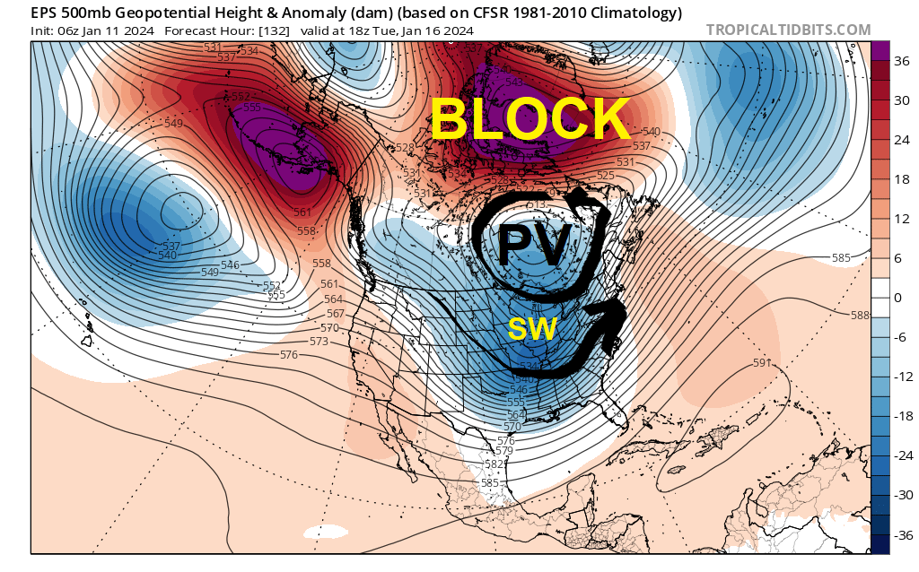
Whether or not this storm would take it to the house in ilsnow land would depend on how much shortwave energy dumps into the central United States to amplify the trough. Something for short term modelology to digest when as time approaches.
January 19th
Polar Vortex (PV) would begin to drift away and weaken, with another shortwave (SW) rolling through the Great Lakes.
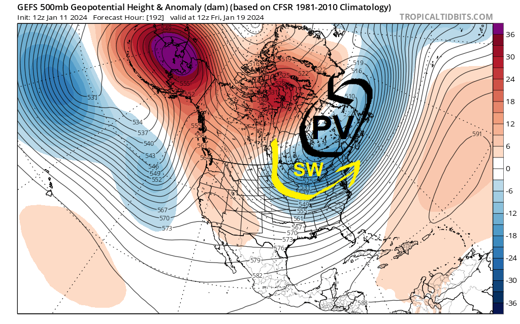
This appears to be a strong Canadian clipper/lake-effect snow event, rather than a pure coastal system. But again, this is something short term modelology to hash out next week.
After that weather system passes through, we’d be in line for a direct discharge from the Canadian Arctic for the weekend of January 20-21. Probably good for the coldest weather we’ve seen this winter to date.
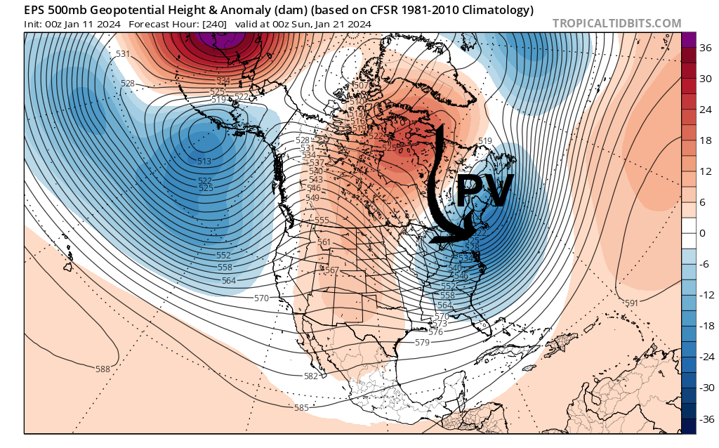
Going forward
Been hearing noise for “severe cold throughout the second half of January!”
Um…. not under this configuration. For the week of January 22-27, Polar Vortex (PV) will have likely retreated to Baffin Island with Pacific flow reestablished over North America.
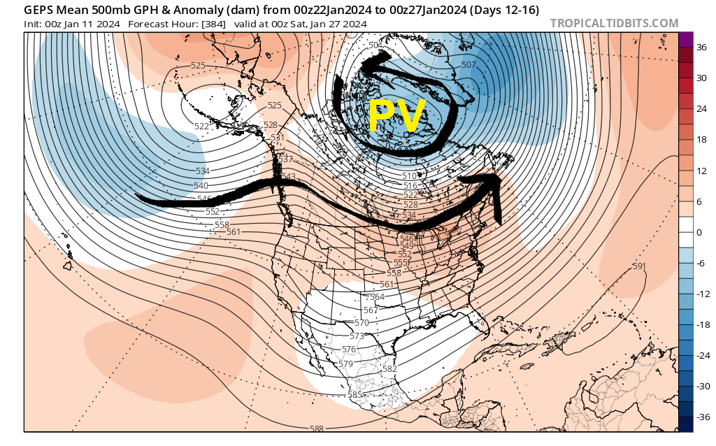
With far greater availability of cold over Canada this time around, this doesn’t appear to be the complete train wreck that mid-late December was. Too early to panic, but we could be vulnerable to a brief warmup. A good case scenario would be to muddle around with stale Canadian cold for that week.
February
I hesitate to put this next panel up, because CFS monthly ensembles are easy to misinterpret (and have dubious accuracy). But here it goes:
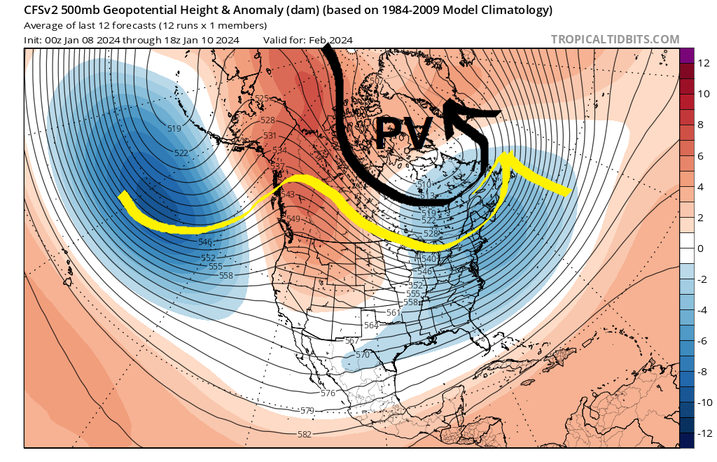
This is not a severely cold look, with the mean Polar Vortex (PV) position north of Hudson’s Bay. But persistent cross-Polar flow would keep the Canadian Arctic stocked with cold. Amplified jet stream ridging over western North America would teleconnect with eastern United States troughing and storm tracks favoring snow events.
This is NOT to declare boldly that February will be all cold and snow without interruption. But it does indicate that, on the balance of probability, February is likely to favor snowmobiling in ilsnow land the majority of the time.
El Niño winters tend to be backloaded with snow for the second half. We’ll see how that plays out as we press into February.
For the ilsnow nation,
Darrin

