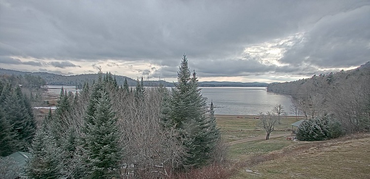
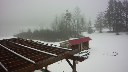
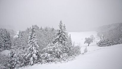
When putting out my “winter outlook” on September 28th, I was concerned about a slow start to the snow season.
Unfortunately, those concerns are playing out as feared.
October 2023 ran quite mild in Indian Lake, NY with mean (daily average) temperature of 48.9*F, several degrees higher than the climo mean of 43.0*F.
And October snow spread was middling at best through Eursaia and North America:
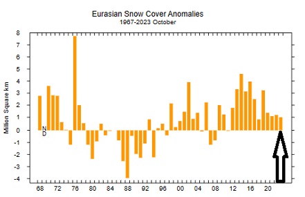
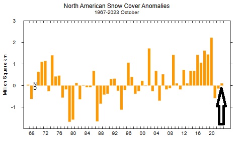
Advance of North American snow cover ran well behind climatology much of October until an explosion of snow cover in the final days, just to barely reach climo.
You can say that winter is running behind schedule in getting here. Heck, you could say that autumn was running behind in September and October!
Looking at November
Let’s see what has happened the past few years at the ilsnow storm center in Indian Lake in November:
2020: Mean temperature 35.0*F, Snowfall 5.0 inches
2021: Mean temperature 33.9*F, Snowfall 7.2 inches
2022: Mean temperature 36.9*F, Snowfall 5.9 inches
When compared to climatology of 32.6*F and 9.1 inches of snowfall, the past 3 Novembers have ran milder and less snowy than average.
Over the following three winters, we struggled with long stretches of poor snowmobiling. Sometimes, lack of snowfall was the culprit. Many other times, it was lack of Arctic cold which allowed warm waves to wash over us in between snow events.
You may be saying, “Hey, the past 3 years have been La Niña, we’re entering El Niño!
My answer: Look at what’s actually happening out there! Prolonged mild autumn weather is often a signal that Arctic cold is somewhat lacking punch in its source regions. When in doubt, I believe what the weather is telling me.
Having said that, we could flip the script for the final week and a half of November.
Let me break it down!
Coming up
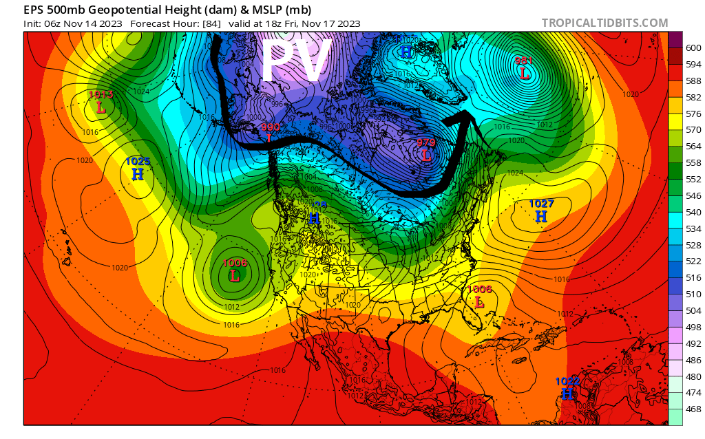
Polar Vortex (PV) will retreat to Arctic Ocean, opening floodgates of mild Pacific air once again by Thursday and Friday:
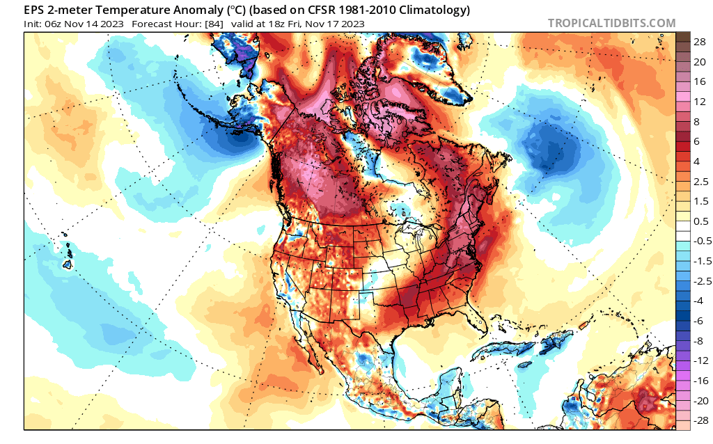
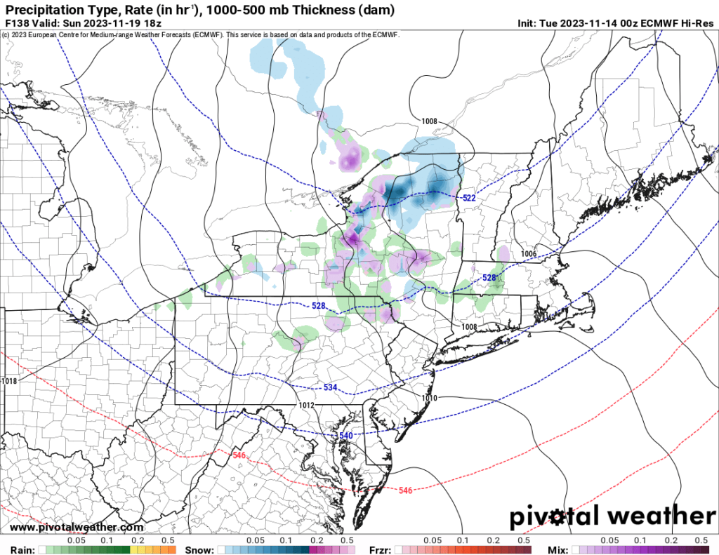
Even with that, we could experience a half-way decent charge of Canadian chill by Sunday, November 19th with sticking snow in places.
Changes ahead?
Stratospheric Polar Vortex has been strong near the North Pole. This usually favors a fast and zonal (west to east) flow across North America, locking true Arctic cold far up north and flooding the lower 48 states with mild Pacific air.
But long range GFS forecasts show stratospheric Polar Vortex weakening and splitting before the end of November.
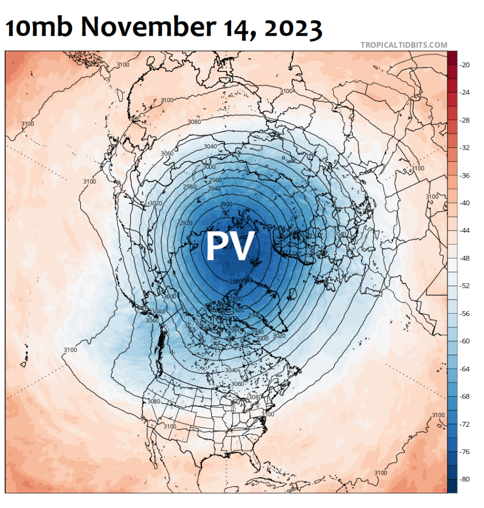
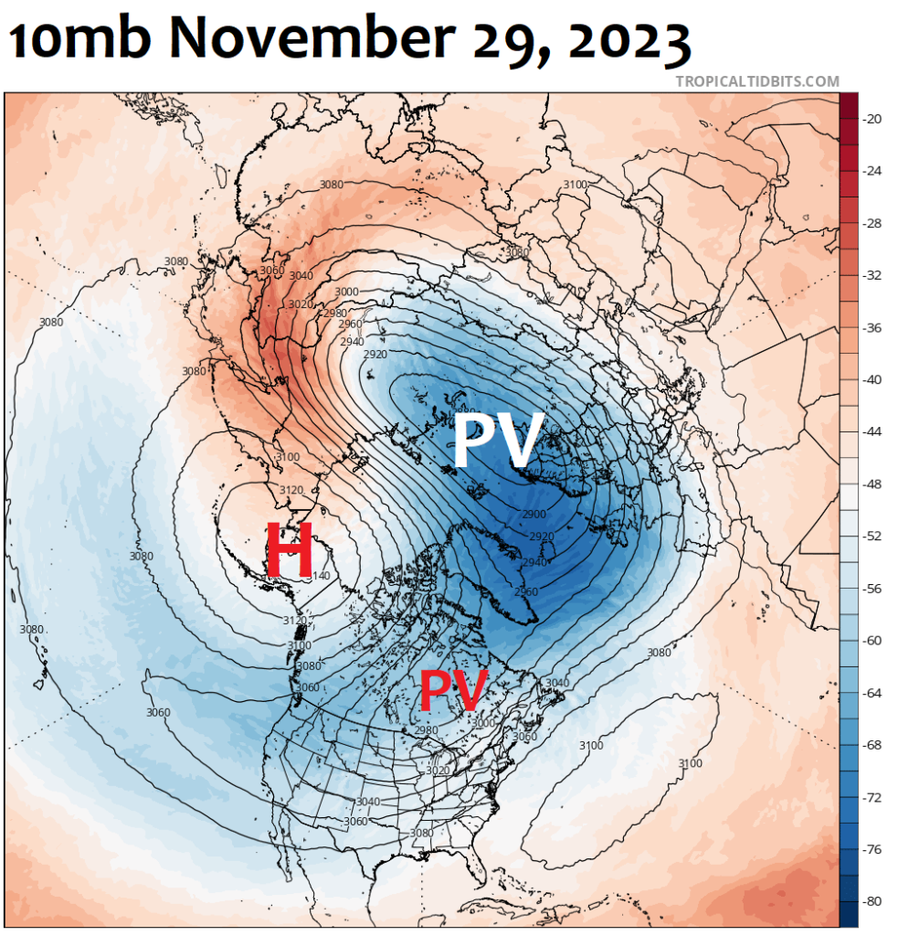
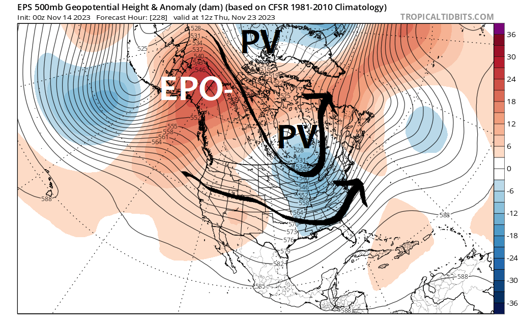
This would be a very significant change to the stratospheric weather pattern, weakening zonal flow underneath. In turn, the polar jet stream would be allowed to buckle and drive Siberian cold deeper into North America. FINALLY!
By Thanksgiving, we could be in for some fun! Strong Alaska ridging, a manifestation of negative phased East Pacific Oscillation (EPO-) would drive cross-Polar flow deep into North America. And a piece of the Polar Vortex (PV) may drop over Hudson’s Bay, giving us something really interesting to watch for.
El Niño Update
At this point, there is no doubt that El Niño will be a major player this winter.
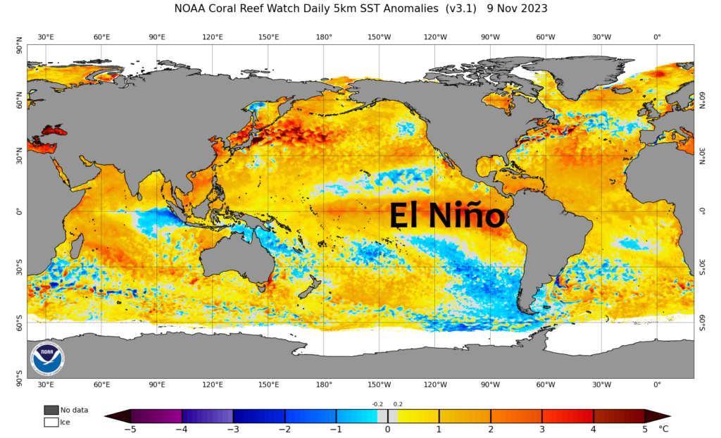
Ensemble forecasts are indicating El Niño to intensify further and remain strong through winter.
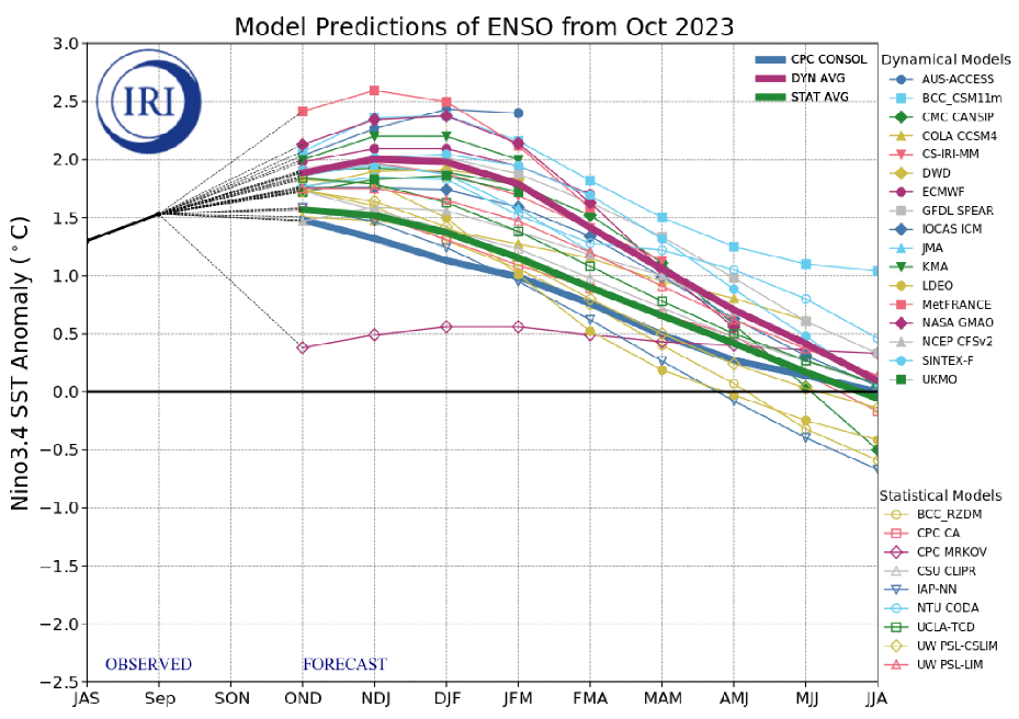
Our history with strong east Pacific biased El Niño events is not good in regards to maintaining cold and snowy winters in ilsnow land.
Climate Prediction Center is forecasting an elevated probability of above normal mean temperature and near normal precipitation for Upstate New York during December-January-February 2023-24.
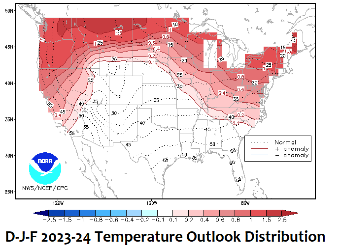
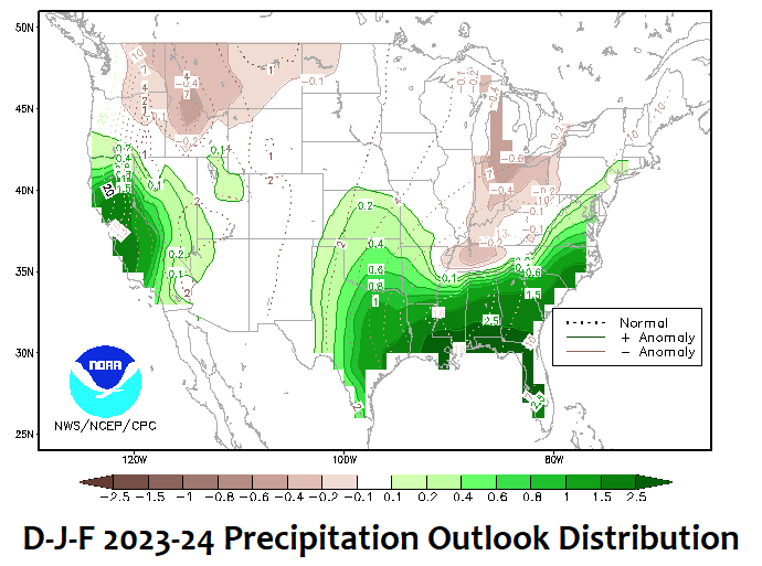
Based on what I’ve seen this autumn and our history with strong East Pacific biased El Niño events, I don’t have the heart to disagree.
Bottom line
This doesn’t mean we can’t get big snowstorms or episodes of strong cold. But, on the balance of probabilities, Adirondack snowmobiling may be prone to mild and snowless periods this winter.
Be prepared to hit it when we get it, because next weekend may not be promised.
For the ilsnow nation,
Darrin

