If you have to ask the question, you may already know the answer.
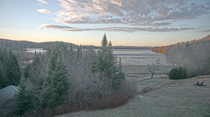
The first third of November 2022 can be described as dry and mild for ilsnow land. Afternoon temperatures even poked 70*F during the weekend of November 5th/6th in the central Adirondacks. That was nearly as warm as it can get here for the time of year.
Rainfall for Indian Lake, NY through November 1-10 totals only 0.09 inch! Leaves are dry and crunchy on the ground.
What does this mean for winter?
Well… I think that magnitude of anomalous warmth indicates the winter train is behind schedule. We flirted with 70*F weather early in November 2020. The following winter struggled MIGHTLY to get off the starting blocks through December into early January.
Even so, Upstate New York (south of ilsnow land) was buried by multiple feet of snow by a snowstorm December 16-17, 2020. Tragically, that bounty was undone by the Christmas Eve Massacre.
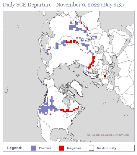
Snow cover spread in October 2022 ranked near average over Eurasia and below average over North America.
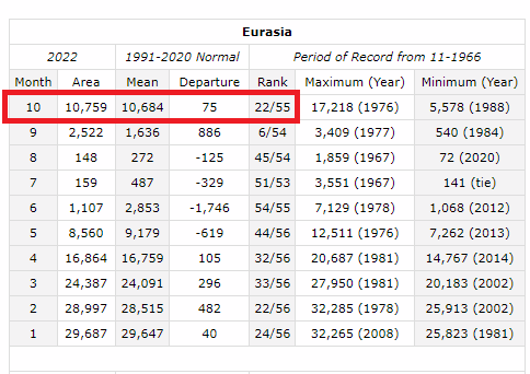
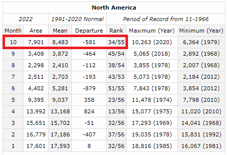
The spread wasn’t shockingly slow as a whole. But, lackluster penetration of snow cover into North America indicates to me that winter is not storming the gates of hell to take an early foothold here.
Through November, snow cover has blossomed ahead of schedule over the western United States whilst the snow train continues to lag behind in eastern Canada.
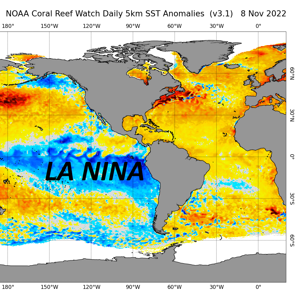
Big elephant in the room?
Of course, we’re talking about La Nina, entering its third consecutive winter. It’s large and in charge over the eastern tropical Pacific Ocean.
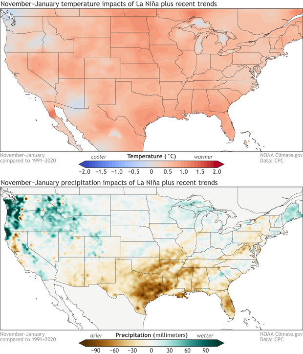
Based on recent trends, winter La Nina episodes are likely to be milder and drier than normal during the November-January time frame for Upstate New York. If the past two years were any indication, the trend is NOT our friend for winter to take foothold early.
Most long-range guidance suggests La Nina will hold moderately strong through early winter, then weaken late winter into early spring.
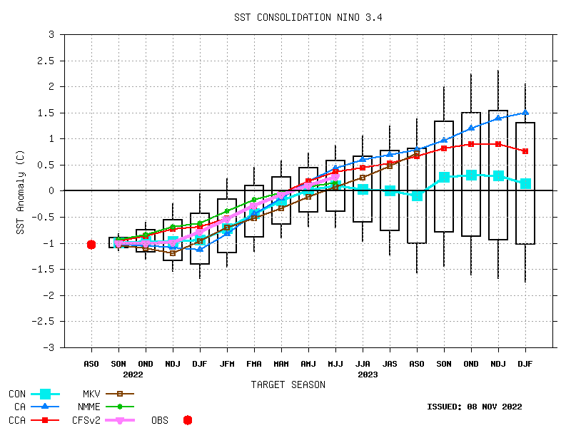
Some long-range weather forecasters are pinning their hopes on a strong second frame to winter (February into March) basis the expected weakening of La Nina. At this time, I am skeptical and believe there is at least a 50/50 chance La Nina will hold moderately strong longer than expected. This is because of the enormous expanse of cold water over the East Pacific tropics that may take a long time to warm up.
But… We can cross that bridge when it gets within sight.
Coming up
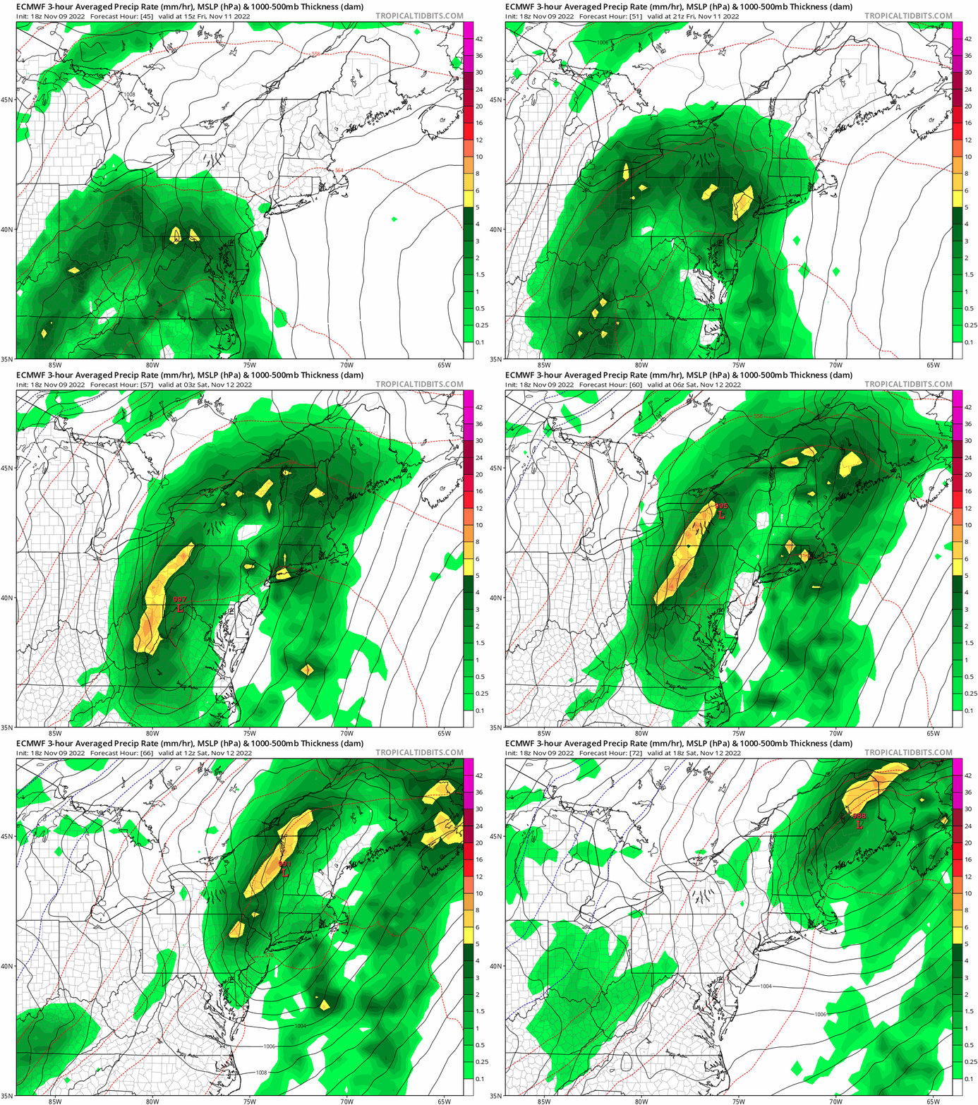
We do have some fun coming down the pike! That will start with soaking rain later Friday into Saturday morning from what remains of Hurricane Nicole. This should put a dent into our November rain deficit.
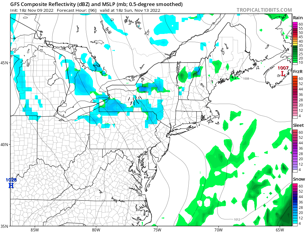
In the wake of ex-Nicole, we’ll tap into a cold shot that should trigger the first lake-effect snow event of the season for upstate New York on Sunday. GFS Composite reflectivity forecast for Sunday shows possible moderately strong lake-effect snow bands over Tug Hill and accumulating snows likely extending into parts of the Adirondacks. It’s a taste of winter that is overdue here.
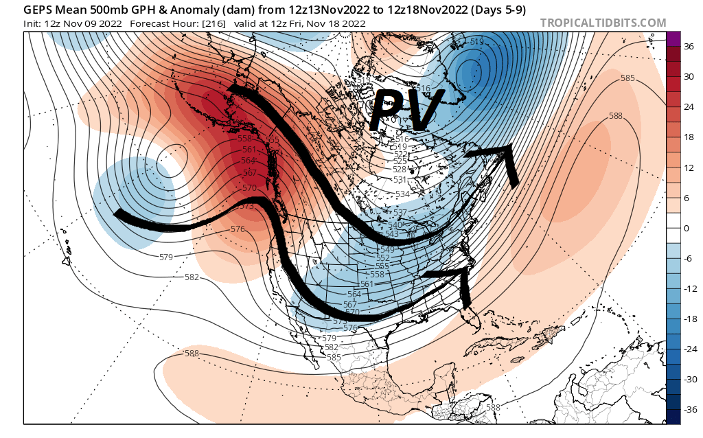
Following Sunday’s lake-effect snow event, the following week (November 13-18) will be squarely on the cold side. Strong ridging should be just offshore from western North America, so it wouldn’t be a true PNA+ pattern. But it would be cold enough for possible snow opportunities in ilsnow land as weather systems roll through.
White Thanksgiving?
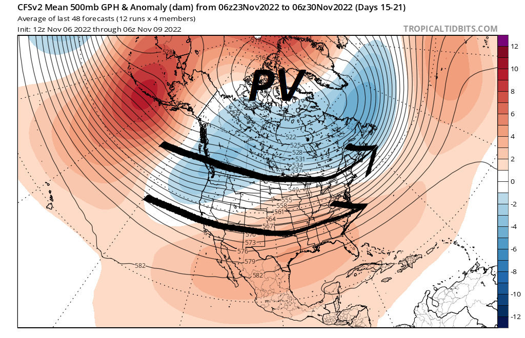
Whoa, Cowboy! Let’s see what mid-November actually does for us before we talk about that. For what it’s worth, CFSv2 ensembles are showing a northward retreat of the Polar Vortex (PV) into the last week of November, not a very cold look for us.
Bottom line
Notwithstanding the early signs, I continue to gear up for winter! I didn’t endure through the grueling grind of #summersucks just to come up short of the prize. Anticipation for my first snowmobile ride continues to build and I’ll be READY when winter is.
For the ilsnow nation,
Darrin
This report is brought to you by Performance Industrial, your one-stop shop for commercial and industrial cleaning, painting and flooring systems. DIRTY. DIFFICULT. DONE. No matter how grimy the job, we show up in professional trucks and crisp uniforms and the only things we leave behind are clean buildings, fresh paint, seamless floors, and bare metal.

