
I don’t have much snowmobiling to report on. The trails were passable over the weekend and some riders were giving it the ole college try through the washouts. Even as temperatures got into the 40s on Monday, I saw a small handful of snowmobiles at the gas pumps in town.
At this point, I’m content to wait it out until the next big snow, which could happen as early as Friday.
We’re at the part of the program where I attempt to peddle realistic hope. So let’s have at it!
Starting off…
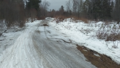
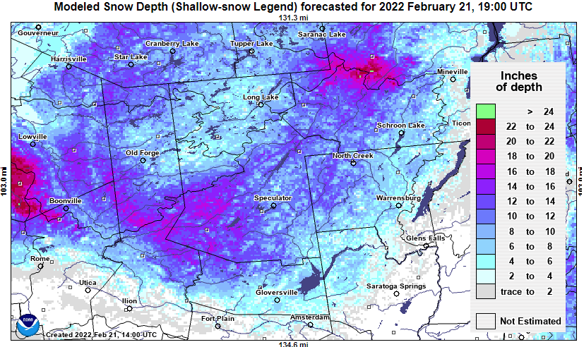
The cupboard isn’t completely bare. Remnant snowpack though the central Adirondacks remain several inches or less in the “cooked spots” to 6-18 inches elsewhere. Except for washouts, the trail base is holding in most places.
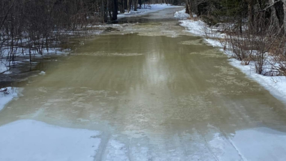
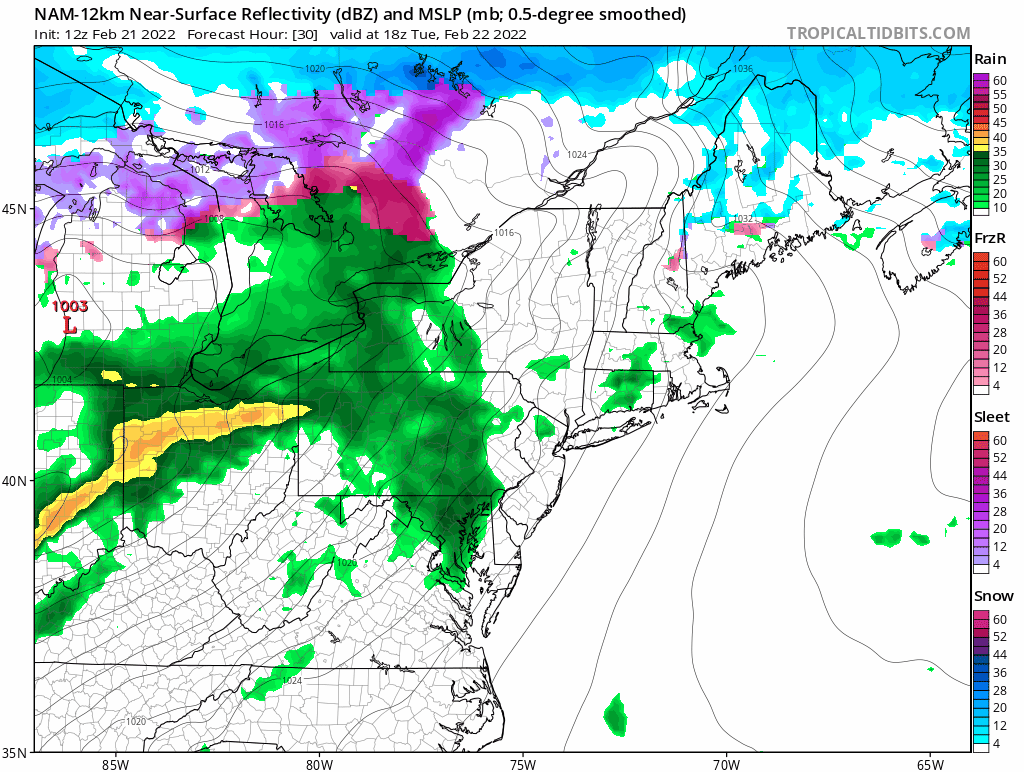
We are in for a shot of rain Tuesday afternoon into Tuesday night as yet another storm passes to our west. Most modelology suggests between a half-inch and full-inch of rain for Indian Lake, NY area. Terrible, but a far cry from the two-inch washout we got last week.
After early highs near 50*F Wednesday morning, cold air will pour in for Wednesday night to staunch the bleeding once again. This will conclude the final beating we will endure for a while.
Friday! Friday!
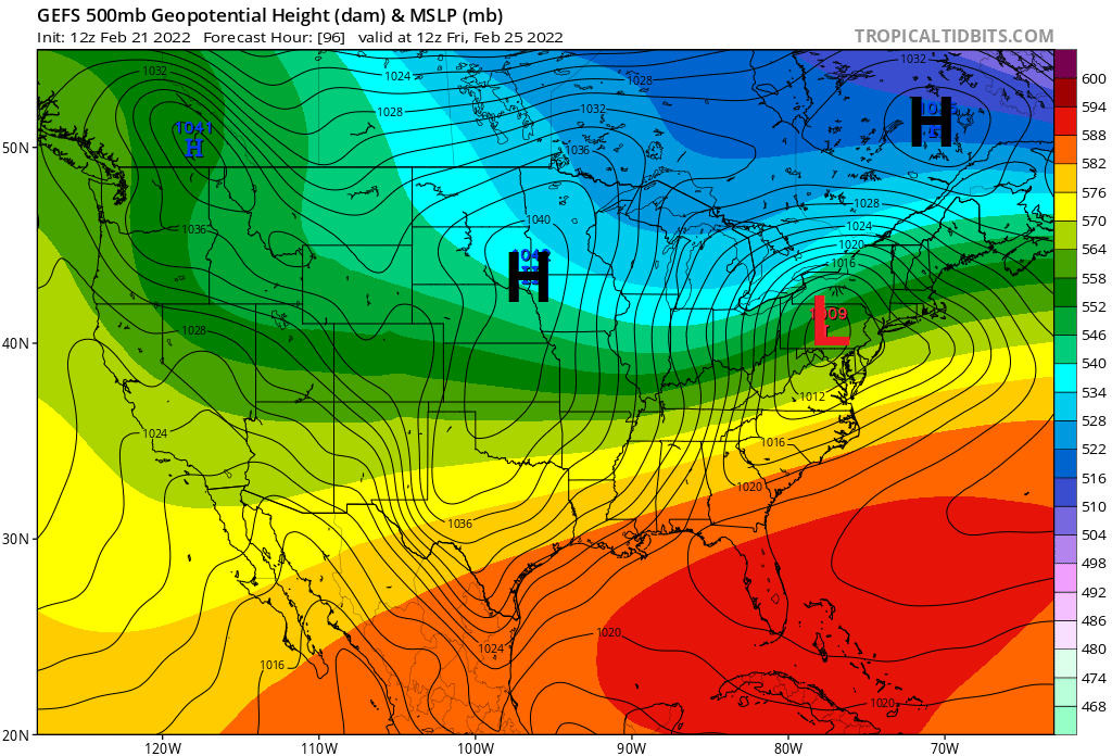
Modelology and their ensemble members remain steadfast, indicating a significant over-running snow event later Thursday night into Friday. Canadian high pressure should be in good position to keep cold air locked in for the duration of the event.
After that?
The pattern should set up EXCELLENT for maintaining cold into the following week with East Pacific Oscillation (EPO-) ridging over Alaska. This will set up nearly optimal cross-polar flow around the Polar Vortex (PV) stationed over Davis Strait.
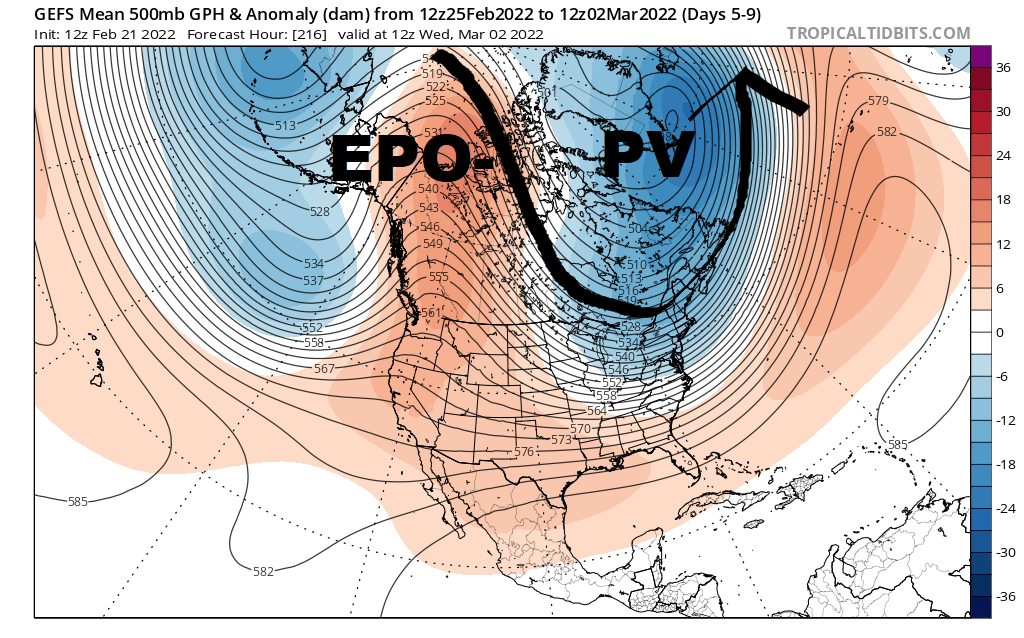
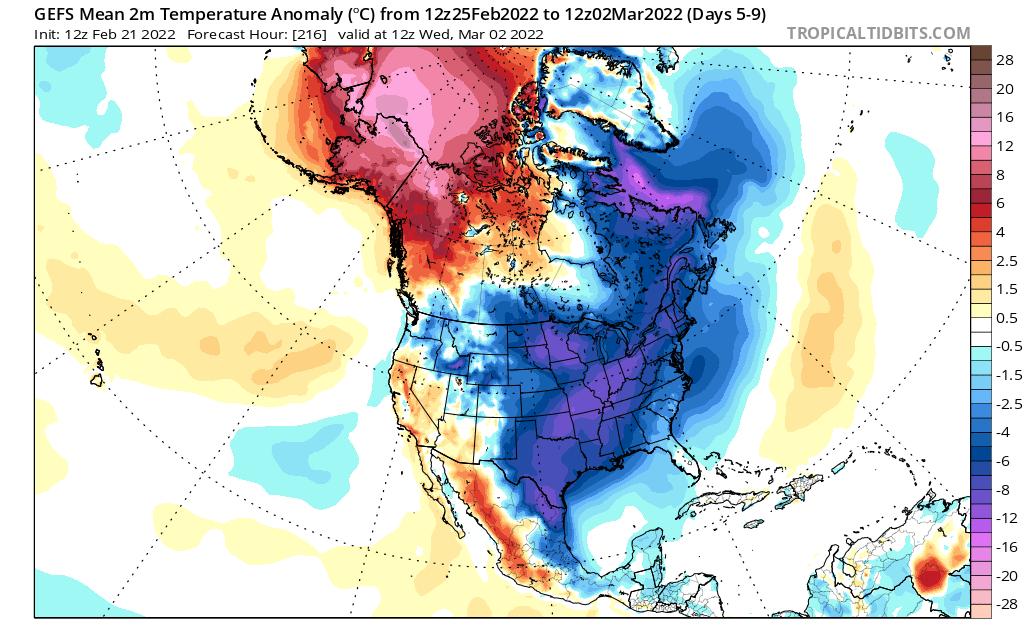
Weather systems in this regime would be low-moisture Canadian clippers. Most of the time through next week would be cold and dry.
March Madness?
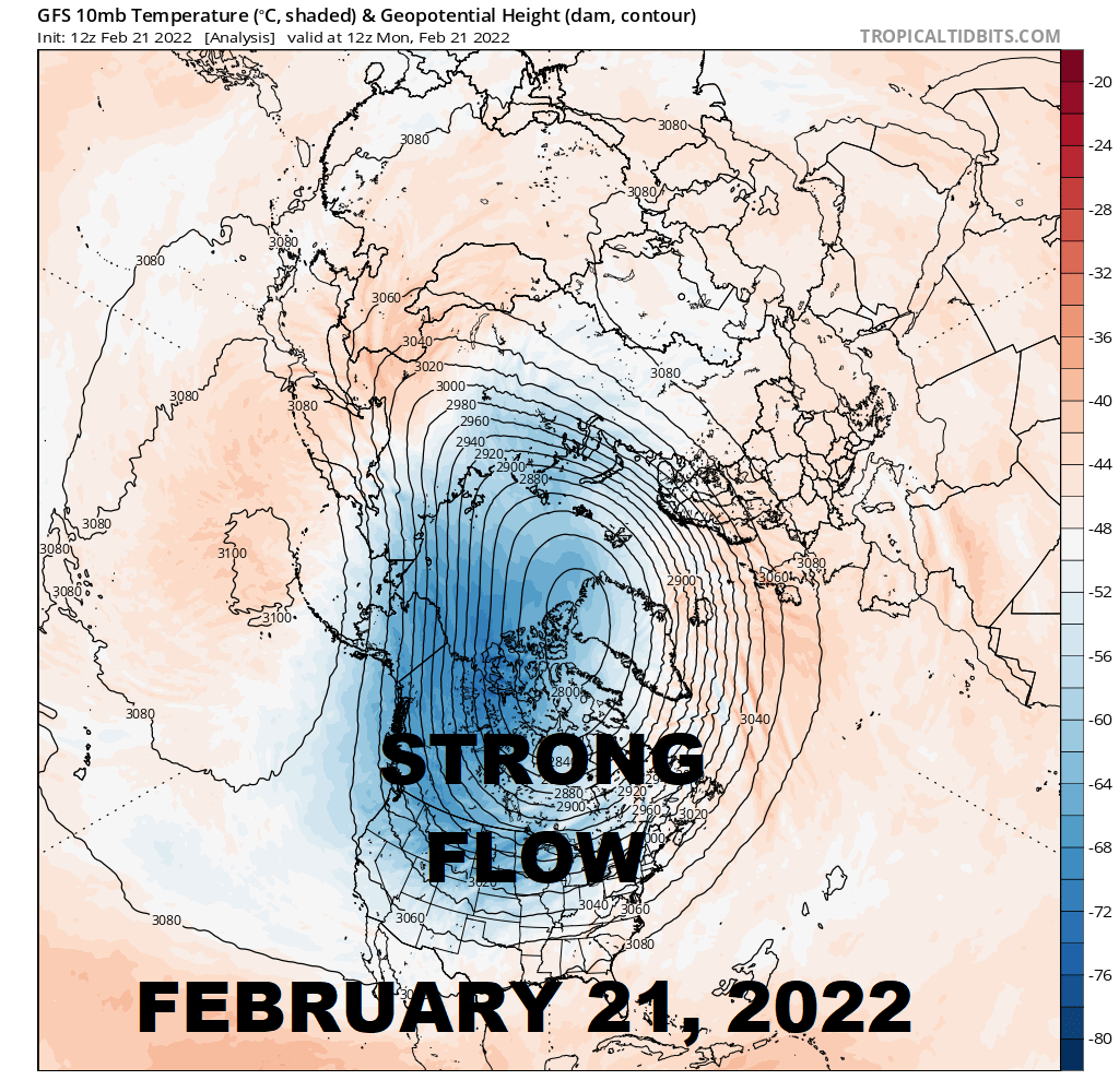
I have been talking about the increasing likelihood of a sudden stratospheric warming (SSW) event for a while. These GFS panels capture the seismic event.
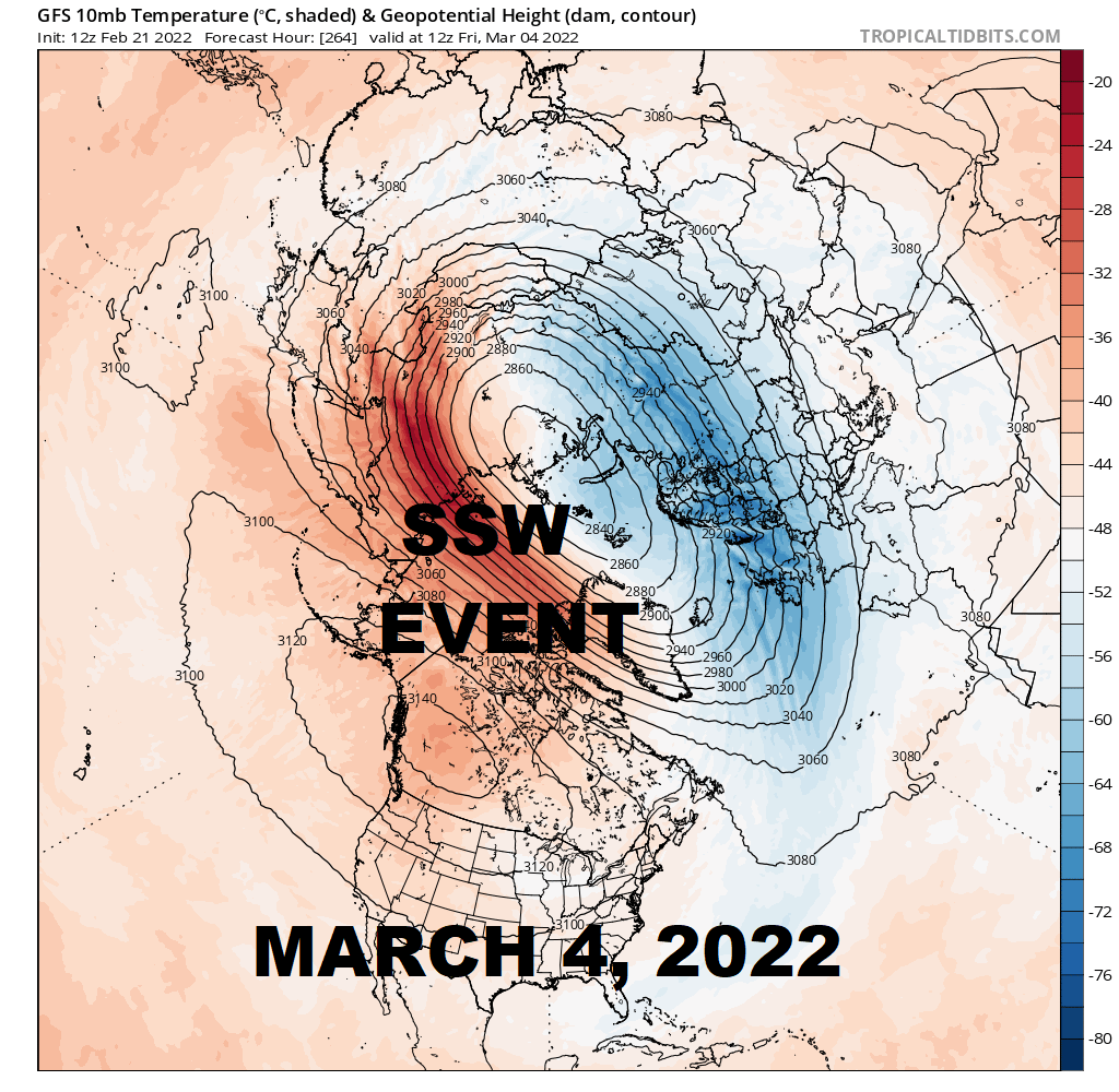
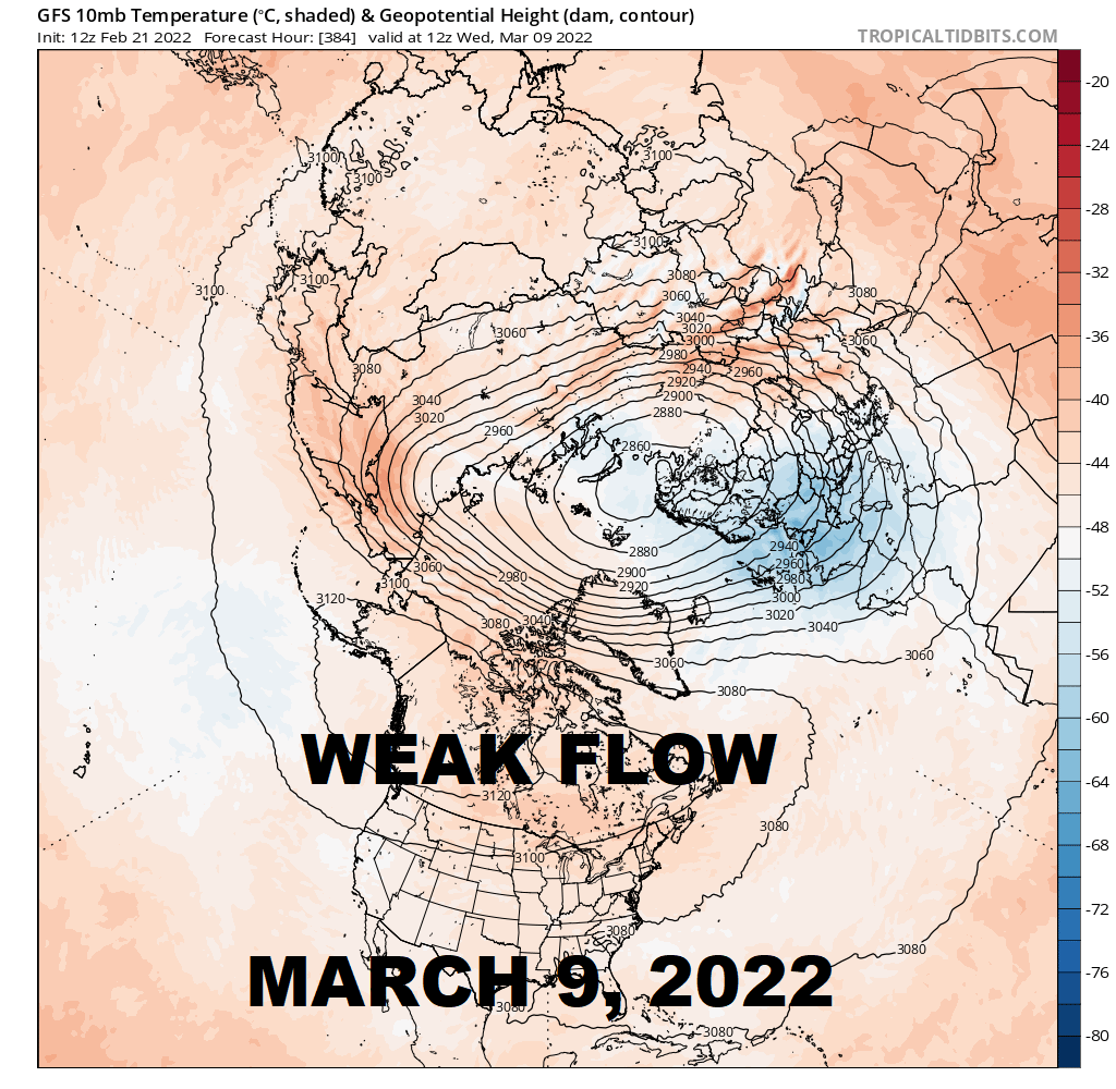
Weak stratospheric flow over North America in wake of the SSW event would favor blocking regimes to set up over Canada. Weather systems would be forced to tunnel under the block, possibly emerging as nor’easter snowstorms as we press into March.
There are no guarantees in the weather biz. But this is the most promising thing I’ve seen on the horizon all season. March has been SORELY lacking in snow the past couple of years. So, I’d say we’re approaching due for March Madness!
For the ilsnow nation,
Darrin
This report is brought to you by Allen Van Hoff – Howard Hanna Real Estate Services. Voted Realtor of the Year 2016 by Southern Adirondacks Realtors Inc., Allen Van Hoff is best described as a warm and friendly, attentive full-time real estate professional with a passion for the area and people he serves.