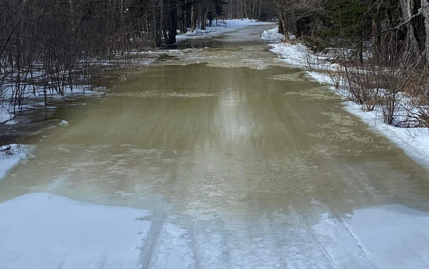

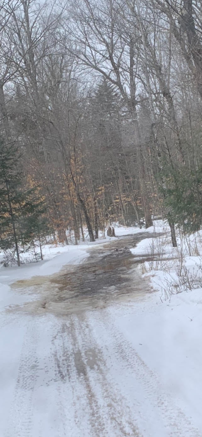
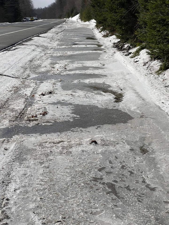
Two inches of rain and a temperature cresting at 47*F in Indian Lake, NY Thursday night did what it’s supposed to do: Melt a ton of snow. Strong winds early Friday probably knocked down some trees.
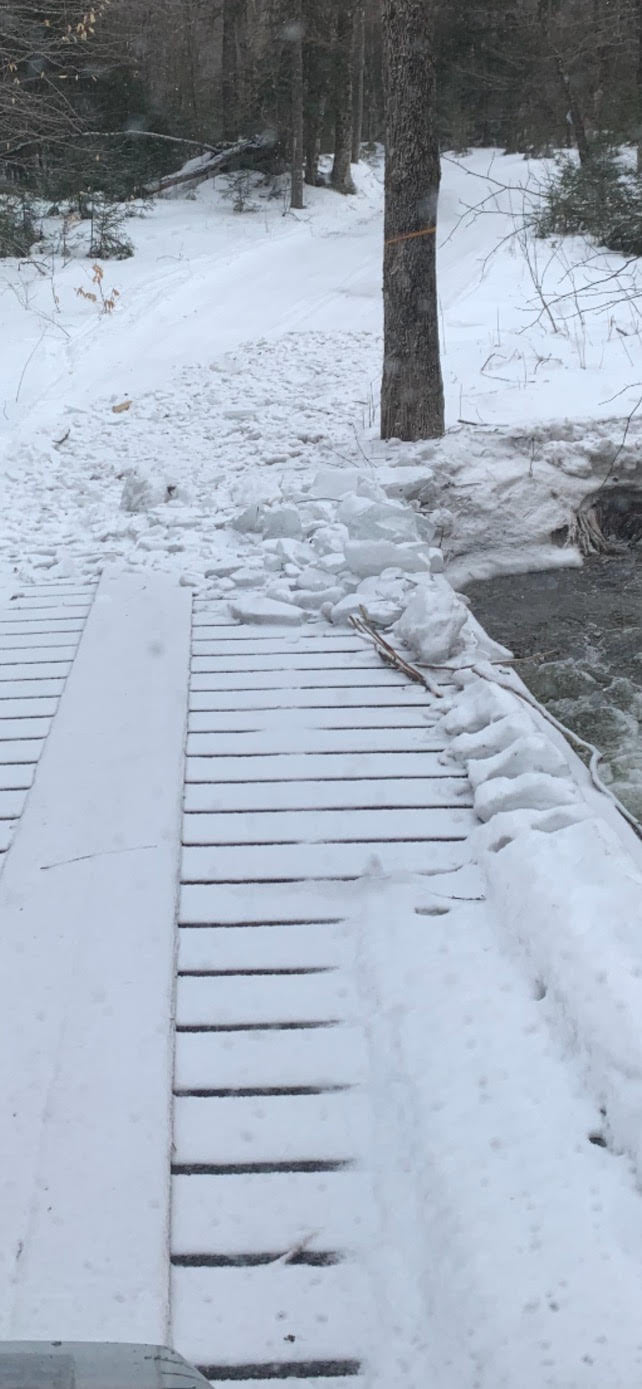
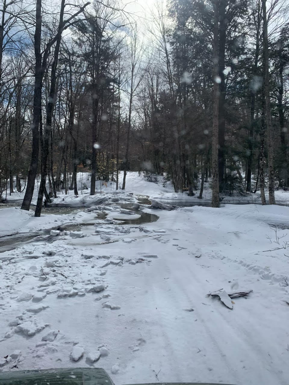
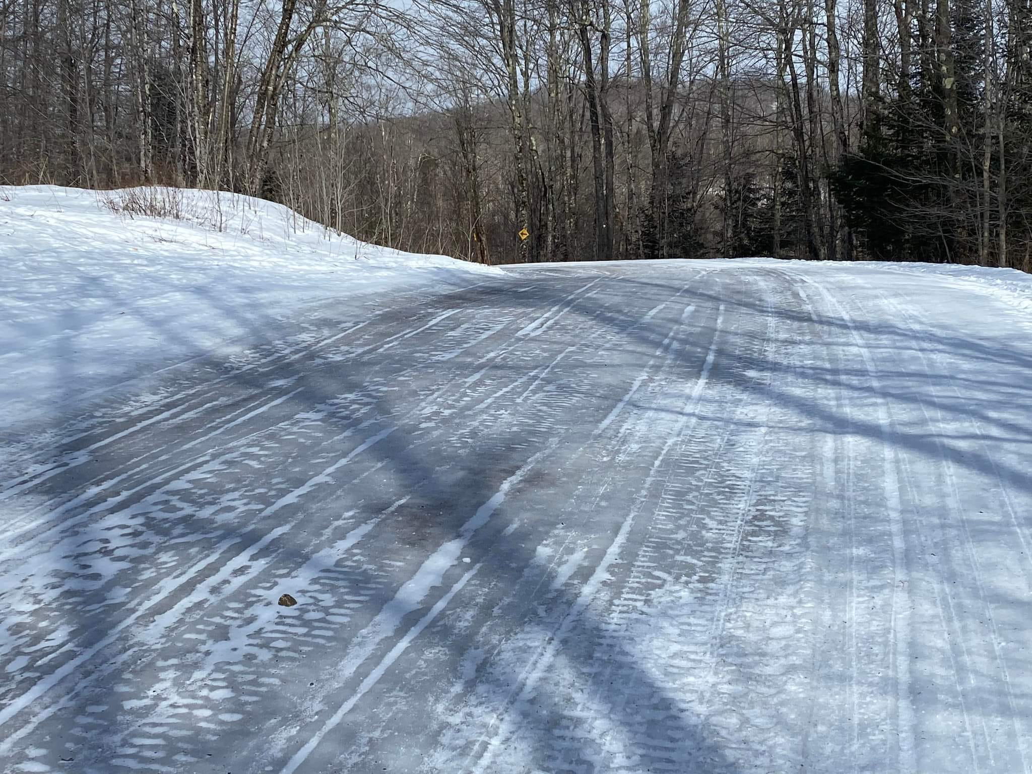
Remnant snow pack is thin in exposed areas and 6-18 inches elsewhere, which is freezing hard as a brick. Narrow woods trails are in especially poor condition with mud holes, roots, rocks and dirt stretches. Flooding and washouts are a problem where trails intersect a stream, creek or river.
Town of Indian Lake
Perkins Clearing
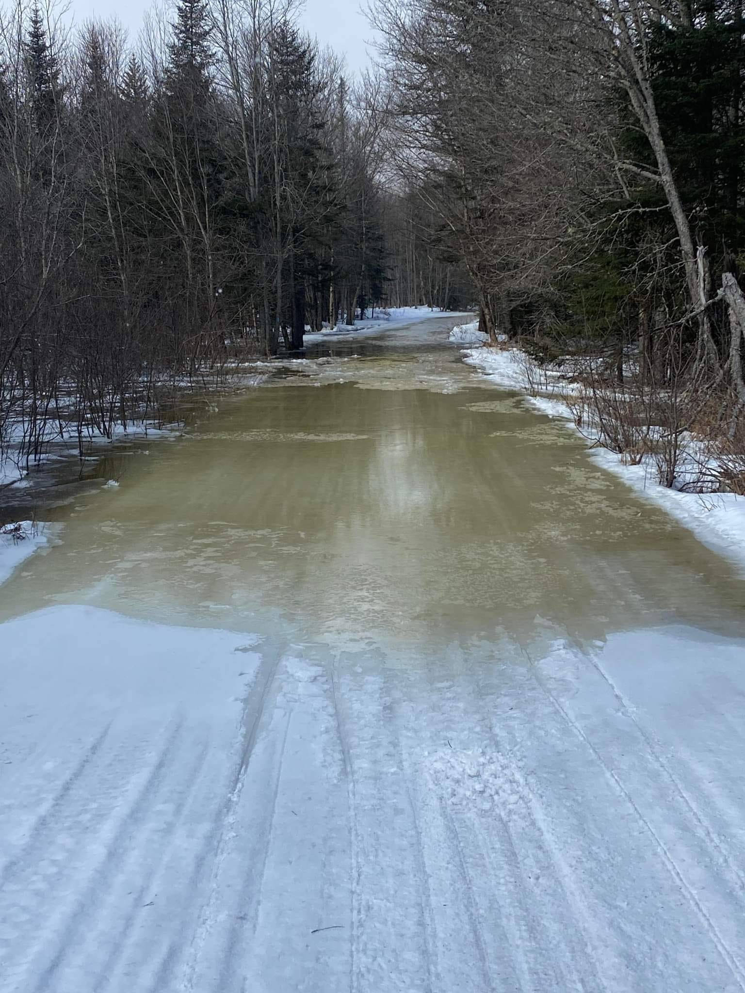
Think twice, three times or as many times as it takes before venturing onto any lake – whatever water the snow pack didn’t absorb eventually ends up in the lakes.
I know some people will attempt to ride because it’s a holiday weekend and they will be here anyway. But I can’t recommend that anyone come here with the express purpose of snowmobiling. The smart play would be to keep the money in your pocket with an eye on playing another time.
Reminder
Oak Mountain has closed their portion of C4 leading from Speculator Village up to Perkins Clearing. That means you’d have to ride Hatchery Brook trail into Speculator Tree Farm -OR- hit Big Brook/Fawn Lake trails from the back side of Perkins Clearing to make a run at Speculator Village if you’re riding down from Indian Lake (when conditions permit).
Is Winter Done?
The short and easy answer (for ilsnow land) would be: NO!
I’ve seen the snowmobiling come back from similar (and worse) conditions this time of year. But we’ll be waiting a while for it to happen.
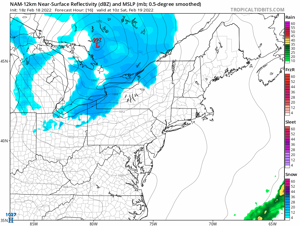
A Canadian Clipper will bring snow and wind on Saturday. Snow squalls should accumulate up to several inches from Moose River Plains into the western Adirondacks.
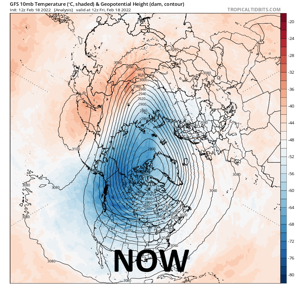
After this weekend, we’ll embark on another mild-weather regime for next week. This pattern should look familiar by now: Polar Vortex (PV) locked over Baffin Island and Pacific North America (PNA-) trough over the western United States.
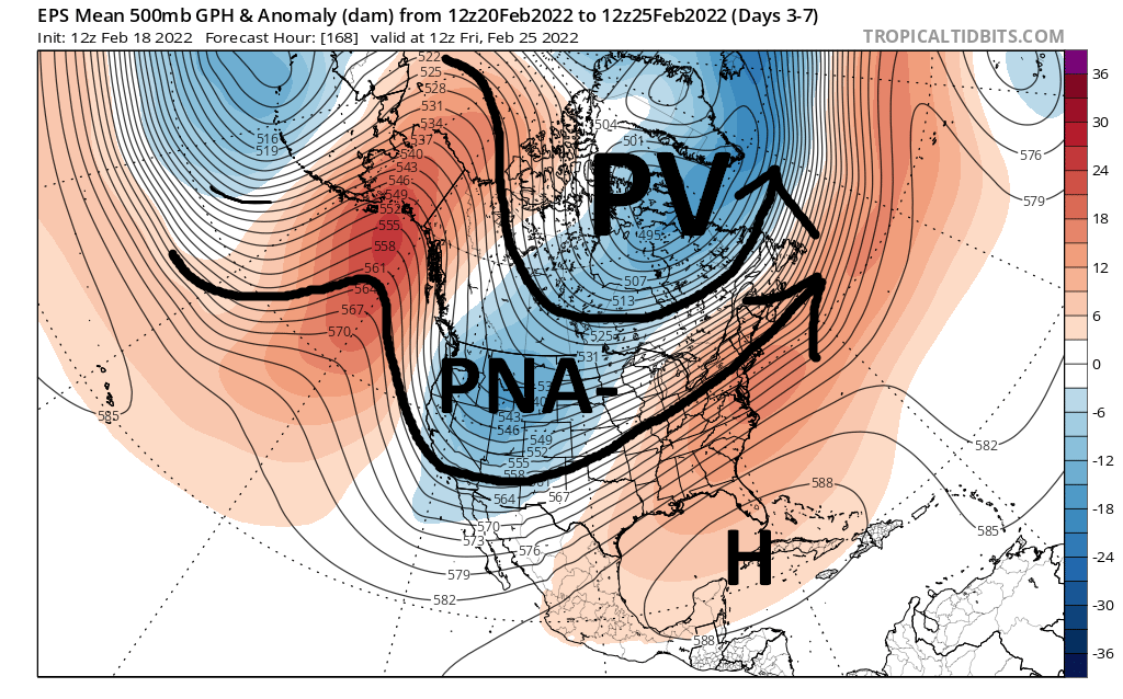
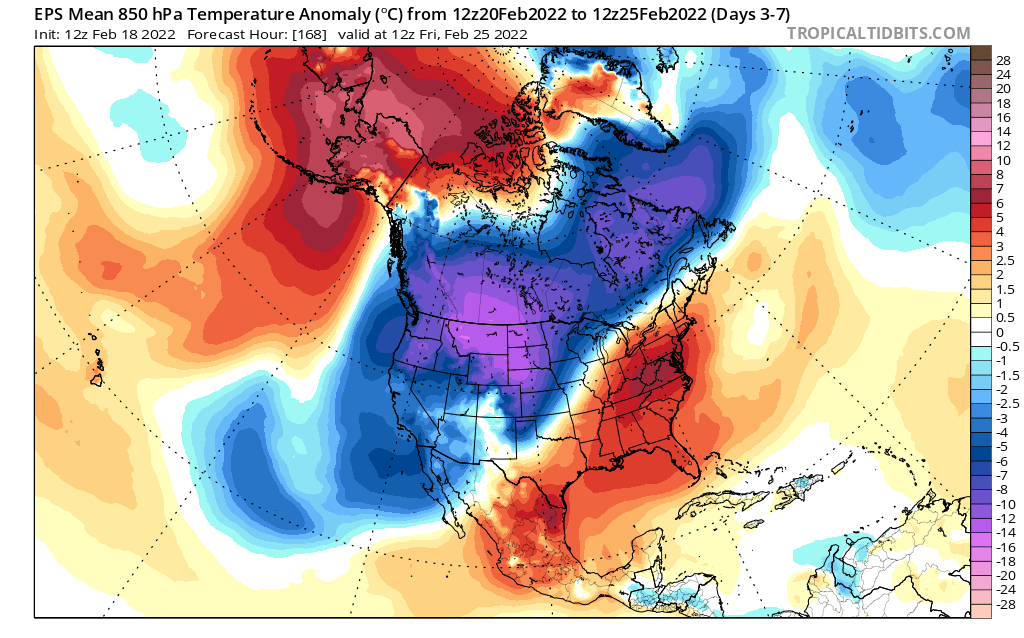
With strong cross-polar flow, there will be good stockpile of cold banked in Canada. So, I cannot say that winter is cooked yet. But we need a configuration change to get things rolling again.
Opportunity knocks?
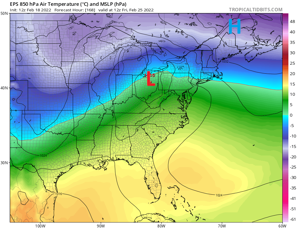
Most modelology and their ensemble members are pointing toward an over-running snow event around Friday, February 25th. This would be one of the rare times in recent weeks that an oncoming storm encounters enough cold air on the front end to produce snow. Demons always lie in the small scale details. But at least we may have something favorable to anticipate within a week.
Moving into March
I’m still hanging my hat on a Sudden Stratospheric Warming (SSW) event that is expected to occur by early March. This would dislodge the current weather pattern. Weaker high altitude westerly winds across North America would weaken the Pacific jet-stream. This, in turn, should give cold shots more staying power and create more frequent snow opportunities.
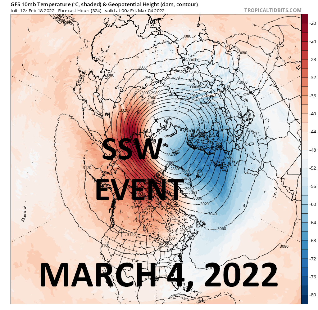
I can’t say how much success would result from the opportunities. But I’ll take gladly take my chances on something other than what we’re enduring right now.
For the ilsnow nation,
Darrin
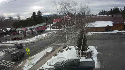
This report is brought to you by Pine’s Country Store. Their motto says it all: “A little bit of everything…” Conveniently located in downtown Indian Lake, NY at the corner of Routes 28 & 30 and proud home of the Pine’s Cam.