
We had some excitement on Sunday as Indian Lake fought and clawed its way to a fresh inch-plus of snow.
All joking aside, it’s been the kind of winter when it’s considered a victory to score an inch of snow rather than an inch of rain.
On top of that, we even bagged a sub-zero morning on Monday which is helping to freeze things up.
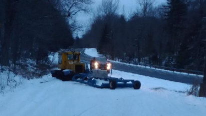
So… Let’s get the trail report thing out of the way: Snow cover is 6 inches or less throughout ilsnow land. Yes, people have been snowmobile riding into Perkins Clearing and Moose River Plains, mainly by those who are really desperate for any riding or want to test some adjustments made to their sled. As for the narrow woods trails, the locals have been bopping around town – but definitely not something I’d recommend traveling from any real distance to ride.
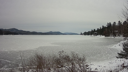
Lake ice?
There are reports of several inches of ice on the lakes from ice fishermen. Given that we’ve just endured a Top-10 warm December, I can’t recommend that people try riding the ice. Several inches of “good ice” in one spot usually means dangerously thin ice in other areas. The reward is simply not worth the risk in most cases.
Coming up
A Canadian clipper system may trigger a decent lake-effect snow response Wednesday night through Thursday although the guns appear to be pointed to the northwest of ilsnow land. At any rate, we’ll likely add a touch-up application of white paint.
There is increasing modelology consensus for a wide-spread significant snow event before the weekend with last night’s ECWMF showing significant short-wave energy digging into Illinois early Thursday night. Whether this storm would be a hit or miss for us on Friday will depend on whether there is enough short-wave energy rounding the base of the trough to force the developing secondary storm center to curl tightly up the coast.
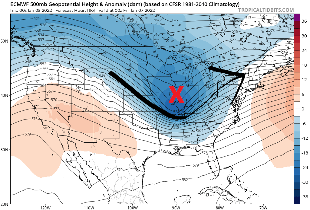
As of Monday, the modelology would not have a sufficient handle on the fine details. And, the demons are always in the details. But at least we something interesting to follow this week.
Pattern change?
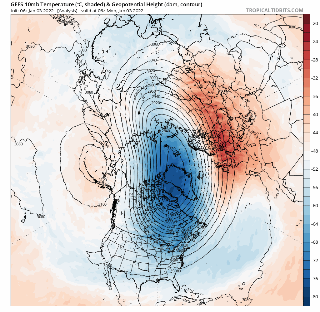
A snow storm or a cold shot doesn’t not necessarily indicate a “pattern change”. The 3 headed Legion of Doom consisting of strong stratospheric Polar Vortex, negative phased Pacific Decadal Oscillation (PDO-) and expansive La Nina are likely to remain large and in charge into the foreseeable future.
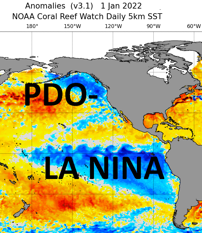
This configuration has favored cold and snow over western North America to date. So… Why should we expect that to change as long as this configuration remains in place? Based on the balance on probabilities, I would expect a limited number of snow opportunities along with alternating shots of seasonably cold air masses and milder air intrusions over the eastern United States well into January 2022.
To offer SOME hope: I can say as we head into the heart of winter, climatology does win and overwhelmingly favors snow over rain as the chief form of precipitation in the Adirondacks. It shouldn’t be as lousy around here as it was in December. And if we can somehow land a big snow? All the better….
For the ilsnow nation,
Darrin
This report is brought to you by Progressive Motorsports, celebrating their 29th year. They live, eat and breathe snowmobiling. Stop in today and see for yourself! Be sure to tell Karen that Darrin @ ilsnow.com sent ya.