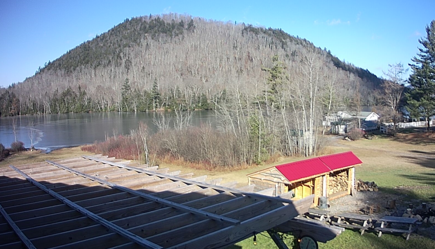
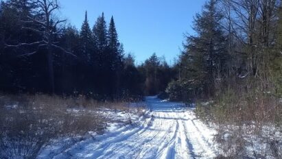
December 20, 2021 Update! Saturday’s storm brought the goods, with around a half-foot of snow mixed with some sleet throughout the central Adirondacks.
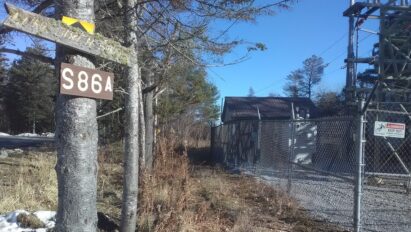
As for TRYING Moose River Plains or Perkins Clearing, I can’t really recommend traveling for any real distance for a “look-see” ride. If you happen to be here anyway and you’ve got sled-on-trailer, it’s there at your own risk. Be wary for early season hazards like rocks, washouts and blow down. Most would be wise to wait until more snow….
For the love of all things good, don’t even think about riding the lakes yet!
December 17, 2021 Report
It’s mid December, but looks far more like mid November out there.
Official maximum temperature at the ilsnow storm center in Indian Lake was 56*F on Thursday, December 16th, which actually occurred after sunset once the strong winds kicked in.
When it gets like this, I almost lose the expectation that it will snow again here. It’s a strange feeling.
We have reached our nadir and the needle will start to point up. Yes, changes are on the way. But it will take time to overcome our dumpster fire start to the snowmobiling season – if indeed that is going to happen. Some winters, it does. Other winters, it tries but never really gets there.
We’ll start from the present, then play it forward….
Ground zero
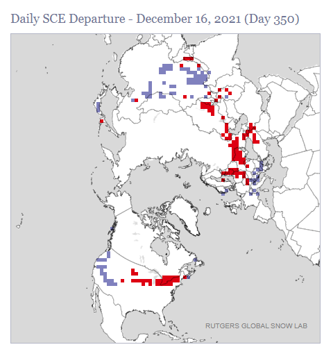
I’ll just let this snow cover chart speak for itself: We’ll be starting from SCRATCH!
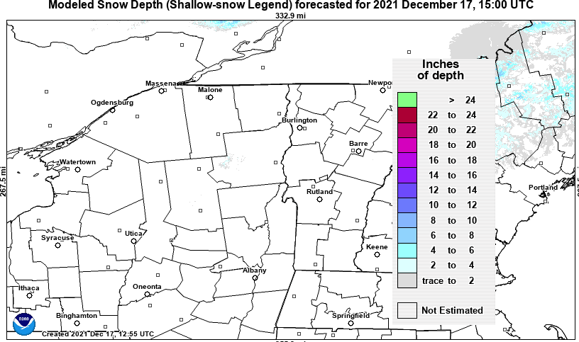
North American snow cover spread continues to lag, especially east of the Rockies.
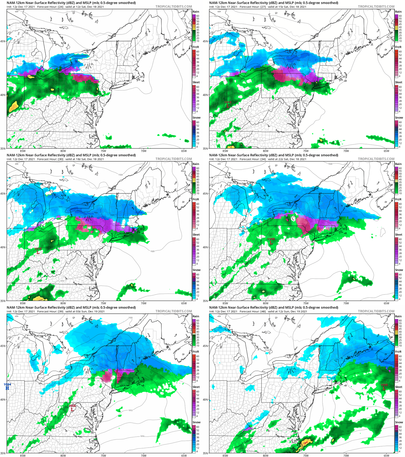
Round 1… Fight!
When you’re starting from nothing, anything that sticks points on the board should be considered a win, no matter how big or small. A quick-hitting, moderate snow event starting Saturday morning figures to deposit at least several inches of white paint onto the central Adirondacks.
Going forward
The days leading up to Christmas should see development of strongly negative phased North Atlantic Oscillation (NAO-) manifested by an anomalous Greenland blocking high. This in turn, squashes the Polar Vortex (PV) southward.
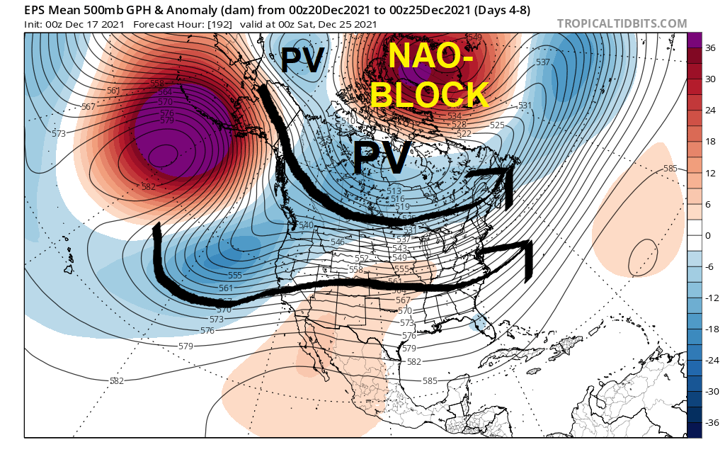
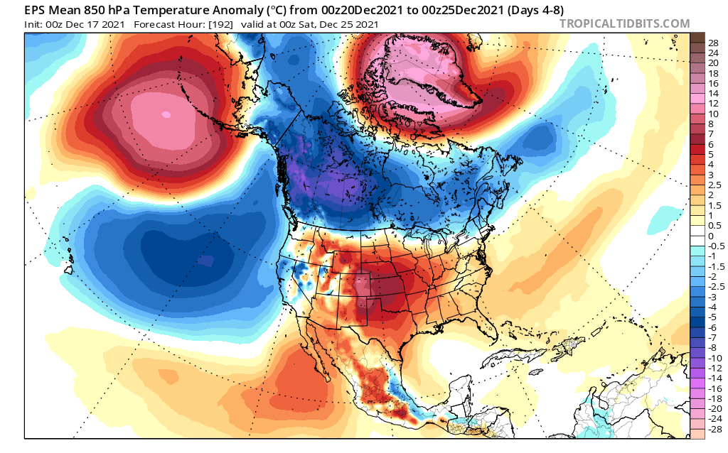
While the brunt of Arctic cold would remain pent-up over western Canada, this shift should put us into a seasonably cold regime, overall, with opportunities for measurable snow coming along every few days.
With the fast flow under the Polar Vortex (PV), weather systems are most likely to be rapidly-moving Canadian Clippers or over-running systems approaching from Colorado. The one with the most juice may approach us near or just after Christmas.
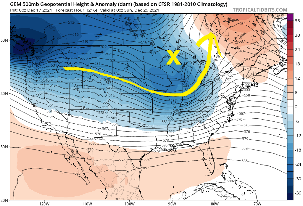
Bottom line
Finally, a tangible reason for hope! Development of a strong Greenland block should change the calculus for us. But it still remains an open question as to how rapidly snow cover can build during the upcoming 2 week period leading into the New Year.
We have much to overcome…
For the ilsnow nation,
Darrin
This report is brought to you by Sportline Power, recognized as one of the largest and most completely stocked retailers of Kawasaki, Yamaha, Honda, Suzuki, Kymco, Polaris, Sea-Doo, CFMoto, Trition and pre-owned products in the region. Whether it is a new vehicle, maintaining or customizing your current vehicle, or a need for new riding gear you will find the staff at Sportline eager to meet your needs.

