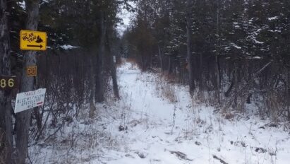

The end of big game hunting season at sundown, Sunday December 5th marks the beginning of snowmobiling season in the central Adirondacks.
It’s looking pretty with a few inches of snow on the ground here. But… Will that build into something rideable for the first week of snowmobile season and into Snodeo?
My take? It’s complicated with an active weather pattern emerging over North America that will produce opportunities for mild surges, cold shots and possible meaningful snow.
Let’s dive into it!
North American Snow cover spread
Like I said back on November 14th, snow cover spread has lagged behind schedule at each turn and that trend continues, shown in red:
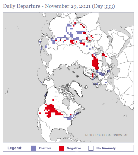
All of the milestones approaching winter have been late this year: First frost, first freeze, first snow flakes, first measurable snow, first plowable snow, etc…
Coming up
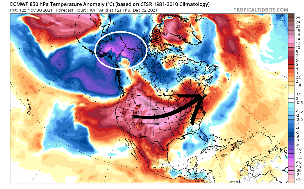
A surge a mild air on Thursday, December 2nd, originating from a near-record warm air mass over the Plains states does not bode well for us. Meanwhile, true Arctic cold will be marooned over Alaska – as it has been for much of the season to date.
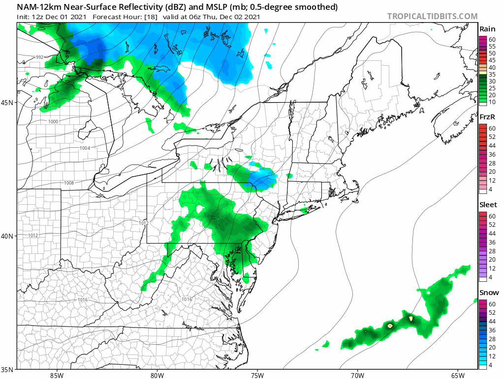
A weather system moving through on Thursday is likely to bring rain to ilsnow land – with afternoon temperatures making a run at 40*F. The bit of front end snow early Thursday and some back end snow Thursday night into early Friday won’t replace our snow loss.
Change around the corner
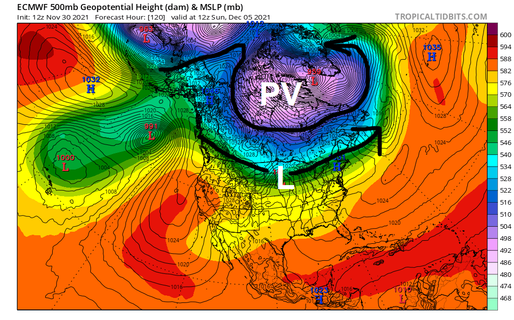
By this weekend, the Polar Vortex (PV) will finally get dislodged from Alaska. However, we’ll still reside in a rapid, zonal flow underneath the Polar Vortex – which means the next weather system will likely cut a path to bring another bout of rain and mild weather when it rolls through on Monday, December 6th.
Wait for it…
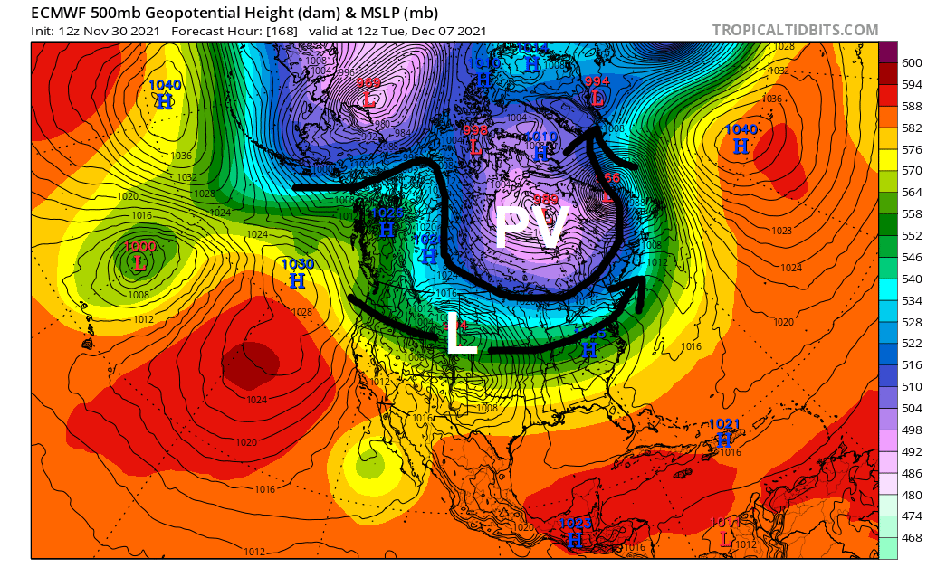
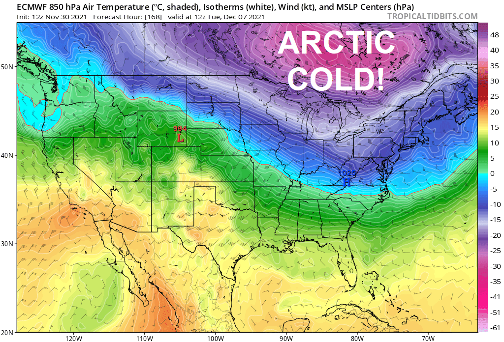
By Tuesday, December 7th the jet stream should buckle deep enough to finally make things interesting around here. For the first time this season, we’ll be grazed by a true Arctic cold air-mass.
This could setup a meaningful snow event around Wednesday, December 8th after a storm emerges from the Rockies.
But… would we roll in the snow and cold for good?
Almost nothing I’ve seen indicates that. In fact, ECMWF is showing Polar Vortex redevelopment over Alaska by Friday, December 10th which would grease the skids for a significant warmup arriving Snodeo weekend.
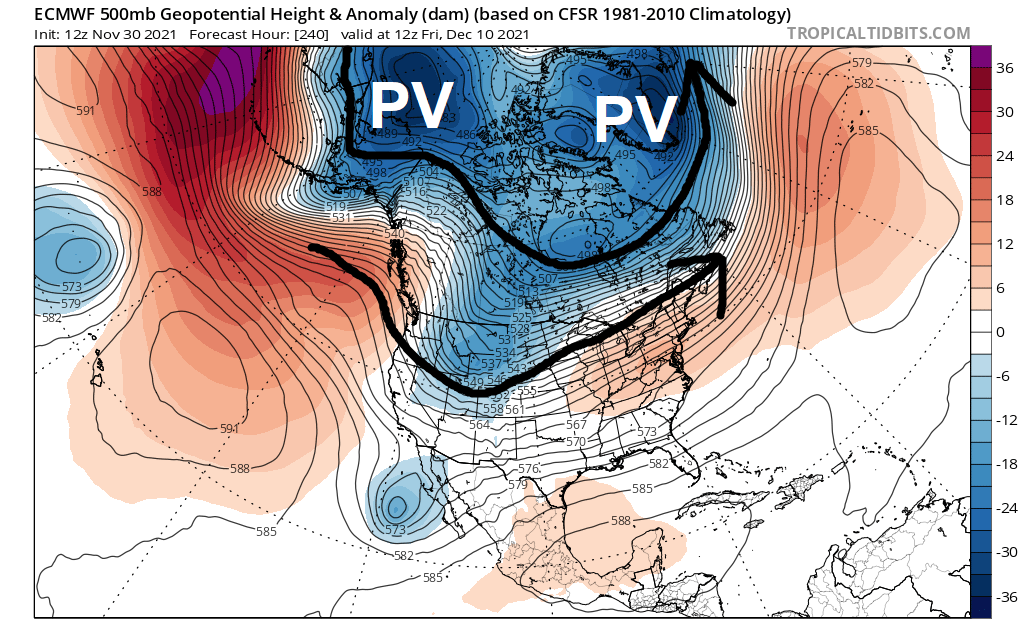
So far, the prevailing pattern this season has been for the Polar Vortex to reside over Alaska. That’s never good for sustaining cold and snowy weather in the Adirondacks over the long haul. Winter needs to show me something more than another false start before I take the bait.
For the ilsnow nation,
Darrin
p.s. Don’t forget the ilsnow.com bulletin board for sled talk and trail condition reports all winter.
This report is brought to you by Progressive Motorsports, celebrating their 29th year. They live, eat and breathe snowmobiling. Stop in today and see for yourself! Be sure to tell Karen that Darrin @ ilsnow.com sent ya.