As expected, the snow late Sunday into the evening was very heavy and wet. It mixed with rain for a while at the onset here at the ilsnow.com storm center but I did end up with an inch-and-a-quarter of wet cement-like snow.
Speculator/Morehouse area had much less rain mix and ended up with 3-4+ inches of snow.
Even though this new snow will add to the base once it freezes up rock solid on Monday, riding conditions will be marginal at best until we get a good dump of snow. The narrow woods trails are still very rocky at this point.
Tuesday’s system will bring a general minor snow to ilsnow land, but the usual snow belts like Perkins Clearing and Moose River Plains could score several inches with some lake-effect input.
THURSDAY- THE BIG TICKET?
The computer models are starting to cluster toward the idea of a significant or major snow event for ilsnow land on Thursday.
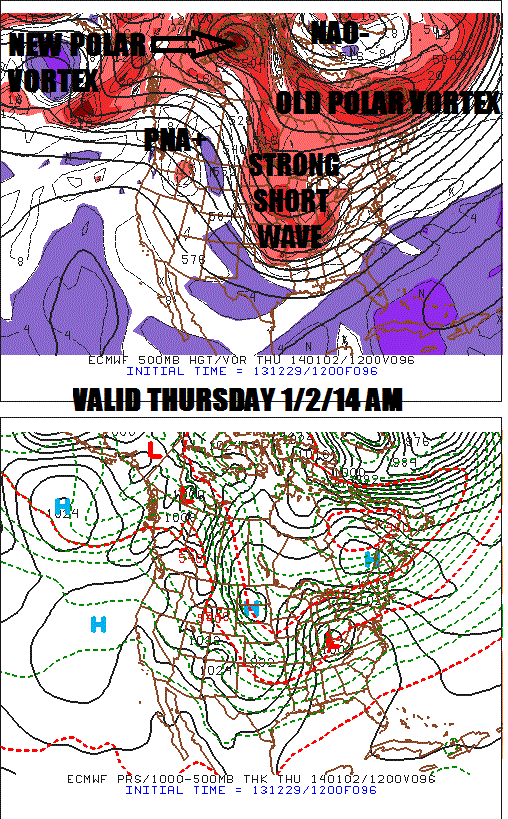
Sunday’s 12Z Euro is showing a textbook setup for a snowstorm here:

Assuming that the strong shortwave moving across the northern United States is for real, the crux of this set-up is the old Canadian Polar Vortex retreating from Hudson’s Bay to the Maritimes. Without that happening, the storm doesn’t have a pathway to “take it to the house” here. We’ve also got a nice Greenland Block (NAO-) and western United States ridge (PNA+).
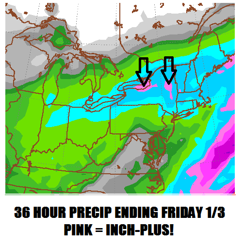
Here is the 12Z Euro’s 36 hour total melted liquid precipitation through Friday 7AM:

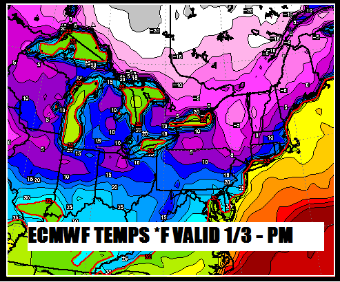
That isn’t my forecast yet: I’m only showing you what I’m looking at. An inch-plus of melted liquid is VERY impressive for a snow event in which the max temperature probably won’t crack 10*F on Thursday.
After the storm passes by, Friday should be a brutally cold day with northerly winds pile-driving polar air down from Canada. Perhaps below zero ALL DAY in ilsnow land, WOW!

WEEKEND OUTLOOK:
Great…if the above works out for us!
As always, we’ll see what happens…
Darrin @ ilsnow.com

