 It all looked good the first couple weeks of snowmobiling season, plenty of snow in Old Forge for Snodeo weekend, then a storm that dumped 8-12+ inches of snow throughout ilsnow land.
Yes, we got hit for a hard loss last weekend. But the bleeding has stopped as temperatures have fallen below 32*F. It’s even snowing a bit, just to remind us that it is December and not April. There is a scant remnant snow pack that will harden up into concrete in places to serve as the base for the next dose of snow.
What’s done is done and it’s time to move on. Let’s take a look into how we’re going to rebuild.
I don’t see any big coastal nor’easters on the immediate horizon, so we’ll have to take some baby steps at first.
A minor storm will move across the Great Lakes into the North Country on Thursday. Overall, snowfall amounts will be light but this system could open up the gates for decent lake effect snows Thursday night into Friday morning:
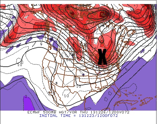
It won’t take that much to bring the usual lake-effect snow belt places like Perkins Clearing and Moose River Plains into Inlet and Old Forge back to life. But I would highly recommend waiting until you hear or see the accumulations for yourself on Friday before heading up for the weekend.
EXTENDED OUTLOOK:
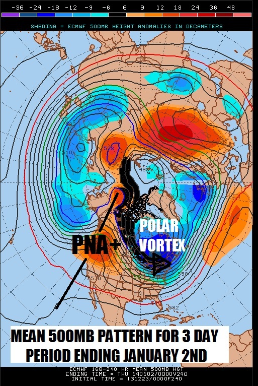
The really good news is a bit further out. The longer range models are painting a nearly picture perfect scenario to dump Arctic cold over the eastern United States and fire up the lake-effect jets by early January. Look at the massive PNA+ pattern over the United States and Canadian west coast with the ridge pumped all the way up past the Arctic Circle, WOW! That sets up the cross-polar flow around the back side of the Polar Vortex into the northeastern United States, which is a very similar to the setup behind the massive lake-effect snowstorm leading up to Snodeo weekend!
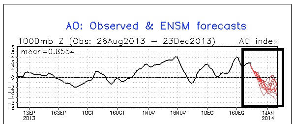
The Arctic Oscillation is forecast by most ensemble members to tank into the negative territory by early January, which will help give the Arctic cold much better staying power than it had in November and December:
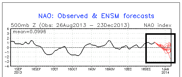
Even the North Atlantic Oscillation is forecast to make it down to at least neutral. A few of the ensemble members tank it negative, but I don’t think that’s plausible yet. But even a shift to neutral, in conjunction with the tanking Arctic Oscillation helps our cause greatly:
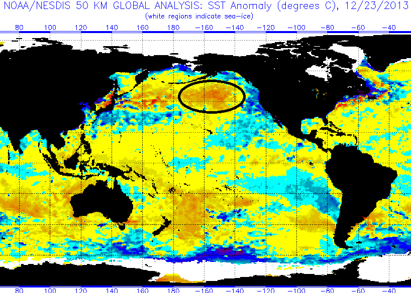
The warm pool of water over the northeast Pacific Ocean that has driven our cold blasts early this season is large, in charge and going nowhere:
Bottom line is that we’ve got a lot of fun to look forward to and Old Man Winter may be digging in his heels to stay. Although there aren’t any obvious candidates for a significant coastal storm yet, one could come out of the woodwork to kick the snowmobiling season back up into high gear.
Darrin @ ilsnow.com

