Another title for this would be: GET OUT AND RIDE, NOW!
We’ve had a nearly 2 week stretch of great winter weather that has spread significant snow cover throughout the Adirondacks.
But our latest winning streak will screech to a halt over the weekend. Although it will start to get milder on Friday and Saturday, you’ll should be able to ride around here if you don’t mind occasional bouts of sketchy weather.
The big hurt will commence Saturday night into Sunday as large trough gets dug into the central United States:
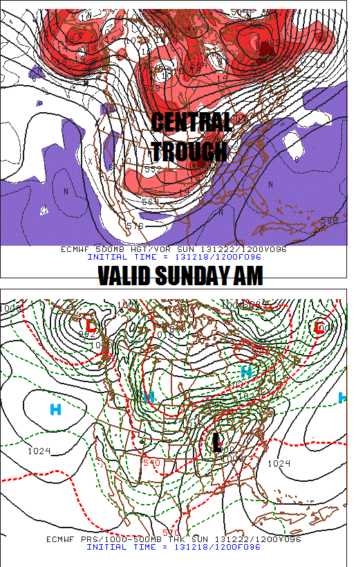
With the total lack of high latitude blocking to keep the cold air in place, the trajectory of the storm is RAIN for ilsnow land. EURO shows temperatures into the 40s by Sunday evening over the heart of the Adirondacks:
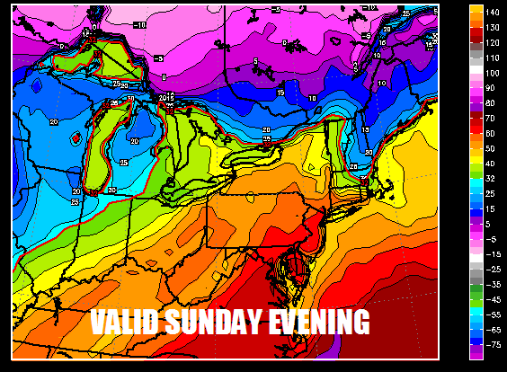
If you’re heading up to the St.Lawrence Valley area, this could be a true ice storm as shallow cold air becomes banked up against the northern foothills of the Adirondacks. For the rest of us, this is a very damaging warm-up accompanied by a soaking rainfall.
As bad as this will be, it won’t wipe out all of the snow cover in the heart of the Adirondacks. Colder air will begin to return to ilsnow land on Monday. By Tuesday, whatever remnant snow cover is left will be frozen into concrete with yet another impressive, blustery Arctic blast:
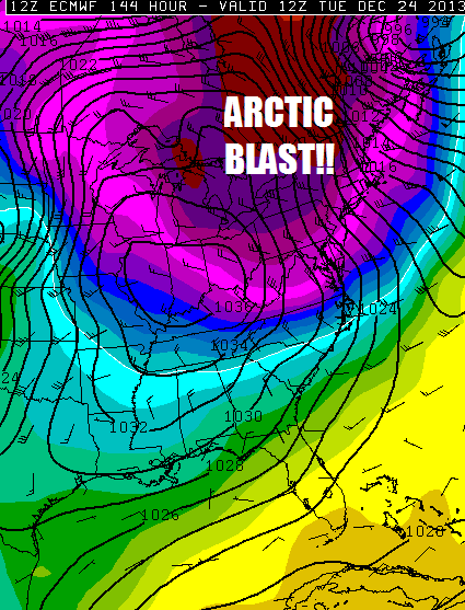
Of course, there will be snow squalls with the blast. But rapidly shifting winds should keep the lake-effect snow from accumulating anywhere near the depths we had in the days leading up to Snodeo.
WHAT’S DRIVING OUR WEATHER:
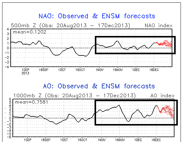
For much of November and December to date, the North Atlantic Oscillation (NAO) and Arctic Oscillation (AO) have been neutral to positive. This usually is a death lock for mild winter weather:
But we have something else going on, what I believe has been saving our winter so far. Look at that huge blob of warm water over the northeast Pacific!
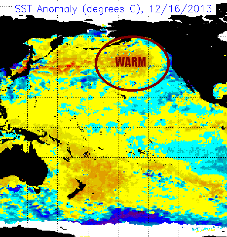
This promotes ridging over Alaska and the western United States, which in turn causes the trans-Siberian Express to blast into the eastern United States with frequent regularity. I believe this, combined with the near record expansion of Siberian snow cover in October and the record breaking explosion of North American snow cover in November, has been the genesis of our cold and snowy (most of the time) December thus far.
The Pacific Decadal Oscillation (PDO) took a tremendous leap toward neutral in November, which is HUGE because that indicates the northeast Pacific is likely to stay warm into the winter:
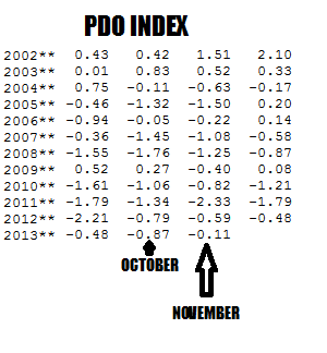
SO, WHAT DOES THIS MEAN FOR THE REST OF WINTER
That warm blob on the northeast Pacific isn’t going away. So, it’s a matter of reversing the present NAO+/AO+ pattern that has been messing with winter every couple of weeks or so. At the moment, I don’t see any real signs of that going away…..YET. However, based on other factors I discussed in my 2013-14 Winter Outlook, I still believe we are on track for a solid winter.
BOTTOM LINE:
Get out and ride before Sunday! It will get cold again. I don’t think we’ll be able to rebuild by Christmas, but there is plenty of winter left in front of us.
Darrin @ ilsnow.com

