News of the upcoming thaw have people nervous. I’m here to tell you that it’s a mere bump in the road on our way to Opening Week and the Old Forge Snodeo.
We’ve had an up and down temperature pattern through November and that is likely to continue well into December. But the cold surges have been much more impressive than the warm ups. Case in point: Indian Lake 2SW cooperative weather station set two all time daily record lows to end November.
November 29th started at -2*F and the 30th started at -7*F, setting daily records lows, which is mighty impressive for a weather station that has been at the same location for over 100 years! This caused Indian Lake to freeze over in November for the first time in over a decade.
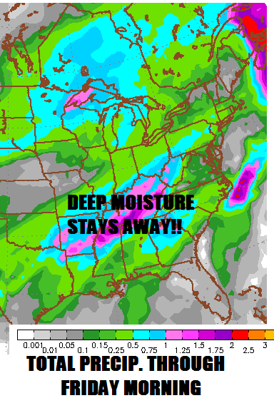
Yes, Thursday is going to get ugly as temperatures soar into the 40s. But the rain to accompany this warm-up is expected to be mainly under a quarter-inch:

Warmth is bad enough, but rain is the true killer of snow and ice pack. By the time the bleeding stops early Friday morning, I suspect there will be some leftover snow cover in the heart of the Adirondacks and the lakes will still be mainly ice covered.
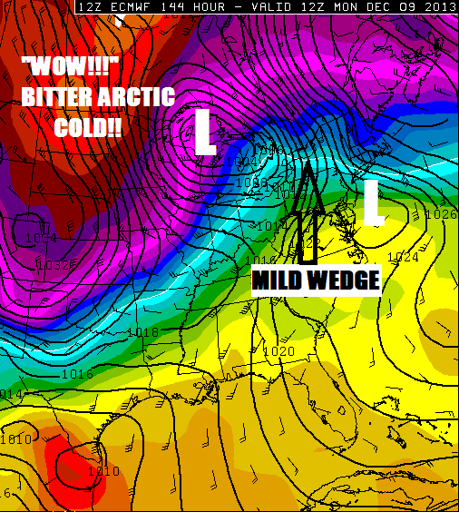
Our “great white hope” for next week rides on Monday’s event:

The primary storm should remain strong as it tracks through the upper Great Lakes, so that will drag a mild wedge toward us. This appears to be a classic snow to sleet to rain, then back to snow again. I don’t have a lock on how much snow we’ll get, but it could be enough to replace what we’ll lose on Thursday. That would be a good start.
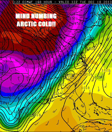
Looking ahead to Tuesday and beyond, look at that massive Arctic chunk traversing Canada: WOW!

Thankfully, we should be spared from the full brunt of that mind numbing cold. But it will certainly be cold enough to spark impressive lake effect snows Tuesday and Wednesday. Depending on where the lake effect guns point the longest, this would be a snow bonanza for somewhere in Tug Hill and the Western ‘Dacks. Just what the good doctor ordered for Snodeo Weekend. 🙂
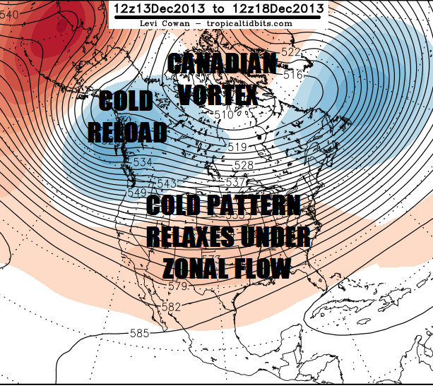
By Snodeo weekend, the true cold will withdraw into Canada as a zonal flow becomes established over the United States:

But there will be a massive “cold reload” over Alaska and northwestern Canada that could make its way down here later in December. Unfortunately, that probably means another warm-up before the Siberian Express comes back to town.
Bottom line: Winter is positioning itself in the early going much better than it has in recent years. There is plenty of cold air to play with. Now it’s just a matter of when the high latitude blocking patterns kick in to keep the cold in place for multiple weeks at a time.
Darrin @ ilsnow.com

