Confession here: I HATE November. HATE IT!! It’s not quite autumn and it’s not quite winter.
It’s the month of 35*F, rain and dark, gloomy days. Only twice in the past 15 years has November segued smoothly into winter: 2003 and 2008.
Usually though, it’s a painful and slow wait for winter through a month that seems like it has 45 days instead of 30.
As much as I would love to see a jump to winter at warp speed through November, that will probably not happen. Despite the rapid spread of snow cover in the Northern Hemisphere in October, there are significant road blocks to overcome before winter comes here to stay.
A look at snow cover:

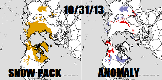
There has been much talk about the amazing buildup of snow cover over Eurasia, relative to normal. However, the spread of Siberian snow cover has “leveled off” during the the final week of October. There is a massive positive anomaly of snow cover in central China, but that’s not the source for our Arctic air masses.
On our side of the North Pole, you can see the large positive snow anomaly over eastern Canada and the equally massive negative snow anomaly over western Canada into Alaska. That was a direct result of the positive Pacific North American Oscillation (PNA+) pattern that become established over the second half of October. That doesn’t raise a red flag with me. In fact, I would love it to stay warm “out west” all winter because that would force it to be cold in the east.
What’s next?
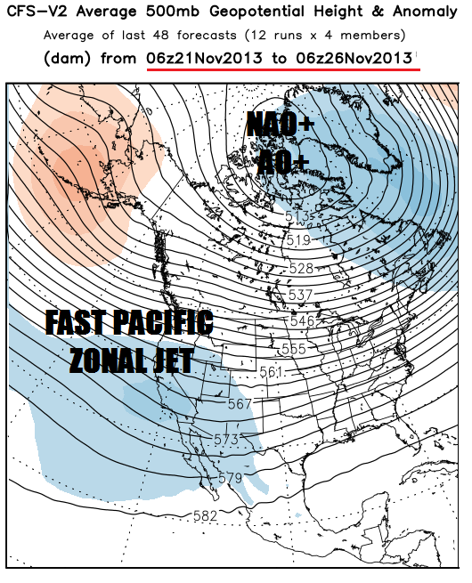
This mean ensemble map takes us nearly into mid-November. There is a strong positive Arctic/North Atlantic Oscillation configuration (AO+/NAO+) here! The massive central Pacific “heat dome” ridge forces the western United States trough, a manifestation of the negative phase of the Pacific North American Oscillation (PNA-).

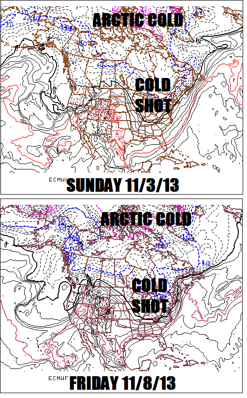
This is NOT a good pattern to maintain cold and snow weather in the eastern United States as most of the cold air will be locked up in Canada. But with that expansive snow cover over eastern Canada, we will get some cold shots. You can see a couple of nice cold shots, one around Sunday the 3rd and another one next Friday the 8th on this panel:

These cold snaps will be fleeting and the true Arctic air will be locked up in Northern Canada. This will put us in a weather “see-saw”, making it nearly impossible for ilsnow land to build a snow cover that will last into winter. You never know, we could get a big lake effect snow event or a snowstorm despite the pattern. But it would almost certainly warm up after that.
Pattern switch for later November?

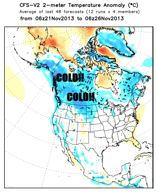
This panel doesn’t look favorable. The AO+/NAO+ regime appears to be large and in charge heading into the final week of November. Look at those tightly packed lines oriented west to east across the United States, which is indicative of a strong Pacific Jet stream. This renders it nearly impossible to drive Arctic air deeply into the United States, other than the occasional brief cold snaps across the northern tier of states as seen here:

You might say, “But that’s only one forecast! Tomorrow it will look different.” Not in this case, because this panel is actually the conglomeration of 36 forecasts spread out over 3 days. In long range forecasting, there is safety in numbers. This pattern will strongly favor snow build up over Canada and the Rockies for much of November, but not here.
So, are we completely screwed?
I don’t think so, for reasons I will dive into next time: Pacific Decadal Oscillation (PDO), El Niño Southern Oscillation (ENSO), North Atlantic Tripole and the Four Horseman of the Apocalypse. OK, I’m kidding about the Four Horsemen….or am I? This is my lame attempt at a tease, as if weather isn’t interesting enough. 😉
I will tell you that we shouldn’t expect an all-time great winter like 1993-94 or even 2002-03. We’re not going to get off to that kind of start, but there is still plenty of reason to expect a winter significantly colder and snowier than last winter, overall.
Darrin @ ilsnow.com

