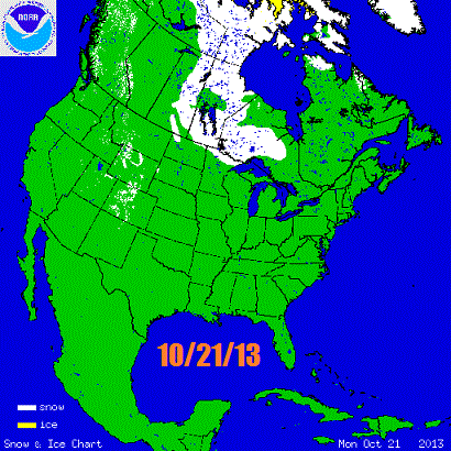
Snow cover is exploding over south-central Canada, starting to nose into the northern United States:
Let’s talk lake effect snow!
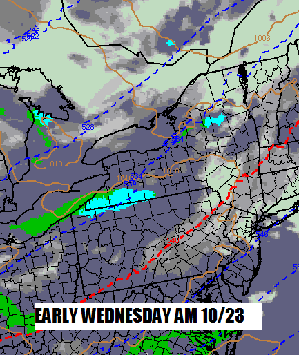
Minor lake effect snow early Wednesday will dust parts of the Western Adirondacks, places like Old Forge into Moose River Plains:
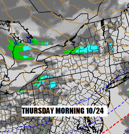
Shifting winds will break up Wednesday’s lake effect snow. But the winds will settle into a deep WNW flow Wednesday night. By Thursday morning, there could be a pretty strong band of lake effect snow nosing into the southwestern Adirondacks:
Today’s 12Z NAM was showing a 2-4+ inch snow accumulation bulls-eye around Morehouse through Thursday night:
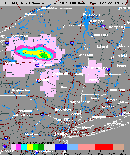
The ground is still warm, but the intensity of the lake effect precipitation should cause the snow to stick over the southwestern Adirondacks. At the very least, Route 8 should be a “fun” work commute Thursday morning for the relatively few people that live in southwestern Hamilton County and adjacent Herkimer County. With the strong WNW flow, I suspect that Speculator could wake up to a decent frosting of snow on grassy surfaces Thursday morning as well.
Outside of the lake effect bands, scattered flurries and snow showers should be seen by almost everybody in the heart of the Adirondacks Wednesday through Thursday night. Friday will be cold, but mainly dry.
What’s next?
There will be another opportunity for snow beginning Saturday afternoon as a low pressure system from the Great Lakes moves through. Temperatures will only be marginally cold. Expect wet snow in the heart of the Adirondacks, rain in the lower elevations:
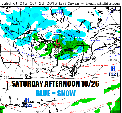
Snow accumulations will be minor from this event, typical of October. I don’t expect that ilsnow land will get enough snow to tempt anyone to come up and steal an early season rip on the snowmobile. But maybe some local lawn jockey in Morehouse or Arietta could thatch his lawn if the snow breaks right on Thursday. 😉
Looking ahead. . .
The EURO is showing an impressive Arctic air mass over southern Canada by early next week:
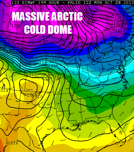
This set-up could result in the second major blizzard of the young cold season for the Northern Rockies and Front Range. Impressive stuff, indeed!
The Arctic and North Atlantic Oscillations are forecast to rise well into their positive phases by the end of October, so I see little chance of us getting nailed DIRECTLY by that Arctic blast. But with such a mountain of cold air just to our north, I wouldn’t be surprised to see one more shot of snow prior to Halloween.
It’s good to see things heading in the right direction early in the season. Keep thinking snow!
Darrin @ ilsnow.com

