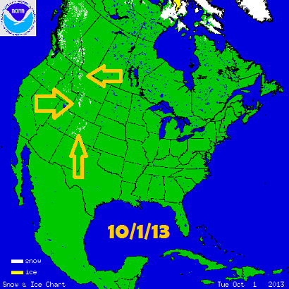
You’ll need to book a flight, drive a long way, or just go on Facebook to find any snow for at least the next couple of weeks. Right now, snow cover over the lower United States is limited to the highest elevations of the Rocky Mountains.

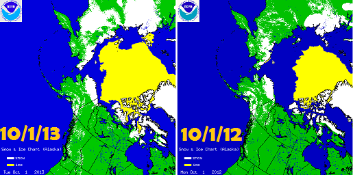
Looking at the big picture, snow cover is building over Siberia and the Canadian Arctic at a more rapid pace than at this time last year. Note that the polar ice cap is also much larger:

It appears that the Arctic freezer is getting primed more quickly than it did last year. If the snow cover rapidly expands over the rest of Eurasia and Canada though the autumn, that could be a very good sign for us this winter.
What’s up for the next 2 weeks?
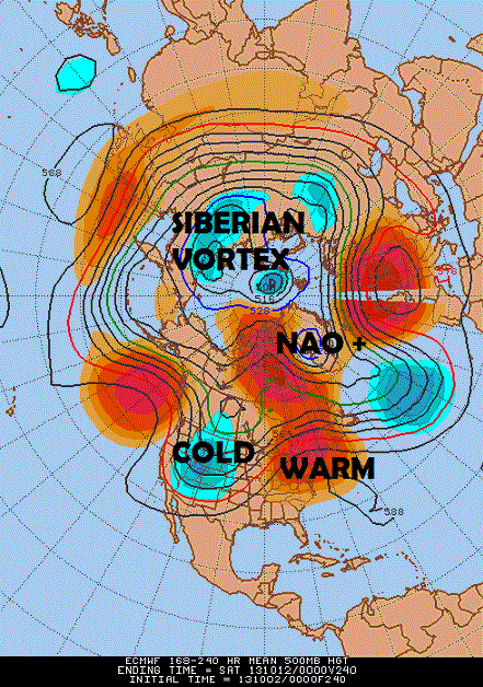
The ECMWF mean 500mb panel valid through October 12th shows why we shouldn’t expect snow in ilsnow land for a while:

Between the persistent jet stream trough over the Rockies and the NAO+ (North Atlantic Oscillation) configuration manifested by the Greenland vortex, we’ll be stuck under the warm wedge in between. It doesn’t get any more straight forward than that. The massive Siberian vortex should foster the continuing expansion of snow cover through Russia. Meanwhile, snow pack should continue to expand over the Rockies, reaching into lower elevations.
It’s good to see the snow cover in places that usually get cold first, but it’s not coming here yet. Without anything on the horizon to break the present pattern, the majority of October should be warmer and drier than normal.
Winter Outlook?
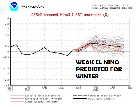
Besides the factors I outlined on my preliminary early Winter 2013-14 Outlook, it’s worth taking a look at the El Niño Southern Oscillation (ENSO). The model clusters indicate a weak El Niño developing this winter:

A weak El Niño in conjunction with PDO+ and the North Atlantic tri-pole could bode well for us this winter in terms of persistent cold and snow. But a moderate to strong El Niño would amp up the Pacific jet stream and cause all kinds of havoc by periodically flooding the United States with mild air.
Bottom line is that our weather in October probably won’t be an indicator of what happens this winter. But it will be important to monitor the build up of snow cover over the North Hemisphere and the sea surface temperature patterns as well.
Darrin @ ilsnow.com

