Last week, I talked about the possibility of a major snowstorm by early March. It’s starting to look like that storm may occur somewhat earlier than I expected. Snow should overspread the Adirondacks Tuesday night, then it becomes really interesting by Wednesday:
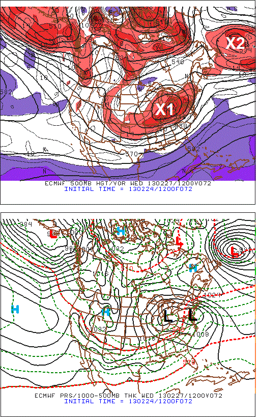
This ECWMF panel is showing the primary low over Indiana with the coastal low developing over the Delmarva by Wednesday morning:
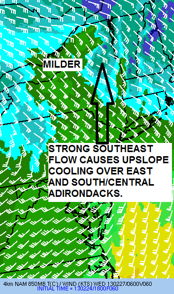
The ocean storm (X2) is important because that will prevent our storm (X1) blowing up to our west and causing a widespread rainstorm. But the strong southeast flow associated with the double barreled storm will create its own forecasting challenges. This meso-NAM panel for 1AM Wednesday shows a strong southeast flow, which favors heavy snowfall over the south/central and eastern Adirondacks due to upslope cooling and robs snowfall over the north/western Adirondacks due to compressional heating:
Here is what the 12Z NAM was forecasting for total snowfall through Wednesday afternoon:
I’m not posting this as an “official forecast” but only to show you the probable location of the heaviest snow through Wednesday afternoon. You can see the potential maximum of foot-plus snows for the south/central and eastern Adirondacks. This is a typical snowfall distribution for these kind of storms.
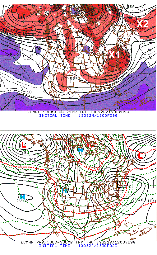
Even if Wednesday proves to be a complete bust for the northern/western Adirondacks, they should get their fair share of snow Wednesday night into Thursday as the storm pinwheels over New York and New England:
If all clicks according to plan, March should start on real strong footing!


