Although the upcoming Thaw will be short lived, it will be very damaging.
Here’s the setup for the main event Wednesday night into early Thursday:
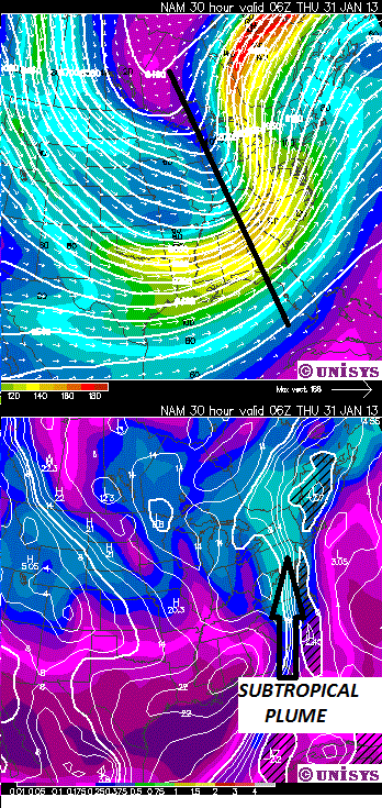
We’ve got a monster storm carving its way through the Great Lakes tapping into a subtropical plume. Not good at all! Meso-NAM is depicting widespread 1-2 inch rain with localized 3 inch rain over the high mountains. That’s going to open up creeks and water holes. Unlike the last Thaw, we will NOT dodge the rain bullet this time.
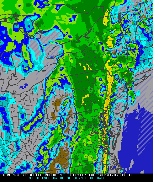
Meso-NAM is depicting a squall line passing through New York State Wednesday night:
The returning cold air on Thursday will be coming in like a cannon shot. Look at the strong pressure gradient shown by the tightly packed lines. That will generate strong, damaging winds!

With the cold air pouring over the Great Lakes into the Adirondacks, there will be a lake-effect snow response. NAM is showing the potential for 6+ inches over the southwestern Adirondacks Thursday into Thursday Night:
The lake effect snow will be inadequate consolation prize in light of the heavy rain and damaging winds we’ll get with this storm. The existing snow pack in the heart of the Adirondacks won’t get completely wiped out, but this one is going to hurt badly.


