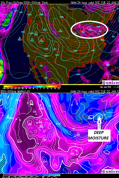
Just because we’re not going to have a classic “storm” doesn’t mean we’re going to get skunked for snow Monday night. There is a saying that it can get too cold for snow. If that is true, why do the Arctic and Antarctic get snow? This panel shows the scenario for Monday night:
Cold air holds less moisture than warm air. But very cold air can become saturated through a deep layer as seen above. The disturbance pivoting across the North Country Monday night will also pick up some Great Lakes moisture.
The MESO-NAM is showing around a quarter-inch of liquid equivalent by Tuesday morning over ilsnow land:
At first blush, that’s not a big deal. Multiply 0.25 inch by the typical 12:1 snowfall to liquid equivalent and you get about 3 inches of snow. But in this case, snowfall to liquid equivalent will be closer to 30:1, so that 0.25 inch becomes 7.5 inches of snow! I’m not entirely sure if we’ll get THAT much, but I feel pretty confident we could get several inches of snow Monday night. Keep in mind, there will be a lot of air in that fluff. But all snow is good snow as far as I’m concerned.


